Pitiquito facts for kids
Quick facts for kids
Pitiquito
|
|
|---|---|

Misión de San Diego, Pitiquito
|
|
| Country | |
| State | Sonora |
| Municipality | Pitiquito |
| Town founded | 1694 |
| Municipality established | 1914 |
| Area | |
| • Total | 11,979.96 km2 (4,625.49 sq mi) |
| Elevation | 305 m (1,001 ft) |
| Population
(2005)
|
|
| • Total | 9,236 |
| (municipal total) | |
| Time zone | UTC-7 (Pacific (US Mountain)) |
| • Summer (DST) | UTC-7 (No DST) |
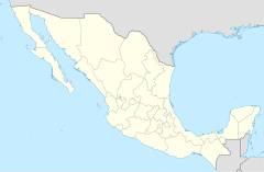
Pitiquito is a small town located in the northwest part of Sonora, a state in Mexico. It is also the main town of the Pitiquito Municipality.
Contents
About Pitiquito
Pitiquito Municipality covers a large area of about 11,980 square kilometers. This makes up about 6.5% of the entire state of Sonora. In 2000, the total population of the municipality was around 9,160 people. The main town of Pitiquito itself had about 4,862 residents in 2000. The town sits at an elevation of 305 meters above sea level.
Weather in Pitiquito
The climate in this region is very hot and dry. It gets very little rain, usually between 75 and 200 millimeters each year. In winter, from December to February, nighttime temperatures can drop to about -8.5°C (16.7°F). But in summer, from June to August, temperatures can soar up to 49.5°C (121.1°F).
History of Pitiquito
When the Spanish first arrived in this area, different groups of native people lived along the Altar and Magdalena rivers. The town of Pitiquito was founded in 1694 by a priest named Father Eusebio Francisco Kino. He first named it Natividad del Señor de Pitiquin.
In 1768, a different group of priests, the Franciscans, took over the churches. They changed the town's name to San Diego de Pitiquin. Local stories say that the town's name comes from an old Native American chief called "Piti" or "Pitic". Pitiquito officially became its own municipality in 1914.
What People Do in Pitiquito
The economy in Pitiquito is mainly based on farming, raising cattle, and fishing.
Farming and Ranching
In 2000, about 6,901 hectares of land were used for farming. Most of these farms get their water from wells. Farmers grow crops like alfalfa, beans, corn, grapes, and sorghum. They also grow special plants to feed cattle. Raising cattle is a big part of the economy too, with over 30,000 cattle counted in 2000.
Fishing and Energy
Pitiquito Municipality has about 170 kilometers of coastline along the Gulf of California. This means fishing is an important activity, especially in coastal towns like Puerto Libertad (Sonora) and Desemboque.
Puerto Libertad is also home to a large electric power plant run by a Mexican company called CFE. Another company, Biofields, is building a special system nearby. This system will use algae to create ethanol, which is a type of fuel. It will even use the exhaust from the power plant to help grow the algae.
Places to Visit in Pitiquito
Pitiquito offers interesting sights for visitors, from historic churches to beautiful beaches.
San Diego del Pitiquito Mission
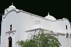
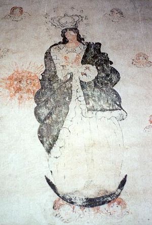
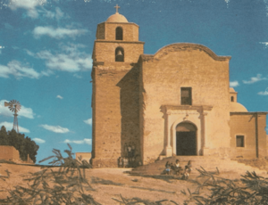
The most important tourist spot is the San Diego del Pitiquito mission. This historic church is right in the center of town. It's special because it's the oldest church in Sonora that still has original art made by native people. These drawings are bold, black lines on a white background. They were found after being hidden under layers of paint for many years.
Coastal Communities and Nature
The small beach towns along the Gulf of California are also worth visiting. These areas are still quite natural and not heavily developed. Puerto Libertad (Sonora) is the most well-known beach town. It has a lovely bay with soft sand and calm waves, perfect for swimming, sailing, and fishing.
Near Puerto Libertad, you can find unique forests of boojum trees. These unusual trees, also called cirio in Spanish, are mostly found in Baja California, making this a rare sight.
Another beach town is El Desemboque. This is a town of the Seri people, an indigenous group. It's located on land owned by the Seri community, part of which is within Pitiquito Municipality.
See also
 In Spanish: Pitiquito para niños
 | Delilah Pierce |
 | Gordon Parks |
 | Augusta Savage |
 | Charles Ethan Porter |


