
Pittsford, Michigan facts for kids
Quick facts for kids
Pittsford, Michigan
|
|
|---|---|
.jpg)
Looking south along Pittsford Road
|
|

Pittsford, Michigan
Location in Michigan

Pittsford, Michigan
Location in the United States
|
|
| Country | United States |
| State | Michigan |
| County | Hillsdale |
| Townships | Jefferson and Pittsford |
| Settled | 1833 |
| Area | |
| • Total | 1.91 sq mi (4.95 km2) |
| • Land | 1.91 sq mi (4.95 km2) |
| • Water | 0.00 sq mi (0.00 km2) |
| Elevation | 1,092 ft (333 m) |
| Population
(2020)
|
|
| • Total | 553 |
| • Density | 290.14/sq mi (112.04/km2) |
| Time zone | UTC-5 (Eastern (EST)) |
| • Summer (DST) | UTC-4 (EDT) |
| ZIP code(s) |
49271
|
| Area code(s) | 517 |
| FIPS code | 26-64600 |
| GNIS feature ID | 635063 |
Pittsford is a small community in Hillsdale County, Michigan. It is known as an unincorporated community. This means it doesn't have its own local government like a city or town. However, it is also a census-designated place (CDP). This means the U.S. Census Bureau counts the people living there for statistics.
In 2020, about 553 people lived in Pittsford. The community is located along M-34. It sits right on the border between two areas called Jefferson Township and Pittsford Township. Even though it doesn't have its own government, Pittsford does have its own post office. Its special mail code is 49271.
Contents
A Look Back: Pittsford's History
Pittsford was first settled a long time ago, in 1833. A person named Hiram Kidler was one of the first to move to this area.
When it was first settled, the community had a different name: Locust Corners. Later, a person named Alpheus Pratt moved to the area. He came from a place called Pittsford, New York. He decided to rename the community "Pittsford" after his old home.
The first post office in Pittsford opened on September 19, 1840. For a very short time in 1845, the post office closed. It then moved to a different part of Pittsford Township and was renamed Sparta. But soon after, in 1846, another nearby post office was moved and renamed Pittsford. Later on, Pittsford even had a train station for the Lake Shore and Michigan Southern Railway.
Where is Pittsford Located?
Pittsford is located in Michigan. The U.S. Census Bureau says that the community covers an area of about 1.91 square miles. All of this area is land, with no large bodies of water.
The students in Pittsford attend schools that are part of the Pittsford Area Schools system. This school system also serves parts of some nearby townships.
Who Lives Here?
The word "demographics" helps us understand who lives in a place. It tells us facts like how many people live there.
According to the 2020 census, the total number of people living in Pittsford was 553.
| Historical population | |||
|---|---|---|---|
| Census | Pop. | %± | |
| 2020 | 553 | — | |
| U.S. Decennial Census | |||
Images for kids
-
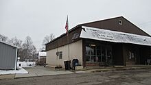
U.S. Post Office in Pittsford -
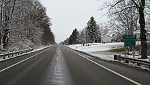
Signage along eastbound M-34


