Plateau Creek (Colorado) facts for kids
Quick facts for kids Plateau Creek |
|
|---|---|

Plateau Creek
|
|
| Physical characteristics | |
| Main source | 39°25′50″N 108°07′36″W / 39.43056°N 108.12667°W |
| River mouth | Confluence with Colorado River 4,770 ft (1,450 m) 39°10′02″N 108°16′52″W / 39.16722°N 108.28111°W |
| Basin features | |
| Progression | Colorado |
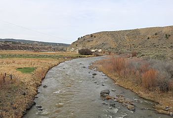
Plateau Creek is a river in western Colorado, United States. It is about 50 miles (80 km) long. This creek is a "tributary" of the Colorado River. A tributary is a smaller river or stream that flows into a larger one.
Plateau Creek flows through a large area known as Plateau Valley. This valley is a place where many cattle ranches are located. It lies north of a big flat-topped mountain called the Grand Mesa. The valley is also east of the city of Grand Junction.
Contents
Plateau Creek's Journey
Where the Creek Begins
Plateau Creek starts in the northeastern part of Mesa County. This area is inside the Grand Mesa National Forest. The creek flows down from the forest through a narrow canyon. It passes north of Vega State Park, which is a popular spot for outdoor activities.
Through Plateau Valley
After leaving the canyon, Plateau Creek enters Plateau Valley near the town of Collbran. Collbran is the biggest community in the valley. The creek then flows generally west. It follows the northern edge of the Grand Mesa uplands. It passes by another small town called Molina.
State Highway 330 follows Plateau Creek through the valley. The highway crosses the creek several times along its path.
Joining the Colorado River
Near where State Highway 330 meets State Highway 65, Plateau Creek enters another narrow canyon. This canyon is about 8 miles (13 km) long. State Highway 65 follows the creek through this lower canyon.
Finally, Plateau Creek joins the Colorado River from the east. This meeting point is in a place called De Beque Canyon. This spot is about 15 miles (24 km) east of Grand Junction.
 | Percy Lavon Julian |
 | Katherine Johnson |
 | George Washington Carver |
 | Annie Easley |

