Plumwood, Ohio facts for kids
Quick facts for kids
Plumwood, Ohio
|
|
|---|---|

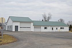
Monroe Township hall
|
|

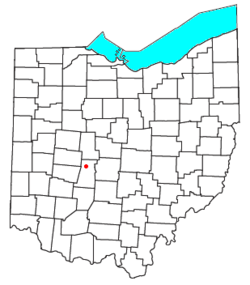
Location of Plumwood, Ohio
|
|
| Country | United States |
| State | Ohio |
| County | Madison |
| Township | Monroe |
| Area | |
| • Total | 0.62 sq mi (1.61 km2) |
| • Land | 0.62 sq mi (1.61 km2) |
| • Water | 0.00 sq mi (0.00 km2) |
| Elevation | 1,007 ft (307 m) |
| Population
(2020)
|
|
| • Total | 257 |
| • Density | 413.18/sq mi (159.61/km2) |
| Time zone | UTC-5 (Eastern (EST)) |
| • Summer (DST) | UTC-4 (EDT) |
| FIPS code | 39-63758 |
| GNIS feature ID | 2628953 |
Plumwood is a small community located in Monroe Township, Madison County, Ohio, United States. It is known as a census-designated place (CDP). This means it's an area that the government counts for population, but it's not an officially organized city or town.
You can find Plumwood where State Route 38 meets Arthur Bradley Road. It's about 8.5 miles (13.5 km) north of London, which is the main city and government center for Madison County. A small stream called the Spring Fork of the Little Darby Creek flows right past the community.
History of Plumwood
Plumwood was first planned out on December 23, 1895. It was created by a person named Charles F. Sanford. Because of him, the community was originally called Sanford. However, the name was later changed to Plumwood.
By 1915, Plumwood had grown quite a bit. It became one of the most important trading spots in Madison County. At that time, the community had three large general stores where people could buy many different things. There was also a blacksmith, who worked with metal to make or repair tools. Farmers in the area used six threshing outfits, which were machines used to separate grain from plants. There were also three hay baling outfits, which helped pack hay into bales. In 1915, about 200 people lived in Plumwood. By the 2020 Census, the population had grown to 257 people.
See also
 In Spanish: Plumwood para niños
 | Laphonza Butler |
 | Daisy Bates |
 | Elizabeth Piper Ensley |

