Porterfield (community), Wisconsin facts for kids
Quick facts for kids
Porterfield, Wisconsin
|
|
|---|---|

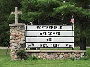
Porterfield welcome sign on Church Street
|
|
| Country | |
| State | |
| County | Marinette |
| Elevation | 203 m (666 ft) |
| Time zone | UTC-6 (Central (CST)) |
| • Summer (DST) | UTC-5 (CDT) |
| ZIP code |
54159
|
| Area code(s) | 715 & 534 |
| GNIS feature ID | 1571805 |
Porterfield is a small community located in Marinette County, Wisconsin, in the United States. It's known as a census-designated place, which means it's a special area defined for gathering population information. Porterfield is part of the larger town of Porterfield.
Where is Porterfield?
Porterfield is found about 9 miles (14 kilometers) west-northwest of a bigger city called Marinette. A railroad line, the Escanaba and Lake Superior Railroad, runs through the community.
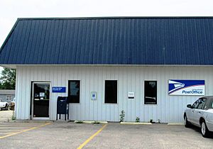
Porterfield has its own post office, and its ZIP code is 54159. The Peshtigo River flows just south of the community, adding to its natural surroundings.
A Look at Porterfield's Past
Porterfield began as a busy spot because of the railroad. It was named after a local farmer and businessman, John Porterfield. He was an important person in the area.
In 1885, a post office was opened in Porterfield. This was a big step for the community. In the past, Porterfield had several businesses. These included a grocery store (which later became an apartment building), a bar, and a blacksmith shop. There was even a cheese factory!
Porterfield's Schools Through the Years
Before 1963, students in the Porterfield area went to many small schools. These included Miles School, Winesville School, Dickie School, and Fairmont School. Other schools were Fairdale School, Phillips School, Plumb School, Sandberg School, Stewart School, and Redelings School.
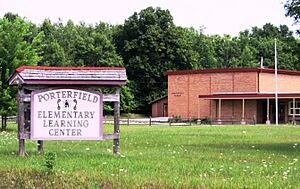
In 1963, a new elementary school was built in Porterfield. All the old county school buildings were then sold. The new Porterfield Elementary School was part of the School District of Marinette. It served about 120 students each year. However, this elementary school closed its doors at the end of the 2006–2007 school year.
 | Claudette Colvin |
 | Myrlie Evers-Williams |
 | Alberta Odell Jones |


