Poseyville, Indiana facts for kids
Quick facts for kids
Poseyville, Indiana
|
|
|---|---|
| Town of Poseyville | |

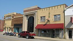
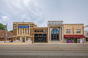
Downtown Poseyville
|
|

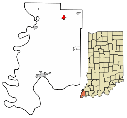
Location of Poseyville in Posey County, Indiana.
|
|
| Country | United States |
| State | Indiana |
| County | Posey |
| Township | Robb |
| Area | |
| • Total | 0.65 sq mi (1.67 km2) |
| • Land | 0.65 sq mi (1.67 km2) |
| • Water | 0.00 sq mi (0.00 km2) 0% |
| Elevation | 440 ft (130 m) |
| Population
(2020)
|
|
| • Total | 966 |
| • Density | 1,497.67/sq mi (577.90/km2) |
| Time zone | UTC-6 (CST) |
| • Summer (DST) | UTC-5 (CDT) |
| ZIP code |
47633
|
| Area code(s) | 812 |
| FIPS code | 18-61416 |
| GNIS feature ID | 2396864 |
| Website | https://www.poseyville.us/ |
Poseyville is a small town located in Posey County, in the state of Indiana, United States. In 2010, about 1,045 people lived there. It's a quiet place in Robb Township.
Contents
History of Poseyville
The town of Poseyville was first planned out on February 28, 1840, by a person named James Smith. It was originally called Palestine. The town was built along an old coach line that connected New Harmony and Princeton. The plans for the new town were officially recorded on November 20, 1840.
The town's name changed to Poseyville on February 10, 1843. This happened because there was already another town in Indiana called Palestine that had a post office. To avoid confusion, the name was changed. The state of Indiana officially approved the name change on December 26, 1844. Local records started using the name Poseyville around 1852. This was when the town grew a lot, nearly tripling in size with new areas added.
A building called the Bozeman-Waters National Bank is an important historical site in Poseyville. It was added to the National Register of Historic Places in 1987.
Geography and Climate
Where is Poseyville?
Poseyville covers an area of about 0.65 square miles (1.67 square kilometers). All of this area is land, with no large bodies of water.
What is the Climate Like?
The weather in Poseyville has hot and humid summers. The winters are usually mild to cool. This type of weather is known as a humid subtropical climate. On climate maps, you might see it labeled as "Cfa."
Education in Poseyville
The MSD of North Posey County serves Poseyville and the northern part of Posey County. This school district has four schools:
- North Posey High School (for students in grades 9-12)
- North Posey Junior High School (for students in grades 7-8)
- North Elementary School (for students in grades K-6)
- South Terrace Elementary School (for students in grades K-6)
The town also has a public library called the Poseyville Carnegie Public Library. It's a great place to borrow books and learn new things.
Population of Poseyville
| Historical population | |||
|---|---|---|---|
| Census | Pop. | %± | |
| 1870 | 213 | — | |
| 1890 | 571 | — | |
| 1900 | 628 | 10.0% | |
| 1910 | 780 | 24.2% | |
| 1920 | 881 | 12.9% | |
| 1930 | 810 | −8.1% | |
| 1940 | 948 | 17.0% | |
| 1950 | 1,005 | 6.0% | |
| 1960 | 997 | −0.8% | |
| 1970 | 1,035 | 3.8% | |
| 1980 | 1,247 | 20.5% | |
| 1990 | 1,089 | −12.7% | |
| 2000 | 1,187 | 9.0% | |
| 2010 | 1,045 | −12.0% | |
| 2020 | 966 | −7.6% | |
| U.S. Decennial Census | |||
Population Details
In 2010, there were 1,045 people living in Poseyville. These people lived in 454 households. About 29.5% of these households had children under 18 years old. Most people living in Poseyville were White (98.9%). The average age of people in the town was about 44 years old.
Getting Around
Several important roads help people travel to and from Poseyville:
 Interstate 64
 Indiana State Road 68
 Indiana State Road 165
See also
 In Spanish: Poseyville (Indiana) para niños
 | Janet Taylor Pickett |
 | Synthia Saint James |
 | Howardena Pindell |
 | Faith Ringgold |


