
Powderly, Texas facts for kids
Quick facts for kids
Powderly, Texas
|
|
|---|---|

Powderly, Texas
Location in Texas

Powderly, Texas
Location in the United States
|
|
| Country | United States |
| State | Texas |
| County | Lamar |
| Area | |
| • Total | 7.44 sq mi (19.27 km2) |
| • Land | 7.25 sq mi (18.79 km2) |
| • Water | 0.19 sq mi (0.48 km2) |
| Elevation | 530 ft (160 m) |
| Population
(2010)
|
|
| • Total | 1,178 |
| • Density | 162/sq mi (62.7/km2) |
| Time zone | UTC-6 (Central (CST)) |
| • Summer (DST) | UTC-5 (CDT) |
| FIPS code | 48-59156 |
| GNIS feature ID | 1365698 |
Powderly is a special kind of community in Lamar County, Texas, United States. It's called a census-designated place (CDP). This means it's an area that the government counts for population, but it's not officially a city or town with its own local government. In 2010, about 1,178 people lived there.
Contents
A Look Back: Powderly's History
Powderly started as a settlement around the time of the American Civil War. It was first known as "Lenoir." In the 1880s, a railway called the St. Louis-San Francisco Railway was built through the area.
How Powderly Got Its Name
When the railway came, the community changed its name to "Powderly." This was to honor Terence V. Powderly. He was an important leader for workers and later worked for the government helping immigrants.
Growing and Changing Over Time
A post office opened in Powderly in 1888. By 1890, the community had a general store, two places to process cotton, a mill for grinding grain, and a sawmill. There was also a blacksmith shop. About 30 people lived there at that time.
In 1914, the population grew to 100 people. However, in the 1920s, the community became smaller. By the early 1930s, Powderly had a church, a school, and a few businesses. Only about 63 people lived there then.
The population started to grow again. It reached 120 people in 1950 and 150 in 1965. The Powderly Volunteer Fire Department was started in 1964. It has been helping the community ever since.
In 1990, Powderly had a church, a school, and many homes. The population was estimated at 185. This number stayed the same in 2000. By 2010, the Powderly Census-Designated Place included more land. The population grew a lot, reaching 1,178 people.
On November 4, 2022, a very strong tornado hit Powderly.
Exploring Powderly's Location
Powderly is located on U.S. Highway 271. It is about 10 miles (16 km) north of Paris. This area is in north-central Lamar County. Powderly is also about 5 miles (8 km) south of where Highway 271 crosses the Red River into Oklahoma.
Land and Water Around Powderly
The U.S. Census Bureau says that the Powderly CDP covers about 19.3 square kilometers (7.5 square miles). Most of this area, about 18.8 square kilometers (7.3 square miles), is land. The rest, about 0.5 square kilometers (0.2 square miles), is water. This means about 2.49% of Powderly is water.
The middle of Powderly is on a low ridge. Water from this ridge flows west into Pat Mayse Lake. It also flows east into Pine Creek, which is a smaller stream that feeds into the Red River.
Who Lives in Powderly: Demographics
| Historical population | |||
|---|---|---|---|
| Census | Pop. | %± | |
| 2010 | 1,178 | — | |
| U.S. Decennial Census 1850–1900 1910 1920 1930 1940 1950 1960 1970 1980 1990 2000 2010 |
|||
Demographics is the study of the people who live in a place. It looks at things like how many people there are and how the population changes over time. The table above shows the population of Powderly from different census counts.
Camp Maxey: A Training Center
Camp Maxey is a training center for the Texas National Guard. It is located about 8 miles (13 km) north of Paris, in north-central Lamar County. It sits along the southwest side of Powderly. Most of the old buildings from the camp were taken down or sold. In 1990, the city of Paris even used the camp's water treatment plant.
History of Camp Maxey
Camp Maxey was originally a training camp during World War II. It was for soldiers who fought on foot, called infantry. The camp was named after Samuel Bell Maxey, who was a general in the Confederate States Army. It opened on July 15, 1942.
The first group of soldiers trained at Camp Maxey was the 102nd Infantry Division. They started training on September 15, 1942. The camp had different types of land for training. This helped soldiers practice for real battle conditions. There was a place for artillery practice, an obstacle course, and even a "German Village" for training exercises. The camp could hold up to 44,931 soldiers. It stopped being active on October 1, 1945.
Pat Mayse Lake: Recreation and Nature
Most of Camp Maxey is now part of the Pat Mayse Lake Project. This lake is a popular place for fun activities like swimming, boating, fishing, and camping. When Pat Mayse Lake was built, some parts of the northern edge of the old camp were covered by water.
The dam for the lake is on Sanders Creek, which flows into the Red River. It is about 1 mile (1.6 km) south of Chicota. It is also about 4 miles (6.4 km) northwest of Powderly and 13 miles (21 km) north of Paris.
Pat Mayse Lake is a large reservoir, covering about 6,000 acres (24 square kilometers). It was built and is managed by the US Army Corps of Engineers. The lake is surrounded by about 15,000 acres (61 square kilometers) of wooded land. There are campgrounds with 200 sites that have water and electricity.
The Army Corps of Engineers runs four recreation areas at the lake. These areas have boat ramps, campsites, restrooms, swimming beaches, and places to empty RV tanks. You can also fish from the shore near the dam. Many people visit the lake every year.
Fishing and Hunting at Pat Mayse Lake
Pat Mayse Lake is a great spot for fishing and hunting. You can catch fish like largemouth bass, white crappie, sunfish, and catfish. The land around the lake is managed for animals like deer and other small game. It is open for public hunting. You might find deer, squirrels, quail, doves, rabbits, raccoons, and turkeys there.
Safety Measures at the Former Camp
In the past, there were activities to remove old training materials from the former Camp Maxey. Special steps were taken to keep people safe. A safety zone was set up around the work areas. This zone was controlled with road barriers and signs. People who worked at Pat Mayse Lake were told daily when roads would be blocked. Sometimes, people ignored the barriers and entered the safety zone. When this happened, work would stop until the area was clear again to ensure everyone's safety.
Learning in Powderly: Education
Students in the Powderly area attend schools in the North Lamar Independent School District.
Gallery
-
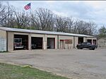
Powderly Fire Department
-
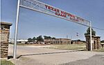
Texas National Guard
-
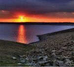
Pat Mayse Lake Dam
-
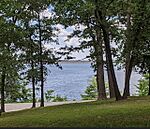
Pat Mayse Lake
-
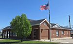
Powderly Post Office
-
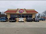
Dairy Queen
-
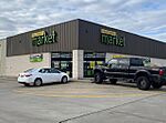
Dollar General Market
-
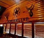
Borderline Steakhouse
-

Barber Hills Mountain Bike and Hiking Trails
-
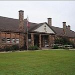
Arron Parker Elementary School


See also
 In Spanish: Powderly (Texas) para niños
