Prince Charles Island facts for kids
|
Native name:
Ammaluqtuq
|
|
|---|---|

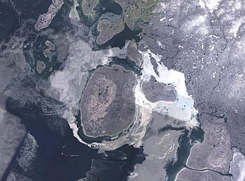
NASA Landsat image of Prince Charles Island
|
|
 |
|
| Geography | |
| Location | Foxe Basin |
| Coordinates | 67°47′N 76°12′W / 67.783°N 76.200°W |
| Area | 9,521 km2 (3,676 sq mi) |
| Highest elevation | 73 m (240 ft) |
| Administration | |
| Territory | Nunavut |
| Region | Qikiqtaaluk |
| Demographics | |
| Population | Uninhabited |
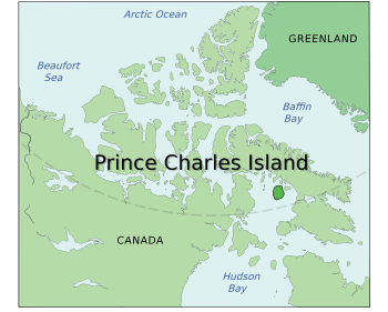
Prince Charles Island is a very large island located in Canada's far north. It is found in a place called Foxe Basin, which is off the west coast of Baffin Island. This island is part of the Qikiqtaaluk Region in Nunavut, Canada.
The island is quite big, covering about 9,521 square kilometers (3,676 square miles). This makes it the 77th largest island in the world. It is also the 19th largest island in all of Canada.
Contents
Discovery of the Island
Even though Prince Charles Island is very large, it was not officially discovered until relatively recently.
Early Sightings
The first known sighting of the island was in 1932. A tugboat captain named W. A. Poole saw the island. However, his discovery was not added to any published maps at that time.
Official Rediscovery
The island was rediscovered in 1948. This time, it was spotted by Albert-Ernest Tomkinson. He was navigating an Avro Lancaster plane for the RCAF 408 (Photo) Squadron. It is important to remember that the local Inuit people likely knew about the island long before these official discoveries.
Naming the Island
Prince Charles Island was named after Prince Charles. He was born in the same year the island was officially rediscovered, in 1948.
Life on the Island
Prince Charles Island is an uninhabited place. This means that no people live there permanently. The island experiences extremely cold temperatures throughout the year.
See also
 In Spanish: Isla del Príncipe Carlos para niños
 | Dorothy Vaughan |
 | Charles Henry Turner |
 | Hildrus Poindexter |
 | Henry Cecil McBay |


