Propre River (Quebec) facts for kids
Quick facts for kids Propre River |
|
|---|---|

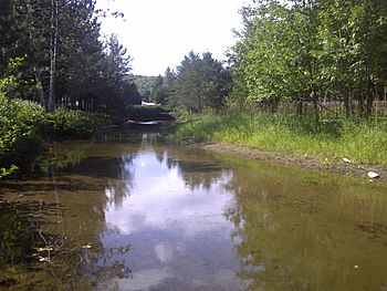
River Propre, located in Lac-aux-Sables, QC, Canada. Photo of August 11, 2013, taken from camping site at a river elbow close to its source.
|
|
| Country | Canada |
| Physical characteristics | |
| Main source | Lac aux Sables 46°50′59″N 72°25′09″W / 46.84972°N 72.41917°W |
| River mouth | Batiscan River, Lac-aux-Sables (Quebec), Canada |
| Length | 6.7 km (4.2 mi) (length including 0.5 km (0.31 mi) to cross Lake Huron) |
| Basin features | |
| Basin | Batiscanie |
The Propre River (which means "Clean River" in French) is a small river in Quebec, Canada. It flows through the area of Lac-aux-Sables. This river is part of a larger area called the Batiscanie, which is like a big natural basin where all the water flows into the Batiscan River. The Propre River is about 6.7 kilometers (or 4.2 miles) long.
Contents
Where the Propre River Flows
The Propre River starts in a place called Lac-aux-Sables. This is a lake located in the northwest part of the main village, near some campgrounds. As the river flows, it passes close to another small lake called Petit Lac Noir (Little Black Lake).
Journey Through Huron Lake
After flowing for about 2.8 kilometers (1.7 miles), the Propre River reaches the southeastern part of Huron Lake. This lake is also in Lac-aux-Sables, located between the main village and Hervey-Jonction. The river then continues its journey from the southwestern side of Huron Lake.
River's Path to the Batiscan River
From Huron Lake, the Propre River flows southeast. It goes under a road bridge called Chemin du Lac Huron. Then, it passes under a railway bridge. Finally, it flows under the Route 153 road bridge. This bridge connects Sainte-Thècle to Lac-aux-Sables.
The "Côte de la Propre"
Near the Route 153 bridge, there used to be a tricky part of the road called "Côte de la Propre" (which means "Bank of the Propre"). This section was known for being dangerous for cars. However, a new bridge and road improvements have made it much safer.
Waterfall and Old Sawmill
Below the Route 153 bridge, the river flows into a large waterfall. Long ago, a dam was built at the top of this waterfall. This dam helped power a sawmill owned by a person named Mr. Champagne.
How Long Are the River Sections?
The part of the river between Huron Lake and Route 153 is about 2.8 kilometers (1.7 miles) long. The very last part, from Route 153 to the Batiscan River, is about 0.74 kilometers (0.46 miles) long.
Joining the Batiscan River
The Propre River is a "tributary" of the Batiscan River. A tributary is a smaller river or stream that flows into a larger river. The Propre River joins the Batiscan River on its right side. Its mouth (where it joins the Batiscan River) is located 3.1 kilometers (1.9 miles) upstream from where the Tawachiche River joins the Batiscan River. It's also 1.3 kilometers (0.8 miles) downstream from the Rang Price bridge, which crosses the Batiscan River near the village of Lac-aux-Sables.
Why is it Called "Propre River"?
The name "Propre River" was officially recorded on December 5, 1968. This was done by the Commission de toponymie du Québec, which is like a special board in Quebec that names places. "Toponymy" is the study of place names and their origins.

