Puerto Bolívar, Colombia facts for kids
Quick facts for kids
Puerto Bolívar
|
|
|---|---|
| Country | |
| Department | La Guajira Department |
| Municipality | Uribia Municipality |
| Time zone | UTC-5 (Colombia Standard Time) |
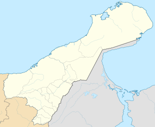
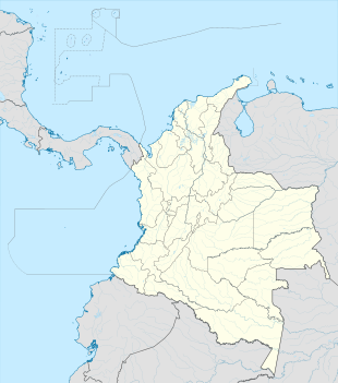
Puerto Bolívar is a very important port city in Colombia. It's located in the La Guajira Department, specifically in the Uribia area. It's known for being the biggest port in Colombia.
This port is found at the southern tip of a bay called Bahia Portete. It's a windy place that doesn't get much rain. It's about 75 km (47 mi) north of Uribia and 166 km (103 mi) from Riohacha.
Contents
History of Puerto Bolívar
How the Port Was Created
The Port of Puerto Bolívar was officially started on April 5, 1982. This happened through a special order, called a decree, from the President of Colombia at the time, Julio César Turbay Ayala.
It was first named the "Harbormaster of Bahia Portete." A harbormaster is like a boss for a port. The main goal was to make sure the government had a strong presence in this part of Colombia. This helped them control ships coming and going from Puerto Bolívar and other nearby docks.
Changing the Name
Later, in 1986, during the time President Belisario Betancur was in charge, the port's name was changed. It became known as the "Harbormaster of Puerto Bolívar," which is the name it still uses today.
Port Infrastructure and Facilities
Puerto Bolívar has many important facilities that help it operate as a major port. These include a railway, the port itself, an airport, and a motorway.
Railway System
- Long Tracks: The railway tracks are about 150 km (93 mi) long.
- Connecting to the Mine: These tracks connect Puerto Bolívar directly to the Cerrejón mine. This mine is a very large coal mine.
- Unique Railway: The Cerrejón mine uses the only 1,435 mm (4 ft 8 1⁄2 in) standard gauge freight railway in Colombia. This means it's a special type of train track used for carrying goods.
The Port Itself
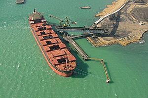
- Largest Coal Port: Puerto Bolívar is the biggest port in Latin America for exporting coal.
- Modern Loading: Since 1985, it has used covered conveyor belts. These belts move coal directly onto ships. This system is very efficient.
- Big Ships: The port can handle very large ships. Some of these ships can carry up to 180,000 tonnes (180,000 long tons; 200,000 short tons) of cargo.
Puerto Bolívar Airport
- Runway Length: The Puerto Bolívar Airport has a runway that is 1,600 metres (5,200 ft) long.
- Restricted Flights: This airport is mainly for operational support. It means it's used for flights related to the port's work, and general public flights might be restricted.
Motorway Access
- Long Road: There is a motorway that is 150 km (93 mi) long.
- Support and Access: This road was built in 1982. It helps with the port's operations and provides access for people living in the La Guajira Department.
- Connecting Regions: The motorway links the southern part of the department with the northern part.
Climate in Puerto Bolívar
Puerto Bolívar has a hot desert climate. This means it's usually very hot and dry. Most months have little to no rain. However, September, October, and November get a bit more rainfall.
| Climate data for Puerto Bolivar | |||||||||||||
|---|---|---|---|---|---|---|---|---|---|---|---|---|---|
| Month | Jan | Feb | Mar | Apr | May | Jun | Jul | Aug | Sep | Oct | Nov | Dec | Year |
| Mean daily maximum °C (°F) | 31.4 (88.5) |
31.6 (88.9) |
32.2 (90.0) |
32.9 (91.2) |
33.6 (92.5) |
34.3 (93.7) |
34.3 (93.7) |
34.5 (94.1) |
33.8 (92.8) |
32.9 (91.2) |
32.1 (89.8) |
31.5 (88.7) |
32.9 (91.3) |
| Daily mean °C (°F) | 28.0 (82.4) |
28.1 (82.6) |
28.5 (83.3) |
29.2 (84.6) |
29.9 (85.8) |
30.6 (87.1) |
30.5 (86.9) |
30.7 (87.3) |
30.3 (86.5) |
29.5 (85.1) |
29.1 (84.4) |
28.3 (82.9) |
29.4 (84.9) |
| Mean daily minimum °C (°F) | 24.6 (76.3) |
24.5 (76.1) |
24.9 (76.8) |
25.6 (78.1) |
26.3 (79.3) |
26.8 (80.2) |
26.6 (79.9) |
26.9 (80.4) |
26.9 (80.4) |
26.1 (79.0) |
26.0 (78.8) |
25.2 (77.4) |
25.9 (78.6) |
| Average rainfall mm (inches) | 4.8 (0.19) |
1.5 (0.06) |
2.6 (0.10) |
6.9 (0.27) |
27.3 (1.07) |
8.2 (0.32) |
11.0 (0.43) |
29.3 (1.15) |
60.2 (2.37) |
95.2 (3.75) |
53.5 (2.11) |
30.3 (1.19) |
330.8 (13.01) |
| Average rainy days | 2.0 | 1.0 | 0.5 | 1.5 | 3.1 | 1.6 | 1.6 | 4.2 | 7.1 | 9.8 | 6.9 | 4.6 | 43.9 |
| Average relative humidity (%) | 75.2 | 73.3 | 73.0 | 74.4 | 74.5 | 71.7 | 71.2 | 73.2 | 75.4 | 78.0 | 77.4 | 76.1 | 74.5 |
| Mean monthly sunshine hours | 279.2 | 258.2 | 270.4 | 244.0 | 245.4 | 239.5 | 276.1 | 281.1 | 235.8 | 222.2 | 228.8 | 260.2 | 3,040.9 |
| Source: IDEAM | |||||||||||||
See also
 In Spanish: Puerto Bolívar (La Guajira) para niños
 | Chris Smalls |
 | Fred Hampton |
 | Ralph Abernathy |


