Puerto Nariño facts for kids
Quick facts for kids
Puerto Nariño
|
|||
|---|---|---|---|
|
Municipality and town
|
|||
 |
|||
|
|||
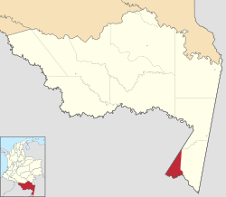
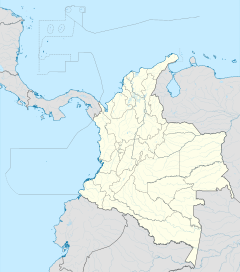
Location of the municipality and town of Puerto Nariño in the Amazonas Department of Colombia
|
|||
| Country | |||
| Department | |||
| Area | |||
| • Total | 1,876 km2 (724 sq mi) | ||
| Time zone | UTC-5 (Colombia Standard Time) | ||
| Climate | Af | ||
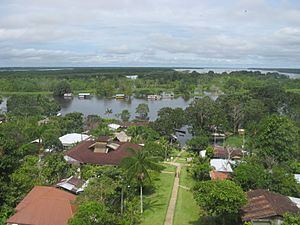
Puerto Nariño is a special town in the Amazonas region of Colombia. It is the second largest "municipality" (like a county or district) in the area. This town sits right on the edge of the mighty Amazon River.
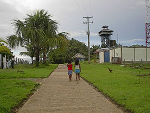
Puerto Nariño covers a big area of about 1,876 square kilometers. Around 6,000 people live here. Most of them are indigenous people from the Ticuna tribe. What makes Puerto Nariño super unique is that it's a "pedestrian-only" town. This means no cars or motorcycles are allowed! It's an exciting experiment to create an eco-friendly community. People travel between smaller villages along the river and to Leticia (the only other Colombian town nearby) using motorboats.
The town is named after a famous Colombian general, Antonio Nariño. He was an important leader in Colombia's fight for independence from Spain.
Contents
Exploring Puerto Nariño's Location
Puerto Nariño is the second biggest municipality in the Amazonas department. It is located on the banks of the Loretoyaco River. The town is about 67 kilometers (42 miles) from Leticia. It is much further, about 1,240 kilometers (770 miles), from Bogota, the capital city of Colombia. The average temperature in Puerto Nariño is around 30 degrees Celsius (86 degrees Fahrenheit).
The Story of Puerto Nariño
This special town was officially started on August 18, 1961. It was founded by a doctor named Jose Humberto Espejo Hernandez.
Puerto Nariño's Weather
Puerto Nariño has a tropical rainforest climate. This means it gets a lot of rain all year round. The weather is usually warm and humid, which is perfect for the amazing plants and animals that live in the Amazon rainforest.
| Climate data for Puerto Nariño | |||||||||||||
|---|---|---|---|---|---|---|---|---|---|---|---|---|---|
| Month | Jan | Feb | Mar | Apr | May | Jun | Jul | Aug | Sep | Oct | Nov | Dec | Year |
| Mean daily maximum °C (°F) | 30.7 (87.3) |
30.8 (87.4) |
30.7 (87.3) |
30.5 (86.9) |
30.1 (86.2) |
29.7 (85.5) |
29.9 (85.8) |
30.7 (87.3) |
31.0 (87.8) |
31.2 (88.2) |
31.2 (88.2) |
31.0 (87.8) |
30.6 (87.1) |
| Daily mean °C (°F) | 26.1 (79.0) |
26.1 (79.0) |
26.2 (79.2) |
25.9 (78.6) |
25.7 (78.3) |
25.3 (77.5) |
25.1 (77.2) |
25.7 (78.3) |
25.9 (78.6) |
26.3 (79.3) |
26.4 (79.5) |
26.2 (79.2) |
25.9 (78.6) |
| Mean daily minimum °C (°F) | 21.5 (70.7) |
21.5 (70.7) |
21.7 (71.1) |
21.4 (70.5) |
21.4 (70.5) |
20.9 (69.6) |
20.3 (68.5) |
20.8 (69.4) |
20.9 (69.6) |
21.5 (70.7) |
21.7 (71.1) |
21.5 (70.7) |
21.3 (70.3) |
| Average rainfall mm (inches) | 349.7 (13.77) |
304.0 (11.97) |
300.9 (11.85) |
323.8 (12.75) |
290.7 (11.44) |
250.6 (9.87) |
151.8 (5.98) |
138.3 (5.44) |
193.2 (7.61) |
203.1 (8.00) |
193.2 (7.61) |
349.2 (13.75) |
3,048.5 (120.04) |
| Average rainy days (≥ 1 mm) | 19 | 17 | 15 | 16 | 17 | 15 | 10 | 9 | 12 | 13 | 12 | 19 | 174 |
| Source 1: IDEAM | |||||||||||||
| Source 2: Climate-Data.org | |||||||||||||
See also
 In Spanish: Puerto Nariño para niños
 | George Robert Carruthers |
 | Patricia Bath |
 | Jan Ernst Matzeliger |
 | Alexander Miles |


