Punta Gabarró facts for kids
Quick facts for kids Punta Gabarró |
|
|---|---|

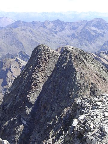
Punta Gabarró seen from Pica d'Estats
|
|
| Highest point | |
| Elevation | 3,105 m (10,187 ft) |
| Geography | |
| Location | Ariège, France Pallars Sobirà, Spain |
| Parent range | Montcalm Massif, Pyrenees |
| Geology | |
| Mountain type | Granite |
| Climbing | |
| First ascent | Unknown |
| Easiest route | From Vallferrera, Alins |
Punta Gabarró, also known as Punta de Gabarró, is a tall mountain. It is part of the Montcalm Massif in the Pyrenees mountain range. This peak stands right on the border between France and Spain.
Punta Gabarró reaches a height of 3,105 meters (about 10,187 feet) above sea level. It is one of the many impressive peaks in this area.
Why is it called Punta Gabarró?
This mountain was named after a person named Pere Gabarró i Garcia. He was a famous mountaineer from Catalonia, a region in Spain. Pere Gabarró was known for finding new ways to climb mountains.
He discovered a new path to reach the top of Pica d'Estats. This mountain is very close to Punta Gabarró. Naming the peak after him was a way to honor his achievements.
Where is Punta Gabarró located?
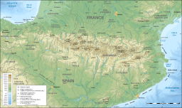
Punta Gabarró is found in the central part of the Pyrenees. This mountain range forms a natural border between France and Spain. On the French side, it is in the Ariège department. On the Spanish side, it is in Pallars Sobirà.
The mountain is also part of an important nature area. It is included in the Parc Natural de l'Alt Pirineu. This park is a protected area in Catalonia, Spain. Other famous peaks like Pica d'Estats and Pic Verdaguer are also within this park. These areas help protect the unique plants and animals of the Pyrenees.
See also
 In Spanish: Punta de Gabarró para niños
- List of Pyrenean three-thousanders
- List of mountains in Catalonia
 | William L. Dawson |
 | W. E. B. Du Bois |
 | Harry Belafonte |


