Pica d'Estats facts for kids
Quick facts for kids Pica d'Estats |
|
|---|---|

Summit of Pica d'Estats
|
|
| Highest point | |
| Elevation | 3,143 m (10,312 ft) |
| Prominence | 1,280 m (4,200 ft) |
| Parent peak | Montcalm Massif |
| Geography | |
|
Lua error in Module:Location_map at line 420: attempt to index field 'wikibase' (a nil value).
|
|
| State/Province | FR |
| Parent range | Pyrenees |
| Climbing | |
| First ascent | 1864 by Henry Russell and Jean-Jacques Denjean |
| Easiest route | By the Vall Ferrera (Spain) |
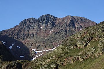
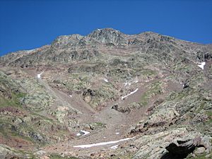
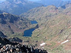
Pica d'Estats is a very tall mountain in the Pyrenees mountain range. It stands at 3,143 meters (about 10,312 feet) high! You can find it right on the border between Spain and France.
In Catalan and Spanish, its name is Pica d'Estats. In French, it's called Pic d'Estats. This mountain is part of a larger group of peaks known as the Montcalm Massif.
Pica d'Estats is a really important mountain for both countries. In France, it's the highest point in the Occitanie region and the Ariège department. In Spain, it's the tallest mountain in the Catalonia community and the Lleida province.
Contents
Exploring the Mountain's Geography
The summit (the very top) of Pica d'Estats is located right on the edge of the Regional Natural Park of the Pyrenees of Ariège in France. This park is known for its beautiful nature.
Pica d'Estats is part of a group of mountains called the Massif du Montcalm. It is the highest peak in the East-Central Pyrenees.
The Three Peaks of Pica d'Estats
The very top of Pica d'Estats actually has three main peaks that are very close to each other:
- The Central peak, also known as Pica d'Estats, is the tallest at 3,143 meters.
- The Western peak, or Pic de Verdaguer, is 3,131 meters high.
- The Eastern peak, or Punta Gabarró, is 3,115 meters high. You can find a special marker called a triangulation station here.
These three peaks line up from north-northwest to southeast, following the border between Spain and France.
Mountain's Rock: Geology
The top of Pica d'Estats is made of a type of rock called granite. Granite is a very strong and common rock found in many mountain ranges.
Weather on the Peak: Climate
Even though Pica d'Estats is very high up, it doesn't always have a lot of snow. The weather can change quickly in the mountains, so climbers always need to be prepared.
History of First Climbs
People have been climbing Pica d'Estats for a long time. The first recorded climb of this peak was in 1827 by two explorers named Corabœuf and Jean-Jacques Testu. Later, in June 1864, a famous climber named Henry Russell also reached the summit.
See also
 In Spanish: Pica d'Estats para niños
 | Stephanie Wilson |
 | Charles Bolden |
 | Ronald McNair |
 | Frederick D. Gregory |


