Pāpaʻaloa, Hawaii facts for kids
Quick facts for kids
Pāpaʻaloa, Hawaii
|
|
|---|---|
| Country | United States |
| State | Hawaii |
| County | Hawaiʻi |
| Elevation | 10 ft (3 m) |
| Time zone | UTC-10 (Hawaii-Aleutian (HST)) |
| ZIP codes |
96780
|
| GNIS feature ID | 363109 |
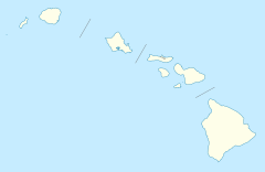
Pāpaʻaloa (sometimes spelled Papaaloa) is a small community in Hawaii, United States. It's located on the island of Hawaiʻi, which is part of Hawaiʻi County. This area is called an unincorporated community. This means it's a place with a shared identity, but it doesn't have its own local government like a city or town.
Pāpaʻaloa is found along Hawaii Route 19. It is north of Hilo, which is the main city and government center for Hawaiʻi County. The community sits about 300 feet (or 90 meters) above the sea.
The Name of Pāpaʻaloa
Over the years, the name of this community has changed a few times. Because of this, the United States Board on Geographic Names stepped in. This board is in charge of officially naming places in the U.S. They first named it "Papaaloa" in 1914 and again in 1954. Finally, in 2001, they officially gave it the current name, Pāpaʻaloa. The community also has its own post office with the ZIP code 96780.
Streams and Waterways
Several streams flow near or through Pāpaʻaloa. These natural waterways are an important part of the area's geography.
- Kihalani Stream runs along the northwest side of the community.
- Kaiwilahilah Stream flows through the middle.
- Ha'akoa Stream is located on the southeast side.
See also
 In Spanish: Pāpaʻaloa para niños
 | Jessica Watkins |
 | Robert Henry Lawrence Jr. |
 | Mae Jemison |
 | Sian Proctor |
 | Guion Bluford |


