Rafael Freyre facts for kids
Quick facts for kids
Rafael Freyre
|
|
|---|---|
 |
|

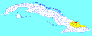
Rafael Freyre municipality (red) within
Holguín Province (yellow) and Cuba |
|
| Country | Cuba |
| Province | Holguín |
| Area | |
| • Total | 620 km2 (240 sq mi) |
| Elevation | 25 m (82 ft) |
| Population
(2022)
|
|
| • Total | 53,408 |
| • Density | 86.1/km2 (223.1/sq mi) |
| Time zone | UTC-5 (EST) |
| Area code(s) | +53-24 |
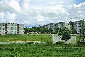
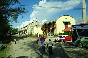
Rafael Freyre is a municipality and town in the Holguín Province of Cuba. It is a place where many people live and work.
About Rafael Freyre
The main town of Rafael Freyre grew up around a sugar cane factory. This factory was very important for the area.
There is a middle school here called “ESBU Rafael Freyre Torres.” Many students from smaller nearby towns attend this school. These towns include Los Mineros, La Viuda, and Cochico.
Beaches and History
Rafael Freyre is close to some beautiful beaches on the north coast. These include Playa Guardalavaca and Guardalavaca. They are known for their natural white sand. These beaches are actually in the neighboring municipality of Banes.
In a small village called Bariay, you can find a special monument. This monument marks the spot where Christopher Columbus first arrived in Cuba. It is a historical place.
Population Information
In 2022, about 53,408 people lived in the municipality of Rafael Freyre. The total area of the municipality is about 620 km2 (240 sq mi). This means there are about 86/km2 (220/sq mi) people living in each square kilometer.
See also
 In Spanish: Rafael Freyre (Cuba) para niños
 | Roy Wilkins |
 | John Lewis |
 | Linda Carol Brown |


