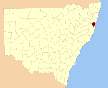
Raleigh County is a special area in New South Wales, Australia. It's one of 141 "cadastral divisions" in the state. Think of a cadastral division as a way to officially divide land for things like property records and maps. This county includes the town of Nambucca Heads and is located just south of the Bellinger River. We don't actually know how Raleigh County got its name!
Exploring Raleigh County's Parishes
Within Raleigh County, there are smaller areas called parishes. In this case, a parish is like a smaller land division used for mapping and administrative purposes. Each parish belongs to a local government area (LGA), which is like a local council that manages services for the community.
Below is a list of these parishes. You can also see which local council they belong to and their approximate location on a map using the coordinates.
| Parish |
Local Council Area |
Map Location |
| Allgomera |
Nambucca Shire Council |
30°45′54″S 152°50′04″E / 30.76500°S 152.83444°E / -30.76500; 152.83444 (Allgomera) |
| Belmore |
Bellingen Shire Council |
30°28′54″S 152°46′04″E / 30.48167°S 152.76778°E / -30.48167; 152.76778 (Belmore) |
| Bonville |
City of Coffs Harbour |
30°22′54″S 153°00′04″E / 30.38167°S 153.00111°E / -30.38167; 153.00111 (Bonville) |
| Bowra |
Nambucca Shire Council |
30°40′54″S 152°52′04″E / 30.68167°S 152.86778°E / -30.68167; 152.86778 (Bowra) |
| Buckra Bendinni |
Nambucca Shire Council |
30°36′54″S 152°46′04″E / 30.61500°S 152.76778°E / -30.61500; 152.76778 (Buckra Bendinni) |
| Congarinni |
Nambucca Shire Council |
30°43′54″S 152°54′04″E / 30.73167°S 152.90111°E / -30.73167; 152.90111 (Congarinni) |
| Denison |
Nambucca Shire Council |
30°46′54″S 152°44′04″E / 30.78167°S 152.73444°E / -30.78167; 152.73444 (Denison) |
| Dingle |
Bellingen Shire Council |
30°24′54″S 152°35′04″E / 30.41500°S 152.58444°E / -30.41500; 152.58444 (Dingle) |
| Dudley |
Bellingen Shire Council |
30°29′54″S 152°41′04″E / 30.49833°S 152.68444°E / -30.49833; 152.68444 (Dudley) |
| Gladstone |
Bellingen Shire Council |
30°29′54″S 152°50′04″E / 30.49833°S 152.83444°E / -30.49833; 152.83444 (Gladstone) |
| Herborn |
Nambucca Shire Council |
30°38′54″S 152°38′04″E / 30.64833°S 152.63444°E / -30.64833; 152.63444 (Herborn) |
| Ingalba |
Nambucca Shire Council |
30°49′54″S 152°43′04″E / 30.83167°S 152.71778°E / -30.83167; 152.71778 (Ingalba) |
| Ketelghay |
Nambucca Shire Council |
30°39′31″S 152°44′56″E / 30.65861°S 152.74889°E / -30.65861; 152.74889 (Ketelghay) |
| Medlow |
Nambucca Shire Council |
30°45′54″S 152°39′04″E / 30.76500°S 152.65111°E / -30.76500; 152.65111 (Medlow) |
| Merrylegai |
Nambucca Shire Council |
30°33′54″S 152°41′04″E / 30.56500°S 152.68444°E / -30.56500; 152.68444 (Merrylegai) |
| Missabotti |
Nambucca Shire Council |
30°34′54″S 152°50′04″E / 30.58167°S 152.83444°E / -30.58167; 152.83444 (Missabotti) |
| Nambucca |
Nambucca Shire Council |
30°38′54″S 152°56′04″E / 30.64833°S 152.93444°E / -30.64833; 152.93444 (Nambucca) |
| Never Never |
Bellingen Shire Council |
30°21′54″S 152°50′04″E / 30.36500°S 152.83444°E / -30.36500; 152.83444 (Never Never) |
| Newry |
Bellingen Shire Council |
30°29′54″S 153°00′04″E / 30.49833°S 153.00111°E / -30.49833; 153.00111 (Newry) |
| North Bellingen |
Bellingen Shire Council |
30°24′54″S 152°57′04″E / 30.41500°S 152.95111°E / -30.41500; 152.95111 (North Bellingen) |
| North Creek |
Nambucca Shire Council |
30°37′24″S 152°35′04″E / 30.62333°S 152.58444°E / -30.62333; 152.58444 (North Creek) |
| Oakes |
Bellingen Shire Council |
30°29′54″S 152°34′04″E / 30.49833°S 152.56778°E / -30.49833; 152.56778 (Oakes) |
| Raleigh |
Nambucca Shire Council |
30°32′54″S 152°31′04″E / 30.54833°S 152.51778°E / -30.54833; 152.51778 (Raleigh) |
| South Bellingen |
Bellingen Shire Council |
30°29′54″S 152°57′04″E / 30.49833°S 152.95111°E / -30.49833; 152.95111 (South Bellingen) |
| Timboon |
Bellingen Shire Council |
30°21′54″S 152°56′04″E / 30.36500°S 152.93444°E / -30.36500; 152.93444 (Timboon) |
| Unkya |
Nambucca Shire Council |
30°51′54″S 152°50′04″E / 30.86500°S 152.83444°E / -30.86500; 152.83444 (Unkya) |
| Valley Valley |
Nambucca Shire Council |
30°35′54″S 152°58′04″E / 30.59833°S 152.96778°E / -30.59833; 152.96778 (Valley Valley) |
| Vautin |
Bellingen Shire Council |
30°23′54″S 152°43′04″E / 30.39833°S 152.71778°E / -30.39833; 152.71778 (Vautin) |
| Warrell |
Nambucca Shire Council |
30°47′54″S 152°56′04″E / 30.79833°S 152.93444°E / -30.79833; 152.93444 (Warrell) |
| Waverley |
Bellingen Shire Council |
30°27′54″S 152°28′04″E / 30.46500°S 152.46778°E / -30.46500; 152.46778 (Waverley) |
| Yarranbella |
Nambucca Shire Council |
30°44′54″S 152°43′04″E / 30.74833°S 152.71778°E / -30.74833; 152.71778 (Yarranbella) |


