Randall, Indiana facts for kids
Quick facts for kids
Randall, Indiana
|
|
|---|---|

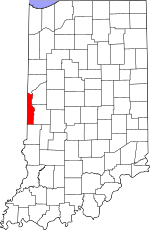
Vermillion County's location in Indiana
|
|
| Country | United States |
| State | Indiana |
| County | Vermillion |
| Township | Helt |
| Elevation | 617 ft (188 m) |
| Time zone | UTC-5 (Eastern (EST)) |
| • Summer (DST) | UTC-4 (EDT) |
| ZIP code |
47847
|
| Area code(s) | 765 |
| GNIS feature ID | 441760 |
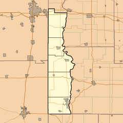
Randall was once a small town in Vermillion County, Indiana, in the United States. Today, it's known as a ghost town, meaning it's no longer an active community. It's located in Helt Township, about 1.6 miles northwest of another old town called Toronto. The closest town that still exists today is Dana, which is to the northeast.
The Story of Randall
Randall was named after the Randall family, who were early settlers in the area. A post office was opened in Randall in 1858. This meant people could send and receive mail right in their community. However, the post office closed its doors in 1872. After that, the town slowly faded away, becoming the ghost town it is today.
Where Was Randall Located?
Randall was situated at specific geographic coordinates: 39 degrees, 46 minutes, 30 seconds North and 87 degrees, 31 minutes, 21 seconds West. These numbers are like an address on a map, helping us pinpoint its exact spot on Earth. It was located in Vermillion County, in the state of Indiana.
 | Leon Lynch |
 | Milton P. Webster |
 | Ferdinand Smith |


