Randlett, Oklahoma facts for kids
Quick facts for kids
Randlett, Oklahoma
|
|
|---|---|

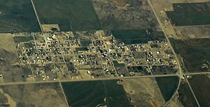
Aerial view of Randlett
|
|

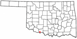
Location of Randlett, Oklahoma
|
|
| Country | United States |
| State | Oklahoma |
| County | Cotton |
| Area | |
| • Total | 0.63 sq mi (1.63 km2) |
| • Land | 0.63 sq mi (1.63 km2) |
| • Water | 0.00 sq mi (0.00 km2) |
| Elevation | 1,040 ft (320 m) |
| Population
(2020)
|
|
| • Total | 289 |
| • Density | 460.93/sq mi (177.84/km2) |
| Time zone | UTC-6 (Central (CST)) |
| • Summer (DST) | UTC-5 (CDT) |
| ZIP code |
73562
|
| Area code(s) | 580 |
| FIPS code | 40-61850 |
| GNIS feature ID | 2412527 |
Randlett is a small town located in Cotton County, Oklahoma, in the United States. In 2020, about 289 people lived there. Randlett is found about 22 miles southwest of Walters, which is the main town of Cotton County. It's also where three important roads, US Route 277, US Route 281, and US Route 70, meet up.
Contents
The Story of Randlett
Randlett got its name from James F. Randlett. He was an agent who worked with the Comanche and Kiowa people. The town was planned out in 1906. People bought land lots at a public sale on May 13, 1907. By 1910, the town had grown to 574 people.
The town tried to get a railroad to come through, but it didn't happen. Even without a railroad, Randlett still did well. It became an important place for farming. In the 1910s and 1920s, there was a short period of oil and gas drilling.
Where is Randlett?
Randlett is located in Oklahoma. The United States Census Bureau says the town covers about 0.6 square miles. All of this area is land, with no large bodies of water.
Who Lives in Randlett?
| Historical population | |||
|---|---|---|---|
| Census | Pop. | %± | |
| 1910 | 574 | — | |
| 1920 | 323 | −43.7% | |
| 1930 | 257 | −20.4% | |
| 1940 | 327 | 27.2% | |
| 1950 | 396 | 21.1% | |
| 1960 | 356 | −10.1% | |
| 1970 | 384 | 7.9% | |
| 1980 | 461 | 20.1% | |
| 1990 | 458 | −0.7% | |
| 2000 | 511 | 11.6% | |
| 2010 | 438 | −14.3% | |
| 2020 | 289 | −34.0% | |
| U.S. Decennial Census | |||
The number of people living in Randlett has changed over the years. In 1910, there were 574 residents. By 2020, the population was 289 people.
People and Homes
In 2000, there were 511 people living in Randlett. They lived in 194 homes. About 140 of these homes were families. The town had about 810 people per square mile.
Most people in Randlett were White (about 95.89%). There were also small numbers of African American, Native American, and Pacific Islander residents. Some people were from other races or had mixed backgrounds. About 4.70% of the population was Hispanic or Latino.
Many homes (36.1%) had children under 18 living there. More than half (56.2%) were married couples living together. Some homes (12.4%) had a female head of household without a husband. About 24.2% of all homes were single individuals.
Age and Income
The people in Randlett were of different ages. About 28.4% were under 18 years old. About 13.7% were 65 years or older. The average age in the town was 34 years.
In 2000, the average income for a home in Randlett was about $27,019 per year. For families, the average income was about $30,455. About 15.5% of all people in Randlett lived below the poverty line. This included 20.7% of those under 18.
Randlett is part of the Big Pasture Public Schools system. This is a school system for rural areas.
See also
 In Spanish: Randlett (Oklahoma) para niños

