Rarden, Ohio facts for kids
Quick facts for kids
Rarden, Ohio
|
|
|---|---|
|
Village
|
|

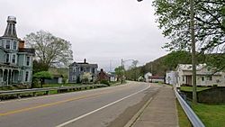
West Main Street of Rarden, Ohio.
|
|

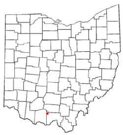
Location of Rarden, Ohio
|
|

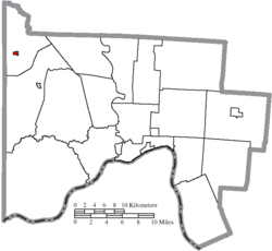
Location of Rarden in Scioto County
|
|
| Country | United States |
| State | Ohio |
| County | Scioto |
| Government | |
| • Type | Village |
| Area | |
| • Total | 0.21 sq mi (0.55 km2) |
| • Land | 0.21 sq mi (0.55 km2) |
| • Water | 0.00 sq mi (0.00 km2) |
| Elevation | 633 ft (193 m) |
| Population
(2020)
|
|
| • Total | 146 |
| • Density | 688.68/sq mi (266.44/km2) |
| Time zone | UTC-5 (Eastern (EST)) |
| • Summer (DST) | UTC-4 (EDT) |
| ZIP code |
45671
|
| Area code(s) | 740 |
| FIPS code | 39-65508 |
| GNIS feature ID | 2399044 |
Rarden is a small village located in Scioto County, Ohio, United States. In 2020, about 146 people lived there. It's a quiet place with a rich history.
Contents
History of Rarden
Rarden started in 1846 and was first called "Moccasin" by early settlers from Pennsylvania. Later, Orvil Grant, who was the brother of famous general and president Ulysses S. Grant, moved to the area. He renamed the village "Galena" after his family's home in Galena, Illinois.
The village officially became a town in 1886. At that time, its name was changed to Rarden to honor an early settler named Thomas Ephrim Rarden. Five years later, in 1891, Rarden Township became its own separate area.
Interesting Buildings and Groups
In 1899, a large 22-room Victorian mansion was built in Rarden. It was owned by Lafe Taylor, a local businessman. Over the years, this big house was used for many things. It was a home, a hotel, a place for people to board, and even a nursing home. For a while, it was also a local haunted house attraction!
The Rarden Volunteer Fire Department was started in 1960. This group of volunteers helps keep the community safe from fires.
There was also a group called Rarden Lodge No. 919, Independent Order of Odd Fellows. This group was formed in 1911. They later joined with another lodge in 1922.
Geography of Rarden
Rarden is a very small village. According to the United States Census Bureau, the total area of the village is about 0.21 square miles. All of this area is land, meaning there are no large bodies of water within the village limits.
Population Changes in Rarden
The number of people living in Rarden has changed over many years. Here's a look at how the population has grown and shrunk:
| Historical population | |||
|---|---|---|---|
| Census | Pop. | %± | |
| 1890 | 296 | — | |
| 1900 | 443 | 49.7% | |
| 1910 | 350 | −21.0% | |
| 1920 | 302 | −13.7% | |
| 1930 | 303 | 0.3% | |
| 1940 | 306 | 1.0% | |
| 1950 | 251 | −18.0% | |
| 1960 | 250 | −0.4% | |
| 1970 | 232 | −7.2% | |
| 1980 | 199 | −14.2% | |
| 1990 | 184 | −7.5% | |
| 2000 | 176 | −4.3% | |
| 2010 | 159 | −9.7% | |
| 2020 | 146 | −8.2% | |
| U.S. Decennial Census | |||
Rarden's Population in 2010
In 2010, there were 159 people living in Rarden. These people lived in 67 different homes, and 46 of these were families. The village had about 757 people per square mile. There were also 82 housing units, which are places where people can live.
Most of the people in Rarden in 2010 were White, making up 99.4% of the population. A small number, 0.6%, were Asian.
Households and Families
Out of the 67 homes in Rarden:
- Almost 30% had children under 18 living there.
- About 49% were married couples living together.
- About 10% had a female head of the house with no husband present.
- About 9% had a male head of the house with no wife present.
- About 31% were not families, meaning individuals living alone or with non-relatives.
About 28% of all homes were made up of just one person. And about 13.5% of homes had someone 65 years old or older living alone. On average, there were about 2.37 people in each home and 2.87 people in each family.
Age of Residents
The average age of people in Rarden in 2010 was 42.5 years old.
- About 24% of residents were under 18 years old.
- About 7% were between 18 and 24 years old.
- About 24% were between 25 and 44 years old.
- About 28% were between 45 and 64 years old.
- About 17% were 65 years old or older.
When it came to gender, about 46.5% of the people in Rarden were male, and 53.5% were female.
See also
 In Spanish: Rarden (Ohio) para niños

