Raubsville, Pennsylvania facts for kids
Quick facts for kids
Raubsville, Pennsylvania
|
|
|---|---|
| Village of Raubsville | |

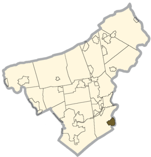
Location of Raubsville in Northampton County, Pennsylvania
|
|
| Country | |
| State | |
| County | Northampton |
| Township | Williams |
| Area | |
| • census-designated place | 1.70 sq mi (4.40 km2) |
| • Land | 1.59 sq mi (4.12 km2) |
| • Water | 0.11 sq mi (0.28 km2) |
| Population
(2020)
|
|
| • census-designated place | 1,079 |
| • Density | 678.19/sq mi (261.80/km2) |
| • Metro | 865,310 (US: 68th) |
| Time zone | UTC-5 (Eastern (EST)) |
| • Summer (DST) | UTC-4 (EDT) |
| ZIP Code |
18042
|
| Area code(s) | 610 and 484 |
| FIPS code | 42-63488 |
Raubsville is a small community in Pennsylvania, United States. It is known as a census-designated place, which means it's a special area defined by the government for counting people. Raubsville is located in Williams Township, Northampton County, Pennsylvania.
In 2020, about 1,079 people lived in Raubsville. This charming village sits right next to the Delaware River. It is also part of the larger Lehigh Valley area. This bigger area is home to over 860,000 people.
Contents
Education and Schools in Raubsville
Students in Raubsville attend schools in the Wilson Area School District. Young people in grades 9 through 12 go to Wilson Area High School. This helps make sure everyone gets a good education.
Location and Local Services
Raubsville is easy to find because it's located along PA Route 611. This road runs along the west side of the Delaware River. For mail, Raubsville uses the Easton ZIP Code 18042.
Population Changes Over Time
The number of people living in Raubsville changes over the years. The United States Census Bureau keeps track of these numbers. Here's how the population has looked:
| Historical population | |||
|---|---|---|---|
| Census | Pop. | %± | |
| 2020 | 1,079 | — | |
| U.S. Decennial Census | |||
See also
 In Spanish: Raubsville para niños
 | Selma Burke |
 | Pauline Powell Burns |
 | Frederick J. Brown |
 | Robert Blackburn |


