Ravalli, Montana facts for kids
Quick facts for kids
Ravalli, Montana
|
|
|---|---|
 |
|

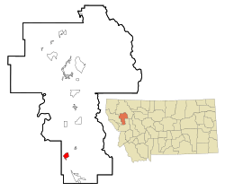
Location of Ravalli, Montana
|
|
| Country | United States |
| State | Montana |
| County | Lake |
| Area | |
| • Total | 2.64 sq mi (6.84 km2) |
| • Land | 2.63 sq mi (6.81 km2) |
| • Water | 0.01 sq mi (0.03 km2) |
| Elevation | 2,717 ft (828 m) |
| Population
(2020)
|
|
| • Total | 85 |
| • Density | 32.34/sq mi (12.49/km2) |
| Time zone | UTC-7 (Mountain (MST)) |
| • Summer (DST) | UTC-6 (MDT) |
| ZIP code |
59863
|
| Area code(s) | 406 |
| FIPS code | 30-61075 |
| GNIS feature ID | 0775601 |
Ravalli (in the Salish language: sk̓ʷɫólqʷe, sk̓ʷɫʔó) is a small, unincorporated community in Lake County, Montana, United States. This means it's not an official city or town with its own government. For counting purposes, the U.S. Census Bureau calls Ravalli a census-designated place (CDP).
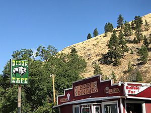
In 2020, about 85 people lived here. Back in the early 1900s, Ravalli was very important for saving American bison. It was home to the Pablo-Allard herd, which was one of the largest groups of bison left in the U.S. This herd played a huge role in bringing bison back from almost disappearing.
Contents
History of Ravalli
A post office was set up in Ravalli in 1887. It served the community for many years until it closed in 1983. The community was named after Antonio Ravalli, who was a Jesuit missionary. He worked with Native American tribes in the area.
Geography and Location
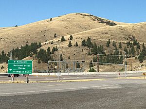
Ravalli is located in the southern part of Lake County. It sits at a key meeting point where U.S. Route 93 and Montana Highway 200 cross paths. This spot is at the bottom of a large hill, close to the famous CSKT Bison Range.
- U.S. Route 93 goes north about 33 miles (53 km) to Polson, which is the main town in Lake County.
- It also goes south about 36 miles (58 km) to Missoula, a larger city.
- Montana Highway 200 heads west about 7 miles (11 km) to Dixon.
According to the United States Census Bureau, Ravalli covers a total area of about 2.64 square miles (6.8 square kilometers). Most of this area is land, with only a tiny bit (0.01 square miles or 0.03 square kilometers) being water. The community is in the valley of the Jocko River. This river flows northwest and eventually joins the Flathead River near Dixon.
Climate in Ravalli
Ravalli has a type of weather called a humid continental climate. This means it has big changes in temperature throughout the year. Summers are usually warm to hot, and sometimes humid. Winters are cold, and can sometimes be very cold. On climate maps, this is often shown as "Dfb".
Population and People
| Historical population | |||
|---|---|---|---|
| Census | Pop. | %± | |
| 2020 | 85 | — | |
| U.S. Decennial Census | |||
In 2000, there were 119 people living in Ravalli. By 2010, the population had gone down to 76 people. The latest count in 2020 showed 85 people living there.
In 2000, about 71% of the people living in Ravalli were White, and about 28% were Native American. A small number of people were from two or more races. About 7% of the population identified as Hispanic or Latino.
The median age in Ravalli in 2000 was 34 years old. This means half the people were younger than 34 and half were older. About 28% of the population was under 18 years old.
See also
 In Spanish: Ravalli (Montana) para niños
 | William M. Jackson |
 | Juan E. Gilbert |
 | Neil deGrasse Tyson |


