Reiderland facts for kids
Quick facts for kids
Reiderland
|
|||
|---|---|---|---|
|
Former Municipality
|
|||
|
|||
 |
|||
| Country | Netherlands | ||
| Province | Groningen | ||
| Area
(2006)
|
|||
| • Total | 156.72 km2 (60.51 sq mi) | ||
| • Land | 98.55 km2 (38.05 sq mi) | ||
| • Water | 58.16 km2 (22.46 sq mi) | ||
| Population
(1 January, 2007)
|
|||
| • Total | 7,004 | ||
| • Density | 71/km2 (180/sq mi) | ||
| Source: CBS, Statline. | |||
| Time zone | UTC+1 (CET) | ||
| • Summer (DST) | UTC+2 (CEST) | ||
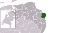
Reiderland (Dutch pronunciation: [ˌrɛidərˈlɑnt]) was a special area in the Netherlands. It was a municipality in the province of Groningen. This area is in the northeastern part of the Netherlands.
Reiderland was created in 1990. This happened during a big change in how municipalities were organized. Two older municipalities, Finsterwolde and Bad Nieuweschans, became part of Beerta. In 1992, this new municipality was named Reiderland. Later, in 2010, Reiderland joined with another municipality called Oldambt.
Exploring Reiderland's Villages
This section lists the towns and villages that were part of the Reiderland municipality. These places are important for understanding the area.
- Beersterhoogen
- Beerta
- Booneschans
- Drieborg
- Ekamp
- Finsterwolde
- Finsterwolderhamrik
- Ganzedijk
- Goldhoorn
- Hamdijk
- Hongerige Wolf
- Kostverloren
- Kromme-Elleboog
- Nieuw-Beerta
- Nieuwe Statenzijl
- Bad Nieuweschans
- Oude Statenzijl
- Oudedijk
- Oudezijl
- Ulsda
The Historic Reiderland Area
The name Reiderland also refers to a historical area of land. This older area was located in both the Netherlands and Germany. A long time ago, in 1277, a large flood happened. This flood created the Dollart inlet. Sadly, 33 villages and a town in Reiderland were covered by water.
Over time, much of this land has been recovered. People used a process called empoldering to reclaim the land from the water. This means they built dikes and drained the water away. You can learn more about villages lost to floods in the Netherlands by checking the List of settlements lost to floods in the Netherlands#Drowned villages in Groningen province.
See also
 In Spanish: Reiderland para niños
 | Janet Taylor Pickett |
 | Synthia Saint James |
 | Howardena Pindell |
 | Faith Ringgold |


