
Relizane Province facts for kids
Quick facts for kids
Relizane Province
ولاية غليزان
|
|
|---|---|

Map of Algeria highlighting Relizane
|
|
| Country | |
| Capital | Relizane |
| Area | |
| • Total | 4,870 km2 (1,880 sq mi) |
| Population
(2008)
|
|
| • Total | 733,060 |
| • Density | 150.53/km2 (389.9/sq mi) |
| Time zone | UTC+01 (CET) |
| Area Code | +213 (0) 46 |
| ISO 3166 code | DZ-48 |
| Districts | 13 |
| Municipalities | 38 |
Relizane Province is a special area, like a state or region, in the country of Algeria. Its main city and capital is called Relizane. This province is located in the northwestern part of Algeria. It's known for its farming and beautiful landscapes.
Contents
About Relizane Province
Relizane Province covers an area of about 4,870 square kilometers. In 2008, more than 733,000 people lived there. The province is led by a governor, called a Wāli, and also has a local assembly that helps make decisions for the people.
How Relizane Province is Organized
Relizane Province is divided into smaller parts to help manage everything. These parts are called districts and municipalities.
Districts of Relizane
The province has 13 main areas known as districts. Each district includes several smaller towns and villages. Here are the names of these districts:
- Ain Tarik
- Ammi Moussa
- Djidiouia
- El H'Madna
- El Matmar
- Mazouna
- Mendes
- Oued Rhiou
- Ramka
- Relizane
- Sidi M'Hamed Ben Ali
- Yellel
- Zemmoura
Municipalities
Within these 13 districts, there are 38 smaller areas called communes or municipalities. These are like local towns or groups of villages that have their own local governments.
Images for kids
-
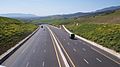
Autoroute Est-Ouest, a highway near Ghomri in Relizane Province.

See also
 In Spanish: Provincia de Relizan para niños
