Rhee Wall facts for kids
The Rhee Wall is an old waterway in a place called Romney Marsh in Kent, England. It's about 12.1 kilometers (7.5 miles) long. This long, raised path stretches from Appledore in the northwest all the way to New Romney near the coast.
The Rhee Wall acts like a border. It separates the main part of Romney Marsh from another area called Walland Marsh.
Contents
What is the Rhee Wall?
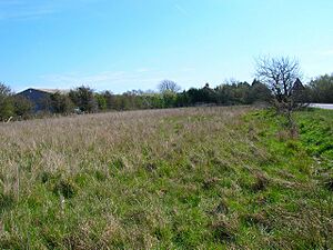
The Rhee Wall isn't just one bank of earth. It's made of two parallel earth banks. These banks are usually between 50 and 100 meters apart. The ground between them is higher than the marshland on either side. This made it a raised path, even though it was originally meant for water.
Why was the Rhee Wall built?
The Rhee Wall was built a long time ago, in the 1200s.
- First, a waterway was dug from Appledore to Old Romney.
- Then, in the year 1258, it was made even longer, reaching New Romney.
The main reason for building it was to help the harbour at New Romney. Harbours often get filled up with mud and sand, which is called silt. The people back then wanted to use the Rhee Wall to wash away this silt. They hoped a strong flow of water would keep the harbour clear.
There were special gates, called sluices, along the Rhee Wall. These sluices were at Appledore, Snargate, and New Romney. They helped control how much water flowed through the channel.
What happened to the Rhee Wall?
Even with the Rhee Wall, the harbour at New Romney kept getting filled with silt. Then, a very big flood happened in February 1287. This flood completely blocked the harbour at New Romney.
After this flood, the River Rother, which used to flow into the sea at New Romney, changed its path. It started flowing somewhere else. Because of this, the Rhee Wall was no longer needed to carry water. It hasn't held water since the Middle Ages.
The Rhee Wall Today
Since medieval times, the Rhee Wall has been used as a dry path. It's a raised causeway, meaning it stays above the wet marshland.
Today, parts of the Rhee Wall are used as roads:
- The B2080 road follows the Rhee Wall from Appledore to Brenzett.
- The A259 road continues along the Rhee Wall's route from Brenzett to New Romney.
So, what was once a waterway to clear a harbour is now an important route for cars!
 | Chris Smalls |
 | Fred Hampton |
 | Ralph Abernathy |


