Rio Salado (New Mexico) facts for kids
Quick facts for kids Rio Salado |
|
|---|---|
|
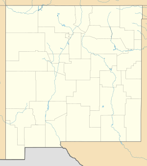
Location of the mouth of the Rio Salado in New Mexico
|
|
| Country | United States |
| State | New Mexico |
| County | Socorro, Catron |
| Physical characteristics | |
| Main source | Northeast Catron County 7,990 ft (2,440 m) 34°29′44″N 107°53′30″W / 34.49556°N 107.89167°W |
| River mouth | Rio Grande North of Socorro 4,678 ft (1,426 m) 34°16′23″N 106°51′31″W / 34.27306°N 106.85861°W |
| Length | 86 mi (138 km) |
The Rio Salado is a river in New Mexico, a state in the United States. It flows into a bigger river called the Rio Grande. The name Río Salado comes from Spanish and means "salty river."
This river starts in Catron County. It flows for about 86 miles (138 kilometers). The Rio Salado generally flows east. It joins the Rio Grande near a town called Polvadera. This spot is about 15 miles (24 kilometers) north of Socorro.
Where the Rio Salado Flows
The Rio Salado begins in the northeastern part of Catron County. It flows through different areas and canyons. One of these is Cow Spring Canyon.
As it travels, smaller streams and creeks join the Rio Salado. These smaller rivers are called tributaries. Some of these include Alamocita Creek and Gallegos Creek.
The river also passes by interesting landforms. These include Table Mountain and Tres Hermanos Mesa. It also flows near the Cibola National Forest.
Further along its path, the Rio Salado enters Socorro County. It continues to collect water from more tributaries. These come from places like the Bear Mountains and Ladron Peak.
The Rio Salado also flows through the Sevilleta National Wildlife Refuge. This is a special area for wildlife. Finally, the river empties into the Rio Grande. This happens just north of Polvadera.
See also
 In Spanish: Río Salado (Nuevo México) para niños
 | Calvin Brent |
 | Walter T. Bailey |
 | Martha Cassell Thompson |
 | Alberta Jeannette Cassell |


