
Riordan, Arizona facts for kids
Quick facts for kids
Riordan, Arizona
|
|
|---|---|

Riordan, Arizona
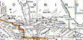
Location in Arizona

Riordan, Arizona
Location in the United States
|
|
| Country | United States |
| State | Arizona |
| County | Coconino |
| Elevation | 7,316 ft (2,230 m) |
| Time zone | UTC-7 (Mountain (MST)) |
| • Summer (DST) | UTC-7 (MST) |
| Area code(s) | 928 |
| FIPS code | 04-60170 |
| GNIS feature ID | 42729 |
Riordan was once a small community in Coconino County, Arizona, in the United States. It was located high up, about 7,316 feet (2,230 meters) above sea level. Riordan used to have a train station, places to cut wood, a post office, a school, and a store. Today, very little of the original town remains.
Contents
Where Was Riordan Located?
Riordan was found along the Atchison, Topeka and Santa Fe Railway (AT&SF) line. It was about 6.5 miles (10.5 km) west of Flagstaff, Arizona. The town was also close to a special area called the Arizona Divide.
The Story of Riordan
How Riordan Began

The town of Riordan was named in 1897. It got its name from the Riordan brothers, Michael and Timothy, who came from Chicago. They started a large lumber mill there. The town grew up around their mill. Another sawmill, owned by the Coconino Lumber Company, opened in Riordan in 1912.
In 1916, the Riordan mill was sold to brothers Charles and Edward McGonigle. They changed the company's name to the McGonigle Lumber Company. Its main office was in Riordan.
Growing into a Town
The Santa Fe Railway built a train station, a bunkhouse for workers, and several homes in Riordan. The logging company also opened a store. A post office was set up in Riordan in June 1917. At that time, the local newspaper, the Flagstaff Coconino Sun, said that "Riordan is rapidly growing into a thriving little city."
The Church of the Nativity, a Catholic church from Flagstaff, also had a small outpost in Riordan around 1920.
The Riordan School
Riordan had its own school, which operated for a short time in the 1910s and 1920s. At first, the school was in a rented building. In 1913, Coconino County planned to build a new school building for the children of Riordan.
The Town's Decline
The McGonigle mill closed in June 1924. This happened because the lumber business was not doing well. The Riordan post office closed soon after, in September 1925. By 1925, only 16 people lived in Riordan.
There were talks in 1924 about closing the Riordan School. The idea was for the children to go to school in Flagstaff instead. In 1926, the Riordan School District had only one teacher. This teacher taught students from first to eighth grade. The school building was sold that same year.
In 1934, a big forest fire happened near Riordan. More than 500 acres of the Coconino National Forest burned before firefighters could stop it.
By 1940, Riordan's population had grown to 74 people. However, the Santa Fe Railway stopped listing Riordan on its train schedules in 1965. The railroad buildings were taken down after that. By the late 1960s, the community had mostly disappeared. A newspaper reported in 1969 that there was very little left at the site.
Images for kids
-
Riordan in central Coconino County, Arizona, in 1925
