River Beult facts for kids
The River Beult (pronounced BELT) is a river in South East England that flows into the River Medway.
Quick facts for kids River Beult |
|
|---|---|
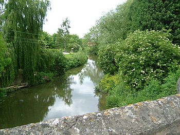
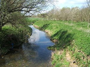
River Beult at Yalding
|
|
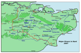
Rivers of Kent
|
|
| Physical characteristics | |
| Main source | several sources west of Ashford TQ 980 390 51°06′57″N 0°49′48″E / 51.115933°N 0.830014°E |
| River mouth | River Medway at Yalding TQ 693 503 51°13′36″N 0°25′32″E / 51.226666°N 0.425660°E |
Contents
River Beult's Journey
The River Beult starts from several places west of Ashford, including one near Woodchurch. It then flows through a town called Headcorn. Near Hunton, about 1.4 kilometers (0.9 miles) before Yalding, a bigger stream called the River Teise joins it.
The river has a very old bridge called Town Bridge. It's about 16.5 kilometers (10.25 miles) from Allington and is the longest medieval bridge in Kent. The River Beult finally meets the River Medway at Yalding. A railway line crosses the River Beult between Headcorn and Staplehurst. In 1865, a train accident happened at this bridge, and the famous writer Charles Dickens was involved.
River Changes and Wildlife
In the 1930s, the River Beult had a big improvement project. This made the river wider, deeper, and straighter from Smarden to Yalding. Even with these changes, the river is still a special place for nature. It's called a Site of Special Scientific Interest (SSSI).
The River Beult is one of the few rivers in England and Wales that flows over clay. It still has many of its special plants. Unlike many other clay rivers, it hasn't been built up with high banks. Most of the trees along its sides were removed. Because there's less shade and some areas are still grazed by animals, the river has many places rich in wildlife. Nearly 100 different kinds of water and riverside plants have been found here!
Water Quality Challenges
The river gets water from farms and wastewater treatment plants. This means that even with recent improvements, the water quality can still be a problem. Long ago, people said the river was "crystal clear" and very clean. However, because of farming and other activities, the water quality has changed a lot from how it used to be.
Upstream from Smarden, the river still winds and bends naturally. The water levels are managed, meaning they are raised in summer and lowered in winter. The plants here are not as varied because the river is smaller, has many trees, and more of the land nearby is used for growing crops.
How We Measure Water Quality
The Environment Agency checks the water quality of rivers in England. Each river section gets an overall "ecological status." This can be high, good, moderate, poor, or bad. This status is based on several things:
- Biological status: This looks at the types and numbers of tiny water creatures (invertebrates), flowering plants, and fish.
- Chemical status: This checks if the levels of different chemicals in the water are safe. Chemical status is either "good" or "fail."
Here's what the water quality of the River Beult was like in 2016:
| Section | Ecological Status |
Chemical Status |
Overall Status |
Length | Catchment | Channel |
|---|---|---|---|---|---|---|
| Beult at Yalding | Moderate | Good | Moderate | 4.566 km (2.837 mi) | 7.632 km2 (2.947 sq mi) | Heavily modified |
| Beult | Moderate | Good | Moderate | 25.751 km (16.001 mi) | 75.137 km2 (29.011 sq mi) | Heavily modified |
| Upper Beult | Poor | Good | Poor | 5.52 km (3.43 mi) | 36.317 km2 (14.022 sq mi) |
River Beult: A Special Place for Nature
| Site of Special Scientific Interest | |
 |
|
| Area of Search | Kent |
|---|---|
| Interest | Biological |
| Area | 29.1 hectares (72 acres) |
| Notification | 1994 |
| Location map | Magic Map |
The River Beult between Hadman's Bridge (west of Smarden) and where it joins the River Medway is a special area. It's a Site of Special Scientific Interest (SSSI) that covers about 29.1 hectares (72 acres). This means it's protected because of its important wildlife.
The river has many different kinds of plants that grow in clay rivers. Almost 100 different species have been found! You can see floating plants like yellow water-lily in the water. On the river banks, you might find plants like amphibious bistort and celery-leaved buttercup.
Watermills Along the River
The River Beult and the smaller streams that flow into it used to power many watermills. These mills used the force of the flowing water to turn large wheels, which then powered machinery for grinding corn or other tasks.
Mills on the Main River Beult
- Cheveney Mill, Hunton: This mill used to grind corn. Around 1900, it was changed to make electricity using a water turbine instead of a waterwheel. During World War II, prisoners of war stayed in the mill building. Today, the building is a house.
- Yalding Mill: This mill has been around for a very long time, even mentioned in the Domesday Book (a famous survey from 1086). It was still working in 1336.
Mills on Smaller Streams (Tributaries)
Most of the watermills on the River Beult were not on the main river itself, but on the smaller streams that feed into it.
Angley Brook Mills
The Angley Brook starts at Angley Woods in Cranbrook and flows into the Beult near Frittenden. It powered several mills:
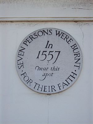
- Maplehurst Mill, Frittenden: This is a very old corn mill that still has most of its original machinery. It has a large cast-iron waterwheel that turned three pairs of grinding stones. In 1557, the miller, William Allin, and his wife Katherine were burned at the stake in Maidstone because they were Protestants. They were known for helping the poor, selling corn cheaply, and reading religious texts to people. The oldest part of the mill dates back to 1756. Later, around 1890, a steam engine was added. The mill worked until 1947-48 when its machinery was damaged by ice.
Hammer Stream Mills
The Hammer Stream powered mills like:
- Hammer Mill, Biddenden: This was once the most easterly iron furnace (a place where iron was made) in the Weald area. Later, in the mid-1600s, it became a corn mill. The Hammer Pond, which supplied water to the mill, used to be very large, about 30 acres.
- Hammer Mill (corn), Biddenden: This corn mill is a brick building with three floors. It had a large waterwheel that powered four pairs of grinding stones at one time. The mill last worked in 1928.
Crane Brook Mills
The Crane Brook starts at Hartley and powered several mills before joining the Hammer Stream.
- Hatmill, Cranbrook: In the late 1700s, John Tooth built a small factory behind his house in Cranbrook. He used a small waterwheel to power machines for making hats. Today, this building is a private house.
Other Mills on Smaller Streams
- Upper Mill, Ulcombe: This mill was probably the one mentioned in the Domesday Book for Ulcombe.
- Chart Mill, Chart Sutton: This mill has a timber frame on a brick base. It had a very large waterwheel, but it was removed during World War II. The building is now used as an office.
Images for kids
 | William Lucy |
 | Charles Hayes |
 | Cleveland Robinson |


