River Teise facts for kids
Quick facts for kids River Teise |
|
|---|---|
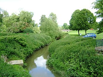
Lesser Teise nearing the River Medway near Yalding (Twyford Bridge in the distance)
|
|
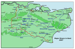
Rivers of Kent
|
|
| Physical characteristics | |
| Main source | Dunorlan Park in Tunbridge Wells |
| River mouth | Major stream River Beult at Hunton, minor stream River Medway at Yalding |
The River Teise (pronounced TEEZ or TYCE) is a smaller river that flows into a larger one. It joins the River Medway in Kent, England.
Contents
Journey of the River Teise
The River Teise starts in Dunorlan Park in Tunbridge Wells. It flows east, passing by Bayham Abbey and then through the town of Lamberhurst. About 2 miles (3.2 km) after Lamberhurst, a smaller river called the River Bewl joins the Teise. The Bewl River is also home to the Bewl Water reservoir.
What's interesting is that the Teise splits into two parts. This happens about 1.25 miles (2 km) southwest of Marden village. The river divides around a low ridge of land.
- The Lesser Teise flows for about 4 miles (6.4 km). It then joins the River Beult at Hunton.
- The Greater Teise carries less water. It flows for about 5 miles (8 km) to the River Medway at Twyford Bridge. This bridge is upstream of Yalding. Long ago, Twyford Bridge was a place where people could cross both the Medway and Teise rivers. The River Beult also flows through Yalding and joins the Medway a little further downstream.
River Improvements
Like many rivers in southern England, the River Teise was changed in the 1950s. This was part of a plan to improve land drainage.
The Lesser Teise was made wider, straighter, and deeper from Horsmonden to where it meets the River Beult. Because of these changes, the Lesser Teise now carries most of the river's water.
The Greater Teise was also "improved." This included the part upstream from where the river splits, and the section from Marden to where it joins the River Medway. During this work, several weirs were built. Weirs are small dams that control water flow. They help split the water between the different river channels. Some weirs also measure how much water is flowing.
Even with these changes, you can still see parts of the old Lesser Teise. Some of its original bends, called meanders, are still visible in wooded areas. These show how the river naturally flowed before it was changed. The 4 km (2.5 mi) section of the Greater Teise that splits off was mostly left alone.
River Water Quality
The Environment Agency checks the water quality of rivers in England. They give each river system an overall "ecological status." This status can be high, good, moderate, poor, or bad.
To figure this out, they look at several things:
- Biological status: This checks the types and numbers of living things in the water. This includes invertebrates (like insects), flowering plants, and fish.
- Chemical status: This compares the levels of different chemicals in the water to safe levels. Chemical status is either "good" or "fail."
Here's how the River Teise's water quality was in 2016:
| Section | Ecological Status |
Chemical Status |
Overall Status |
Length | Catchment | Channel |
|---|---|---|---|---|---|---|
| Lower Teise | Moderate | Good | Moderate | 21.542 km (13.386 mi) | 37.302 km2 (14.402 sq mi) | Heavily modified |
| Teise and Lesser Teise | Moderate | Good | Moderate | 24.398 km (15.160 mi) | 34.159 km2 (13.189 sq mi) | Heavily modified |
| Teise at Lamberhurst | Poor | Good | Poor | 9.041 km (5.618 mi) | 14.266 km2 (5.508 sq mi) | Heavily modified |
| Tributary of Teise | Moderate | Good | Moderate | 3.869 km (2.404 mi) | 24.093 km2 (9.302 sq mi) | |
| Upper Teise | Moderate | Good | Moderate | 8.774 km (5.452 mi) | 26.697 km2 (10.308 sq mi) | Heavily modified |
Historic Watermills
The River Teise and its smaller streams once powered many watermills. These mills used the force of the flowing water to turn large wheels. These wheels then powered machinery for different tasks.
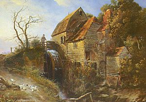
Standings Mill, Tunbridge Wells
This mill was a corn mill, meaning it ground grain into flour. It used an overshot waterwheel, where water flowed over the top of the wheel to make it turn. A painting of this mill can be seen in the Tunbridge Wells Museum & Art Gallery.
Bayham Abbey Forge
This was a forge, a place where metal was heated and shaped. It was working as early as 1520. The pond that supplied water to the forge is still there today.
Gloucester Furnace, Lamberhurst
This furnace was built in 1695. Furnaces were used to melt iron ore to make iron. It produced 200 tons of iron in 1717. It stopped making iron around 1787.
Hoadly Forge, Lamberhurst
Hoadly Forge was built in 1548. It's famous because the railings around St. Paul's Cathedral in London were made here!
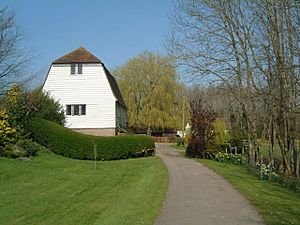
Furnace Mill, Lamberhurst
This was another corn mill. The building still stands today, but it has been turned into a home. It no longer has its old machinery, except for a sack hoist which was used to lift bags of grain.
Hope Mill, Goudhurst
This corn mill is now a house. It used to have two waterwheels working at the same time.
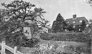
Marden (Pattenden) Mill, Marden
Marden Mill was a corn mill located on the Lesser Teise. It was a small, three-story building made of timber and covered in white wood panels. It was powered by an overshot waterwheel. The mill stopped working in 1892 and was taken down in 1912.
Watermills on Tributaries
Other watermills were located on the smaller streams that flow into the River Teise.
Benhall Mill, Frant
This corn mill was built on the site of an even older furnace mill. The mill was working in the early 1800s. The remains of the mill were taken down in 1964.
Brookland Forge, Frant
This forge was sold in 1521. It was abandoned sometime between 1629 and 1640. There is evidence that this forge also used an overshot waterwheel.
Verredge Forge, Frant
This forge was also owned by the Barham family. It was last mentioned in 1642.
Bartley Mill, Frant
Bartley Mill is on the Winn Stream, a small tributary. It was once owned by Bayham Abbey. It stopped working for business in the early 1900s. However, it was fixed up and started working again in 1990. You can visit this mill by making an appointment.
Bedgebury Furnace, Goudhurst
This furnace was used to make iron. It was working in the 1500s and 1600s. It was even used again during the Peninsular War (early 1800s) because there was a high demand for iron for military uses. However, it eventually stopped making iron because it was too expensive to transport the iron from this location.
Later, the furnace was used to fire clay and bricks. In 1880 and 1912, new oast kilns were built here for drying hops, which were grown in the surrounding gardens. These oast kilns are still standing today.
The original pond that held water for the furnace has now filled with silt, but you can still see the area where it was. There is also a very large dam that is nearly 130 meters (426 ft) long and 8 meters (26 ft) high.
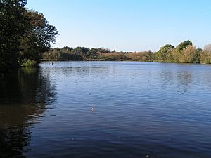
Brenchley Furnace, Horsmonden
This is a very old site. The Furnace Pond is still there today and covers about 30 acres (12 hectares). The dam across the valley is about 140 yards (128 m) long.
This furnace was first mentioned in 1574. It was a busy place, employing about 200 men in 1613. It was still working in 1667.
 | Emma Amos |
 | Edward Mitchell Bannister |
 | Larry D. Alexander |
 | Ernie Barnes |


