
River Dibb facts for kids
Quick facts for kids River Dibb |
|
|---|---|

River Dibb at Dibbles Bridge, which carries the B6265 between Pateley Bridge and Threshfield
|
|
| Country | England |
| Physical characteristics | |
| Main source | Grimwith Reservoir 253 metres (830 ft) 54°4′48″N 1°54′41″W / 54.08000°N 1.91139°W |
| River mouth | River Wharfe nr Appletreewick 143 metres (469 ft) 54°02′28″N 1°56′35″W / 54.0410°N 1.9431°W |
| Length | 5.2 kilometres (3.2 mi) |
| Basin features | |
| Basin size | 25.5 square kilometres (9.8 sq mi) |
The River Dibb is a small river in North Yorkshire, England. It's like a smaller stream that flows into a bigger river called the River Wharfe. The River Dibb starts near Grimwith Reservoir, which is a large lake that holds water. The river's name might come from an old English word, dib, which means hollow or dip. This name was used for a small village nearby way back in the 1200s.
Contents
The River's Journey
The River Dibb begins its journey from the south side of Grimwith Reservoir. It flows mostly towards the southwest, passing through an area called Burnett Fold Nook. Then, it turns south for a bit before heading southwest again.
A famous spot along the river is Dibble's Bridge, where the B6265 road crosses over. This bridge has a long history. After the river meets another small stream called Holes Beck, its name changes on some maps to Barben Beck.
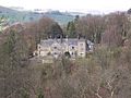
The river continues its path, flowing mainly south through wooded areas like Rough Close Wood and Barnscar Plantation. It then turns west through Sprinsgide Wood. Finally, it heads southwest again, passing by Hartlington Mill. This mill once used the river's power to turn a large water wheel! The river then goes under Hartlington Bridge before joining the larger River Wharfe.
Fun Folklore About Dibble's Bridge
Dibble's Bridge is sometimes called Devil's Bridge. There's an old story that says the Devil himself built this bridge! The legend tells that a shoemaker named Ralph Calvert offered the Devil a drink, and in return, the Devil built the bridge for him. It's a fun tale that adds to the mystery of the area!
Things You'll Find Along the River
Smaller Streams Joining the Dibb
|
Places Near the River
|
Bridges Over the River
|
Images for kids
-
Hartlington Hall

