
River Wharfe facts for kids
Quick facts for kids River Wharfe |
|
|---|---|

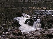
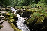
Linton Falls, on the upper Wharfe near Grassington
|
|
| Country | England |
| Physical characteristics | |
| Main source | Beckermonds, Langstrothdale Chase 310 m (1,020 ft) 54°13′03″N 2°11′39″W / 54.217481°N 2.194231°W |
| River mouth | River Ouse at Wharfe's Mouth, near Cawood 4.9 m (16 ft) 53°50′39″N 1°07′46″W / 53.8441°N 1.129544°W |
| Length | 65 mi (104.6 km) |
The River Wharfe is a cool river in Yorkshire, England. For a lot of its journey, it forms the border between West Yorkshire and North Yorkshire.
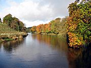
The valley where the river flows is called Wharfedale. The river starts at Beckermonds in Langstrothdale, which is part of the Yorkshire Dales National Park. It then flows through many towns and villages like Kettlewell, Grassington, Bolton Abbey, Ilkley, Otley, Wetherby, and Tadcaster. Finally, it joins the River Ouse near Cawood. The first part of the river, from its source to around Addingham, is known as Upper Wharfedale and looks quite different from the rest of the river.
The River Wharfe is about 65 miles (104.6 km) long before it meets the River Ouse. This makes it the 21st longest river in Britain! You can even use boats on the river from the weir at Tadcaster all the way to the Ouse. The river's water levels also change with the tides from Ulleskelf to the Ouse.
Contents
What's in a Name?
The name 'Wharfe' comes from an old language called Old Norse. The word hverfi means 'to turn'. But it's also thought that an even older name from the Brittonic language, meaning 'liquid', might have influenced it. So, the name probably describes how the river winds and turns!
Where Does the Wharfe Flow?
.JPG)


The River Wharfe begins where two smaller streams, Oughtershaw Beck and Green Field Beck, meet in Langstrothdale. As it flows, many tiny streams join it. These streams often come from sink holes on Yockenthwaite Moor and Horse Head Moor.
After passing Hubberholme, the river flows south past Buckden and Starbotton. Then it turns south-east past Kettlewell before heading south again. Near Conistone, you can see gentle waterfalls called Scar Lash. Close to Grassington, the river flows over the beautiful Linton Falls.
South of Appletreewick, the river briefly flows south-west before turning south again. North of Bolton Bridge, the river gets very narrow and rushes over waterfalls in a famous spot called The Strid. The river then winds its way south and south-east towards Ilkley. From there, it heads east through Otley and Collingham. It briefly flows north to Wetherby before turning south and then south-east through Tadcaster, where it finally joins the River Ouse.
How High Does the Water Get?
The water level in the River Wharfe changes a lot, especially when it rains. Here's a table showing how high the water can be at different places along the river:
| Monitoring station | Station elevation | Low water level | High water level | Record high level |
|---|---|---|---|---|
| Kettlewell | 212 m (696 ft) | 0.17 m (0.56 ft) | 2 m (6.6 ft) | 2.54 m (8.3 ft) |
| Grassington | 171 m (561 ft) | 0 m (0 ft) | 1.5 m (4.9 ft) | 2.79 m (9.2 ft) |
| Ilkley | 78 m (256 ft) | 0.09 m (0.30 ft) | 2.9 m (9.5 ft) | 3.88 m (12.7 ft) |
| Otley | 56 m (184 ft) | 0.36 m (1.2 ft) | 1.5 m (4.9 ft) | 2.46 m (8.1 ft) |
| Pool Bridge | 46 m (151 ft) | 0.09 m (0.30 ft) | 2.9 m (9.5 ft) | 3.77 m (12.4 ft) |
| Arthington | 46 m (151 ft) | 0.32 m (1.0 ft) | 3.3 m (11 ft) | 4.14 m (13.6 ft) |
| Collingham | 25 m (82 ft) | 0.35 m (1.1 ft) | 1.59 m (5.2 ft) | 4.7 m (15 ft) |
| Wetherby | 25 m (82 ft) | 0.4 m (1.3 ft) | 1.8 m (5.9 ft) | 3.10 m (10.2 ft) |
| Tadcaster | 11 m (36 ft) | 0.18 m (0.59 ft) | 2.9 m (9.5 ft) | 3.79 m (12.4 ft) |
| Cock Beck Sluices | 6 m (20 ft) | 3.44 m (11.3 ft) | 7.3 m (24 ft) | 9.26 m (30.4 ft) |
| Fleet Pumping Station | 6 m (20 ft) | 2 m (6.6 ft) | 6.5 m (21 ft) | 7.35 m (24.1 ft) |
- Low and High Water Levels are average numbers.
A very big flood happened in 1686. It was so powerful that it washed away many bridges and buildings!
Wildlife and Plants of the Wharfe
The River Wharfe valley is home to a huge variety of living things.
Amazing Animals of the Wharfe
More than 230 types of birds have been seen here! These include birds like the eagle-owl, red grouse, stonechat, whinchat, golden plover, pied flycatcher, redstart, wood warbler, common sandpiper, grey wagtail, dipper, tawny owl, sparrowhawk, greater spotted woodpecker, nuthatch, treecreeper, and, in wetter areas, snipe and woodcock. You might also spot chiffchaffs, willow warblers, garden warblers, and twites.
The Wharfe has many signal crayfish, but the native white-clawed crayfish are in danger. The river is also special because it has a group of tiny fine-lined pea mussels. These mussels are usually found in Wales and central/southern England, so finding them here is quite unique!
You can also find mammals like rabbits, red foxes, grey squirrels, otters, water voles, and deer living along the river.
Wonderful Plants of the Wharfe
The valley is full of interesting plants. You can find ferns like wall rue, maidenhair spleenwort, brittle bladder-fern, Hart's-tongue, and hard shield-fern. In Upper Wharfedale, rocky areas have plants like alpine cinquefoil and hoary whitlowgrass. Other plants include lesser meadow-rue, goldenrod, scabious, and bloody crane's-bill. You might also see mountain melick, limestone fern, wood crane's-bill, melancholy thistle, green spleenwort, wall lettuce, and hairy stonecrop.
Further down the valley, you'll find alpine cinquefoil, lily-of-the-valley, mountain melick, herb paris, blue sesleria, common valerian, and wild angelica. The limestone rocks have rare plants like rock whitebeam, Solomon's seal, bird's-eye primrose, butterwort, rockrose, dropwort, and limestone bedstraw.
The flat limestone areas are special habitats for plants usually found in forests, such as dog's mercury, wood anemone, and ramsons. In the deep cracks of the rocks, you can find rarer species like baneberry and downy currant, along with ferns like rigid buckler-fern. Other plants here include alternate-leaved golden saxifrage, reed canary-grass, and stone bramble.
Some hard-to-reach cliffs are home to special mosses and liverworts, like red leskea, sharp rock-bristle, and the very rare Zygodon gracilis. These ledges also support woodrush, polypody, water avens, purple saxifrage, yellow saxifrage, hoary whitlowgrass, and roseroot.
You can also spot blue moor-grass, sheep's-fescue, and herbs like thyme, salad burnet, and common rock-rose. There's also wild thyme, common milkwort, fairy flax, bird's-foot trefoil, autumn gentian, harebell, and eyebright.
Trees and shrubs in the area include ash, downy birch, hazel, hawthorn, yew, and rowan. In the woods, you might find wild privet and spindle. A rarer plant to see is the dark red helleborine.
The Wharfe's Geology
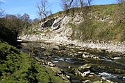
The rocks in Upper Wharfedale are very old, from a time called the Lower Carboniferous period. The main rock here is the Great Scar Limestone, which is covered by layers of hard limestones, sandstones, and shale called the Yoredale Beds. These layers are about 300 meters deep and are slightly tilted towards the east. To the south-east, you'll find rocks from the Upper Carboniferous period, known as the Millstone Grit. These areas are covered by heather moorland and rocky cliffs.
Over time, the Yoredale Beds have worn away, creating a stepped shape on the valley sides. You can see flat limestone areas, sometimes with grass, and often with special karst features like limestone pavements, gorges, and sinkholes. During the last ice age, huge glaciers carved out the U-shaped valleys we see today.
When the river valley changes into Lower Wharfedale, you can see the different types of rock in the stone walls of the fields. The Millstone Grit rocks stick out at places like the Cow and Calf Rocks near Ilkley. Because these rocks don't let water through, you find blanket bogs and wet areas, while drier spots have heathlands and grasslands.
Some rough sandstones in the area are called Addingham Edge and Bramhope Grits. The Otley Shell Beds can be seen at Otley Chevin. At Great Dib Wood, the Otley Shell Bed is found between two Namurian sandstones.
Long ago, glacial lakes filled Lower Wharfedale, leaving behind sand and gravel. These materials were dug up, and now those areas are places like the Otley Wetland Reserve, and the Ben Rhydding and Knotford Nook gravel pits.
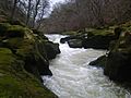
The Strid: A Dangerous Beauty
The Strid (grid reference: SE064565) is a series of waterfalls and fast-moving water. The River Wharfe, which is usually about 30 yd (27 m) wide, suddenly narrows down to just a few feet wide here! This creates a very deep channel underwater. It's super dangerous because the banks are undercut, meaning the ground underneath is hollowed out. Sadly, there have been several accidents here, including a newly married couple in 1998. Even though it's dangerous, the walk to The Strid from Bolton Abbey is very popular.
Its name comes from an Old English word Stryth, which means 'turmoil' or 'chaos'. Later, it changed to Strid, which sounds like 'stride', because it looks like you could just stride across it. But don't try it!
The Strid's risky nature has even been mentioned in books, like "The Force of Prayer" by William Wordsworth and "The Striding Place" by Gertrude Atherton.
Linton Falls: A Scenic Spot
Linton Falls (grid reference: SE001633) are beautiful waterfalls located near the village of Linton, just south of Grassington. You can easily get to the falls from Grassington by walking along Sedber Lane. There's a special footbridge right over the falls, so you can get a great view!
A Look Back in Time
The name Wharfe might have been recorded by the Romans as Verbeiae on an old stone at Ilkley. This was dedicated to Verbeia, who was thought to be the goddess of the river. The name likely comes from an old British language, meaning "winding." Later, the Old Norse word hwerfi (meaning "bend") probably influenced the name we use today.
You can still see outlines of Iron Age fields and hut circles on the hills above Grassington and Kettlewell. The Romans built a road through Wharfedale that went over Stake Moss into nearby Wensleydale. The local British tribe, the Brigantes, were taken over by the Romans in AD 74. The Romans mined lead in the hills near Greenhow Hill until AD 410.
After AD 620, the Ancient Britons were joined by Angles, who cleared more forests to create fields for crops and animals. Later, Danes settled here, followed by Vikings in the 10th century. The Vikings gave their language to some of the names of villages and places in Upper Wharfedale. During Anglo-Saxon times, large estates were set up, and the River Wharfe and its valley were protected by Earl Edwin of Bolton-in-Craven. After the Norman invasion, the lands were given to Robert Romilly.
In medieval times, people farmed using simple methods to grow crops and raise animals. But big monasteries like Fountains, Rievaulx, and Bolton Priory had huge flocks of sheep and sold their wool across Europe. In 1155, Alice de Romilly gave land for Bolton Priory and Kilnsey to Fountains Abbey. These monasteries helped create large sheep farms and special roads for moving animals, which you can still see today. The success of the monasteries also helped the market towns of Grassington and Kettlewell grow.
When the monasteries were closed down in 1539, and wool prices dropped, many farmers started raising cattle and sheep instead. By the early 19th century, there was a big demand for food from the growing industrial towns. So, many farms began producing milk from the lower lands and using the higher hills for sheep.
On July 5, 2014, the Tour de France cycling race passed through Wharfedale! Stage 1 from Leeds to Harrogate followed roads close to the river. The route in Wharfedale started near Harewood and ended after Buckden, where the cyclists climbed over Kidstones Pass.
The River Wharfe has even appeared in movies! In 1992, the town of Grassington was used for filming Wuthering Heights. The 2003 film, Calendar Girls, was filmed in several places in the river valley, including Buckden, Burnsall, Kettlewell, and Kilnsey.
The Wharfe's Economy
.JPG)
In the 1990s, more people started buying second homes in Upper Wharfedale. By 1991, about 13% of homes in the Craven area were second properties. This number went up to 15% in Upper Wharfedale by 2001, but then dropped to only 7% by 2011.
Farming has always been important in Upper Wharfedale. Even though fewer people work in farming now, it still made up 9.16% of jobs in 2001 and even increased to 11.27% by 2011.
Lead mining used to be the main industry in Wharfedale. From the 1600s to the late 1800s, hundreds of men and boys worked in the mines. They dug for lead in the limestone at places like Greenhow, Hebden, Grassington, and Appletreewick. You can still see piles of mining waste today, which are full of lead. Only a few special plants, called 'lead plants' like spring sandwort and alpine penny-cress, can grow on them.
Tourism is very important for the local economy in Wharfedale. There are many walking paths of different lengths, all with clear signs. People also enjoy outdoor activities like rock climbing at Kilnsey Crag, kayaking, canoeing, cycling, mountain biking, horse riding, and caving. Several long-distance walking routes pass near or over the river:
- Dales Way (follows the river valley from Beckermonds to Ilkley)
- Lady Anne's Way (enters the valley near Hubberholme and leaves west of Bolton Abbey)
- Inn Way to the Yorkshire Dales (part of the walk from Grassington to Buckden)
- The Way of the Roses (part of the cycling route from Appletreewick to Thorpe)
The Wharfe also has two power plants that use the river's water to make electricity. These are Burley Hydro (at Greenholme Mill in Burley in Wharfedale), which started in August 2011, and Linton Falls Hydro, which opened in March 2012.
River Wharfe: Key Features
Here are some important places and features along the River Wharfe, starting from where it begins:
Tributaries: Streams Joining the Wharfe
|
|
Settlements: Towns and Villages Along the Wharfe
|
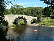
Crossings: Bridges Over the Wharfe
|
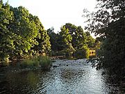
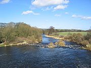
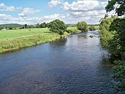
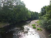
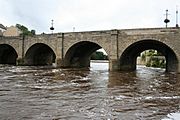
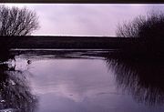
Gallery
- Along the River Wharfe
-
Oughtershaw Beck and Green Field Beck in Langstrothdale near Beckermonds become the River Wharfe
54°13′0.6″N 2°11′39.34″W / 54.216833°N 2.1942611°W -
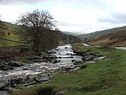
River Wharfe in Langstrothdale
54°12′33.62″N 2°9′22.87″W / 54.2093389°N 2.1563528°W -
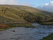
River Wharfe, Langstrothdale, east from the Dales Way Long Distance Walk
54°12′59.34″N 2°11′13.38″W / 54.2164833°N 2.1870500°W -
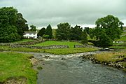
River Wharfe below Grassington Bridge
54°4′6.01″N 2°0′16.38″W / 54.0683361°N 2.0045500°W -
Linton Falls near Grassington
-
River Wharfe Upstream of Hebden suspension bridge
-
River Wharfe at Loup Scar Gorge
54°3′3.21″N 1°57′5.02″W / 54.0508917°N 1.9513944°W -
Barden Bridge, River Wharfe
54°0′45.32″N 1°55′19.15″W / 54.0125889°N 1.9219861°W -
The Strid near Bolton Abbey
54°0′15.18″N 1°54′13.3″W / 54.0042167°N 1.903694°W -
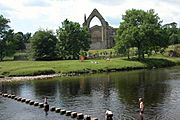
Bolton Abbey and the River Wharfe
53°59′0.39″N 1°53′12.53″W / 53.9834417°N 1.8868139°W -
River Wharfe, Ilkley from footbridge
53°55′56.94″N 1°48′56.43″W / 53.9324833°N 1.8156750°W -
River Wharfe at Otley
-
Bridge over River Wharfe at Otley
-
River Wharfe east of Otley looking upstream
53°54′38.72″N 1°40′37.97″W / 53.9107556°N 1.6772139°W -
River Wharfe east from Harewood Bridge
53°54′49.31″N 1°31′18.97″W / 53.9136972°N 1.5219361°W -
River Wharfe at Pool-in-Wharfedale east from A658 bridge
-
River Wharfe from Linton Bridge
53°54′47.53″N 1°24′38.92″W / 53.9132028°N 1.4108111°W -
River Wharfe, Wetherby
53°55′35.68″N 1°23′21.48″W / 53.9265778°N 1.3893000°W -
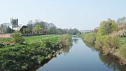
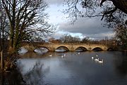
River Wharfe at Tadcaster with St Mary the Virgin Church in background
53°53′4.24″N 1°15′38.16″W / 53.8845111°N 1.2606000°W -
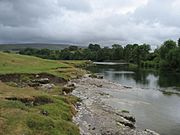
Wharfe's Mouth south of Cawood
53°50′38.73″N 1°7′50.17″W / 53.8440917°N 1.1306028°W


Images for kids
-
The rapids of The Strid

See also
 In Spanish: Río Wharfe para niños
