Tadcaster facts for kids
Quick facts for kids Tadcaster |
|
|---|---|
| Town and civil parish | |
|
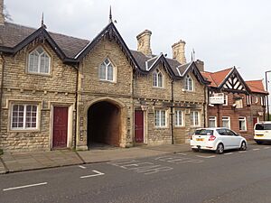
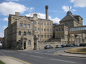
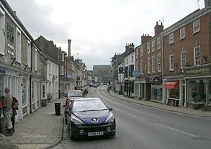
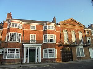
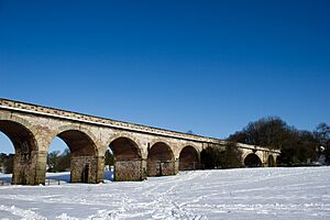
From the top left: John Smith's Brewery, St Mary's Church, Tadcaster Viaduct and the High street |
|
| Population | 6,350 (2021 census) |
| OS grid reference | SE4843 |
| • London | 170 mi (270 km) SSE |
| Civil parish |
|
| Unitary authority |
|
| Ceremonial county | |
| Region | |
| Country | England |
| Sovereign state | United Kingdom |
| Post town | TADCASTER |
| Postcode district | LS24 |
| Dialling code | 01937 |
| Police | North Yorkshire |
| Fire | North Yorkshire |
| Ambulance | Yorkshire |
| EU Parliament | Yorkshire and the Humber |
| UK Parliament |
|
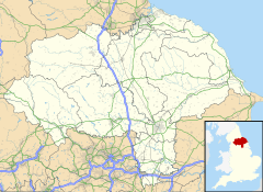
Tadcaster is a historic market town in North Yorkshire, England. It is located about 15 miles (24 km) northeast of Leeds and 10 miles (16 km) southwest of York.
The town has been important since Roman times. It was the lowest place where people could cross the River Wharfe by road for a long time. This changed when a new bypass road was built in 1978. Because it is on the River Wharfe, some parts of Tadcaster near the bridge can sometimes experience flooding.
Tadcaster was part of the West Riding of Yorkshire until 1974. Now, it is part of North Yorkshire. The town is also twinned with Saint-Chély-d'Apcher in France.
Contents
History of Tadcaster
Roman Times: Calcaria
The Romans built a settlement here called Calcaria. This name comes from the Latin word for 'lime'. This shows how important the local limestone was. Limestone was used for building, even for famous places like York Minster. Calcaria was a key stop on the road to Eboracum (which is now York). It was a place where travelers could cross the River Wharfe.
Anglo-Saxon and Medieval Times
The name Tadcaster comes from an old Anglo-Saxon word. It includes 'castra', which means 'military camp' in Latin. The Angles and Saxons used this term for any old Roman walled town. Tadcaster is first mentioned in the Anglo-Saxon Chronicle in 1066. It was where King Harald gathered his army before the Battle of Stamford Bridge. The name likely means 'Tata's fort', after an early landowner.
The town is also in the 1086 Domesday Book. It was called "Tatecastre" then. The book describes land, farms, and mills in the area.
In the 11th century, William de Percy built a motte-and-bailey castle. He used stones from Roman buildings. You can still see the remains of this castle, called Castle Hill, near the church. The castle was later abandoned.
The first stone bridge over the Wharfe was built around 1240. It might have used stones from the old castle. The current bridge was built in 1699 and has been changed many times since.
The English Civil War
During the English Civil War, a small battle happened in Tadcaster. On December 7, 1642, Sir Thomas Fairfax's Parliamentarian forces fought against Sir Thomas Glemham's Royalist army. This fight took place on and around Tadcaster Bridge.
Tadcaster's Market
Tadcaster has had a market since 1270. Henry de Percy received a special permission from King Henry III to hold "a market and fair". The old market place was where Kirkgate and Bridge Street meet. Today, the market is held on Thursdays.
Local Government
| Tadcaster Town Council | |
|---|---|
| Type | |
| Type |
Town Council
|
| Leadership | |
|
Mayor
|
David Bowgett
|
|
Town clerk
|
Jane Crowther
|
| Structure | |
| Seats | 12 Councillors |
|
6 / 12
|
|
|
3 / 13
|
|
|
2 / 12
|
|
|
Vacant
|
1 / 12
|
| Elections | |
| Plurality-at-large | |
|
Last election
|
2 May 2023 |
|
Next election
|
1 May 2027 |
| Meeting place | |
| The Ark, Tadcaster | |
Tadcaster has a Town Council that helps manage local services. The town is part of the North Yorkshire Council. Tadcaster also elects a mayor each year.
The population of Tadcaster was estimated to be over 6,300 people in 2021. The town used to be divided by the River Wharfe for voting purposes. Since 2024, Tadcaster is part of the Wetherby and Easingwold area for national elections.
Tadcaster's Economy
Tadcaster is well-known for its brewing industry. This is because the local water is perfect for making beer. It has a lot of lime sulphate from filtering through limestone. Sometimes, freshwater springs called popple-wells still bubble up near St Mary's church. Records from 1341 show that there were already two breweries in the town. Today, Tadcaster is sometimes called The Burton of the North, after another famous brewing town.
There are three breweries in Tadcaster today:
- The Tower Brewery (Coors)
- John Smith's
- Samuel Smith Old Brewery, which is the oldest brewery in Yorkshire. It is the only independent brewery left in Tadcaster.
Over the years, the town centre has seen some changes. The railway station closed in 1964. The market became smaller, and the A64 bypass was built in 1978. While the bypass helped reduce traffic on Tadcaster Bridge, it also meant fewer people walked through the town centre.
Culture and Community
Tadcaster has local newspapers like The Press and the Wetherby News. You can also listen to local radio stations like Radio York.
The town has a leisure centre on Station Road. It offers many sports activities. Tadcaster also has a community swimming pool that opened in 1994. It is run as a charity.
The Ebor Way, a long walking path, goes through the town.
A traditional local food is Tadcaster pudding. This is a rich fruit pudding that has been made since the 16th century.
Tadcaster is twinned with Saint-Chély-d'Apcher in France.
Important Landmarks
Famous Breweries
The large Tadcaster (John Smith's) Brewery was built in 1883. It is a great example of old industrial buildings. Its tall stone chimney and fancy iron entrance are special protected structures.
Next to it are the smaller, older buildings of Samuel Smith's Brewery. These include their main office and a pub called The Angel and White Horse.
The Ark Building
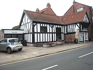
The Ark is one of the oldest buildings in Tadcaster that is still used. It was built in the late 1400s. Two carved heads on its front are thought to be Noah and his wife, which gave the building its name. The Ark has been many things over time: a meeting place, a post office, an inn, and a museum. Today, it is the Town Council offices. Some people believe that the Pilgrim Fathers planned their trip to America in this building.
Tadcaster Viaduct
The Tadcaster Viaduct is a railway bridge with eleven arches. It is about a quarter of a mile (400 meters) from the Wharfe bridge. It was planned as part of a railway line from Leeds to York in 1846. The line was never fully finished. From 1883 to 1959, the viaduct was used by a short railway line that served a corn mill. The viaduct is now a protected building and is owned by Tadcaster Town Council.
Tadcaster Bridge
The current Tadcaster Bridge was built in the early 1700s. It might have used stone from the old castle. It was made wider in the 1800s. This bridge is a main route connecting the two parts of the town, which are divided by the river.
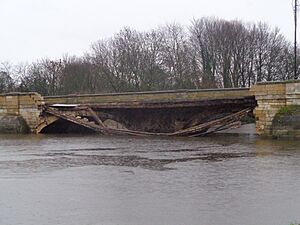
On December 29, 2015, parts of the bridge collapsed after heavy flooding from Storm Eva. This caused a gas leak and meant many people had to leave their homes. The town was split in two. The bridge was repaired and made wider. It reopened to traffic on February 3, 2017. The area around the bridge flooded again in February 2022.
Tadcaster Mere
To the southeast of Tadcaster is Tadcaster Mere. This area is a special scientific site. It is the center of an old lake basin that was formed during the last ice age, about 10,000 years ago. Tadcaster was at the very edge of the ice. Scientists study the mere's sediment and pollen to learn about the area's geological history.
Religion
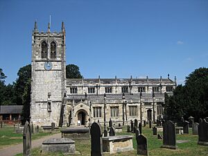
St Mary's Church is on the banks of the River Wharfe. It was first built around 1150. The Scots destroyed it in the 1300s. It was rebuilt between the 14th and 15th centuries. Because of repeated flooding, the church was taken apart and rebuilt higher up between 1875 and 1877. The tower was left as it was.
At the other end of the High Street is a large Methodist chapel. It was built in 1815 and has a very simple style.
Transport in Tadcaster
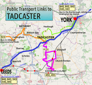
Tadcaster has local bus services that connect it to nearby towns. The Yorkshire Coastliner service stops here, which goes to the Yorkshire Coast. Buses also run to Wetherby, Harrogate, and Sherburn-in-Elmet.
The Tadcaster railway station closed to passengers in 1964. The closest train stations are now Ulleskelf, Church Fenton, and York railway station. You can get to York station from Tadcaster using the Yorkshire Coastliner bus.
Tadcaster is on the A64, A659, and A162 main roads. It is also about 5 km (3 miles) east of the A1(M) motorway.
Education
Tadcaster has three primary schools for children aged 5–11. It also has one secondary school, Tadcaster Grammar School, for ages 11–18. In 1999, Tadcaster Grammar School had some of the best A Level results in the country for a state school.
Sports
Tadcaster has several sports teams:
- Two football teams: Tadcaster Albion and Tadcaster Magnets.
- Tadcaster Rugby Football Club.
- Tadcaster Harriers running club.
- Cyclesense Cycling Club.
- Tadcaster Tornadoes Basketball Team (plays in the Leeds Basketball League).
- Tadcaster Swim Squad for young people up to 18.
Notable People
- David Brown, a footballer.
- Jan Dalibor, who helped create the children's TV puppets Pinky and Perky.
- Joseph Entwisle, a Methodist minister.
- Charles Hague, a composer.
- Owen Oglethorpe, a Bishop who crowned Queen Elizabeth I.
- Adelle Stripe, an author and journalist, grew up in Tadcaster.
See also
 In Spanish: Tadcaster para niños
 | Sharif Bey |
 | Hale Woodruff |
 | Richmond Barthé |
 | Purvis Young |


