River Ingol facts for kids
Quick facts for kids River Ingol |
|
|---|---|
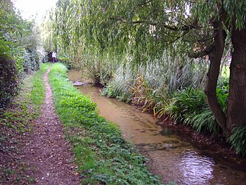
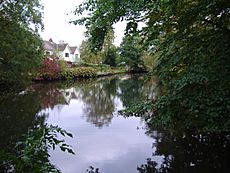
River Ingol at Snettisham
|
|
|
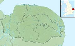
Location within Norfolk
|
|
| Country | England |
| County | Norfolk |
| Region | East of England |
| District | King's Lynn and West Norfolk |
| Physical characteristics | |
| Main source | Shernborne 28 m (92 ft) 52°51′43″N 0°32′38″E / 52.8620°N 0.5438°E |
| River mouth | The Wash Wolferton Creek 0 m (0 ft) 52°50′40″N 0°27′10″E / 52.8444°N 0.4529°E |
| Length | 10.4 km (6.5 mi) |
| Basin features | |
| Basin size | 34.4 km2 (13.3 sq mi) |
The River Ingol is a small river located in the western part of Norfolk, a county in England. It flows for about 10.4 kilometers (6.5 miles).
Contents
The Historic Snettisham Watermill
A cool watermill stands right on the River Ingol in Snettisham. This watermill was built way back in 1800. It cost £800, which was a lot of money then! The people of Snettisham built it for their village because bread was hard to find.
A Look Back at the Mill's History
People think there might have been an even older mill here before. We know that someone named Thomas Stonne was a miller in Snettisham back in 1626. During the time of the Domesday Book (a very old survey from 1086), Snettisham had seven mills! That was more than any other village in Norfolk.
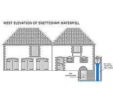
The mill you see today is quite small. It was first built with dark brown 'carrstone' from the area and had a special tiled roof. In 1877, the mill got better machines. They also added a place to store grain and wagons.
How the Mill Worked
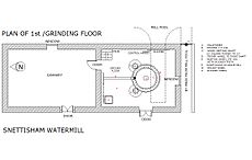
This mill had three sets of grinding stones. Two larger sets were powered from above, which was unusual. A smaller set was powered from below. This smaller set needed less power and was used when the river's water level was low.
The mill kept working until 1940, making flour for bread. After that, it was used to make food for animals until 1960. The mill was later fixed up and started working again by 1984. It was sold in 2008, and there were plans to turn part of it into holiday homes, but this idea was not approved.
From Snettisham to the Sea
After leaving Snettisham, the River Ingol flows through open farmland. The river's path has been changed a bit over time. However, there are no big walls or structures to stop floods along its banks.
Where the River Meets the Sea
The lowest parts of the river run next to the coastline. Here, the river water collects in a series of ponds. These ponds have special gates that open to let the water out into the sea when the tide is low.
These areas, where fresh river water mixes with salty seawater, are called brackish lagoons. There are also muddy areas and salt marshes. These places are home to many different birds, plants, and rare tiny creatures (invertebrates). An old map from 1797 shows that these ponds were once part of Snettisham harbour and salt marshes, which was also where the River Ingol met the sea.


