River Spean facts for kids
Quick facts for kids River Spean |
|
|---|---|

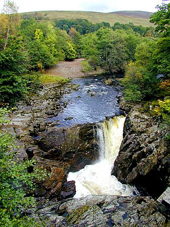
Waterfall on the Spean near Achluachrach
|
|
|
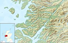
Location of the mouth within Lochaber
|
|
| Country | Scotland |
| Physical characteristics | |
| Main source | Loch Laggan |
| River mouth | River Lochy 56°54′34″N 4°59′05″W / 56.90956°N 4.98479°W |
The River Spean is a beautiful river in the Scottish Highlands. It starts its journey from Loch Laggan, a large lake. The river then flows west, making its way through the stunning Scottish landscape. Finally, it joins another river, the River Lochy, at a place called Gairlochy. This meeting point is located in the famous Great Glen.
The River Spean has several smaller rivers that flow into it. These are called tributaries. Some important ones include the Abhainn Ghuilbinn and the River Treig, which join from the left side. The River Roy and a river known as The Cour also add their waters to the Spean.
Contents
Discover the River Spean's Journey
The River Spean travels a long way from its source to where it meets the River Lochy. It flows through a part of Scotland known for its amazing mountains and valleys.
Where Does the Spean Flow?
The river begins at Loch Laggan. From there, it flows mainly towards the west. It passes by several small towns and villages. The A86 road follows the river for most of its path. This road goes from the upper part of Loch Laggan all the way to Spean Bridge.
Bridges Over the Spean
Many bridges cross the River Spean. One important bridge carries the A82 road. This is near where the A82 meets the A86 at Spean Bridge. There is also a smaller road bridge above the waterfalls at Inverlair. Two other crossings exist. One is a private road near Loch Laggan. The other is a road that goes over the top of the Laggan Dam.
Railways Near the River
The West Highland Line is a railway that also follows the River Spean. It crosses the river close to Tulloch Station. The railway then runs along the north side of the river. It crosses the river again about a mile east of Spean Bridge. There used to be another railway branch that went west from Spean Bridge. It crossed the river one more time west of the village.
How the River Spean Was Formed
The landscape around the River Spean was shaped by ice a very long time ago. This happened at the end of the last Ice Age.
Ancient Lakes and Ice Dams
During the Ice Age, huge sheets of ice covered much of Scotland. In the valleys of Glen Spean and Glen Roy, these ice sheets created natural dams. These dams held back massive lakes of water. At one point, the surface of these lakes was about 260 meters (850 feet) high.
A Giant Flood Event
Around 11,500 years ago, something dramatic happened. The ice dam holding back these lakes suddenly broke. When this happened, a huge amount of water was released. Scientists believe about 5 cubic kilometers of floodwater rushed out. This giant flood flowed along the path where the River Spean is today. This powerful event carved out the deep gorge that the modern river now flows through. It was a truly massive natural event that shaped the land we see today.
 | Janet Taylor Pickett |
 | Synthia Saint James |
 | Howardena Pindell |
 | Faith Ringgold |


