A82 road facts for kids
Quick facts for kids
A82 road |
|
|---|---|
| Lua error in Module:Infobox_road/map at line 15: attempt to index field 'wikibase' (a nil value). | |
| Route information | |
| Length | 167 mi (269 km) |
| History | Classified as A82 in 1923 Specific sections built from 1724 – present |
| Major junctions | |
| From | Glasgow |
|
|
| To | Inverness |
| Location | |
| Primary destinations: |
|
| Road network | |
|
|
The A82 is a major road in Scotland that connects two big cities: Glasgow in the south and Inverness in the north. It passes through Fort William along the way. This road is super important for travel between the central part of Scotland and the amazing Scottish Highlands.
The A82 goes past many famous places. You'll see Loch Lomond, Rannoch Moor, Glen Coe, the Ballachulish Bridge, Ben Nevis (Britain's highest mountain!), the Commando Memorial, and even Loch Ness with its famous castle, Urquhart Castle. It's known for its beautiful scenery, making it a popular choice for tourists.
Parts of the A82 follow old military roads built in the 1700s by generals like George Wade. Later, in the 1800s, a famous engineer named Thomas Telford designed much of the route we see today. The road has been improved many times, especially in the 1920s and 30s.
People often say the A82 offers a memorable driving experience, especially the section through Rannoch Moor and Glencoe. It's a key route for both tourists enjoying the views and for trucks carrying goods. The Scottish government is always working to make the road safer and less crowded.
Contents
Exploring the A82 Route
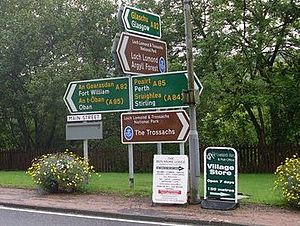
The A82 is about 167 miles (269 km) long. It's the second longest "A-road" in Scotland, after the A9. Many people call it the "slower but more scenic route" compared to the A9.
The A82 was one of the first "trunk roads" in Scotland, created in 1936. Trunk roads are main roads managed by the national government (now Transport Scotland) because they are so important. Some parts of the A82 near Glasgow are now looked after by local councils.
The A82 also runs through areas where Scottish Gaelic is spoken. Since 2003, you can see bilingual signs (in both English and Gaelic) on the A82 from Tarbet to Inverness. This helps tourists and celebrates the Gaelic language.
Starting in Glasgow
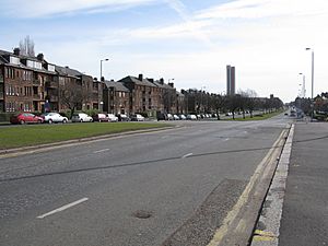
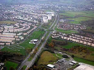
The A82 starts in central Glasgow, connecting with the M8. It heads northwest along a famous street called Great Western Road. This road passes beautiful old buildings and becomes a wide dual carriageway (two lanes in each direction).
This part of the road was first built as a toll road in 1816. It was made wider in the 1970s. The trees along the road were carefully saved during this work. Many people think Great Western Road is a very grand way to enter Glasgow.
The A82 then becomes a high-quality dual carriageway. It goes past Dumbarton and around Alexandria on a bypass built in the late 1960s. This wide road ends near Loch Lomond, where the A82 enters the beautiful Loch Lomond and The Trossachs National Park.
Along Loch Lomond to Crianlarich
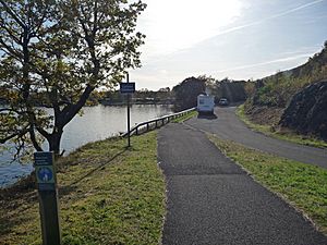
The A82 follows the western shore of Loch Lomond, passing through villages like Luss. Much of this section was improved in the 1980s. Luss itself now has a bypass, so traffic goes around the village instead of through it.
At Tarbet, another main road, the A83, splits off towards Campbeltown. The A82 continues north along the loch. This part of the road is narrower and can be tricky for large trucks because of tight bends.
For many years, a section at Pulpit Rock was so narrow it was only one-way, controlled by traffic lights. But in 2015, this part was widened with a new bridge, making it much easier to drive.
After Loch Lomond, the A82 follows Glen Falloch, a valley shaped by glaciers. It then reaches Crianlarich. The road now goes around Crianlarich on a bypass that opened in 2015.
From Crianlarich to Glencoe
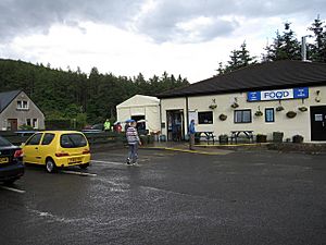
Between Crianlarich and Tyndrum, the A82 shares its route with the A85. Tyndrum is a good place for drivers to stop, with places like the Real Food Cafe, which is popular with both drivers and walkers on the West Highland Way.
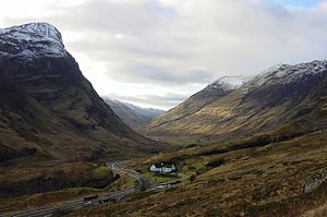
North of Tyndrum, the A82 enters the wild, open land of Rannoch Moor. This is the highest point on the A82, reaching about 1,142 feet (348 meters). The road then turns west and goes down into the famous Glen Coe.
This part of the A82 is known for its amazing scenery. Many people say it's one of the most beautiful places in Britain. However, it can get very busy with tourist buses and trucks. The road goes past beautiful waterfalls called the Meeting of the Three Waters. This area was even used for filming scenes in the movie Monty Python and the Holy Grail.
Near the waterfalls, there's a path to Coire Gabhall, also known as the "lost valley" of Glencoe. This is where the Clan Donald used to hide cattle they had taken! The A82 then passes the Glencoe visitors' centre before reaching Glencoe village.
Glencoe to Fort William
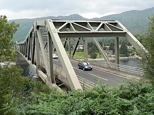
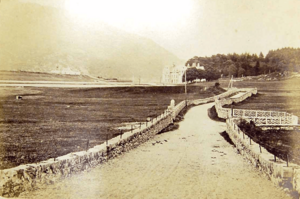
After Glencoe, the A82 continues along the south shore of Loch Leven. It then bypasses Ballachulish and crosses the mouth of the loch on the impressive Ballachulish Bridge. This bridge was planned in the 1960s and opened in 1975. Before the bridge, cars had to use a ferry to cross the loch.
Near the bridge, you'll see a monument to the Appin Murder, a famous historical event from 1752.
The A82 then turns north and follows the Great Glen, a long valley that stretches all the way to Inverness. It runs alongside Loch Linnhe towards Fort William. This area is very popular with tourists, and you'll see many hotels and bed and breakfasts along the road.
In Fort William, the A82 briefly becomes a dual carriageway bypass along the loch shore. It passes the modern train station. Another road, the A830 (known as the "Road to the Isles"), heads west from here towards Mallaig.
From Fort William to Inverness
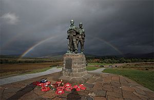
North of Fort William, the A82 runs through Leanachan Forest towards Spean Bridge. It crosses the River Spean on a bridge built by Telford in 1819. Near the village, you'll find the Commando Memorial. This tall monument honors the original Commandos from World War II who trained in this area. It's also a great spot for amazing views of the Highlands.
The A82 then follows the eastern shore of Loch Lochy and Loch Oich. Near Loch Oich, you can see the "Well of the Seven Heads" monument, which tells a dramatic story from 1663.
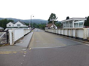
The road continues to Fort Augustus, where it crosses the Caledonian Canal at a swing bridge. This bridge opens to let boats pass through the canal locks.
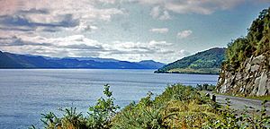
The last 36 miles (58 km) of the A82, from Fort Augustus to Inverness, run along the western shore of Loch Ness. This is the side opposite the old military road, as Telford wanted to connect the communities along this shore.
Because the A82 can be busy, tourists who want a quieter experience are sometimes suggested to use the older Military Road. Cyclists and walkers can enjoy the Great Glen Way, a path that runs between Fort William and Inverness.
At Invermoriston, the A82 crosses the River Moriston. Between Invermoriston and Drumnadrochit, there's a memorial to John Cobb, who died trying to break the water speed record on Loch Ness. As the A82 gets closer to Drumnadrochit, it passes the famous Urquhart Castle right by the loch.
Finally, the A82 reaches Inverness. It crosses the Caledonian Canal again at the Tomnahurich Swing Bridge. The road then goes through the city, crosses the River Ness, and ends at a roundabout with the A9.
History of the A82
The A82 was officially named in 1923. Its route has stayed mostly the same since then, following Telford's original design. Many improvements were made in the early 1900s to help the economy after the Great Depression.
Glasgow's Road Changes
When it was first created, the A82 started in a different part of Glasgow. But in 1934, its starting point was changed to use the newly completed Great Western Road extension. This made it easier to get from Glasgow to Dumbarton.
Rannoch Moor's Route
The section of the A82 across Rannoch Moor has a long history. The current road was built because Telford's older road often flooded. Construction on the modern route began in 1927 and was finished in 1933. It made the road wider and better for travel.
Some people worried that the new road would spoil the natural beauty of Glen Coe. But the government said it was important for connecting different parts of Scotland.
Kinlochleven's Road
Before the Ballachulish Bridge, the A82 used to cross Loch Leven by ferry. But in the 1930s, a new road was built all the way around the loch to Kinlochleven. This was because of the new aluminum factory there. In 1934, the A82 was rerouted to use this new road, as the ferry closed at night. This road is now called the B863, but it's still important for local travel. The Ballachulish Bridge saves a long 16-mile (26 km) trip around the loch.
Inverness's New End Point
The A82 used to end closer to the center of Inverness. But in 1986, its end point was moved to connect with the new A9 and the Kessock Bridge. This helped with the development of Inverness's docks.
Why the A82 is Important
The Scottish government says the A82 is "a vital artery" for communities in the western Highlands. It connects places like Fort William and the Western Isles to Glasgow and central Scotland.
The Highlands and Islands Transport Partnership (HITRANS) believes that improving the A82 is super important to help these areas grow and stop people from moving away. They think that if the A82 is improved, it could bring in an extra £76 million to the area. Scottish Transport Minister Keith Brown called the A82 a "vital economic and social lifeline."
Keeping the A82 Safe
The A82, like the A9, has sometimes been called one of Scotland's more challenging roads. A group called the A82 Partnership works to encourage the Scottish government to keep making improvements.
The section of the A82 around Loch Lomond can get very busy, especially with tourists. Sometimes, the road has to close overnight for repairs, which can cause long detours. Local people and businesses have protested these closures because they make travel very difficult. For example, a journey from Oban to Fort William, normally 44 miles (71 km), could become a 166-mile (267 km) detour!
The A82 also has special gates that can be closed during bad weather, especially on the section between Tyndrum and Glencoe. These gates now have bright, lit-up signs. The road also has signs to warn drivers about deer crossing, as deer-vehicle collisions can be a problem in the Highlands.
A82 Junctions and Landmarks
The A82 has many different types of junctions, from big highway connections near Glasgow to simple T-junctions in the Highlands.
| Distance | Name | Destination |
|---|---|---|
| 0 miles (0 km) | Edinburgh, Kilmarnock, Greenock, Glasgow Airport M8 Carlisle (M74) Stirling (M80) |
|
| 22 miles (35 km) | Erskine Bridge, Paisley A898 | |
| 33 miles (53 km) | Tarbet | Campbeltown A83 |
| 50 miles (80 km) | Crianlarich | Perth, Stirling A85 |
| 54.7 miles (88.0 km) | Tyndrum | Oban A85 |
| 87.6 miles (141.0 km) | Oban A828 | |
| 88 miles (142 km) | ||
| 102 miles (164 km) | Fort William | Mallaig A830 |
| 110 miles (180 km) | Spean Bridge | Newtonmore A86 |
| 125 miles (201 km) | Invergarry | Kyle of Lochalsh, Skye A87 |
| 138 miles (222 km) | Kyle of Lochalsh, Skye A887 | |
| 167 miles (269 km) | Perth, Thurso A9 Aberdeen A96 Ullapool (A835) |
|
See also
 | Leon Lynch |
 | Milton P. Webster |
 | Ferdinand Smith |


