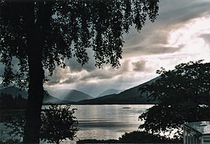
Loch Linnhe facts for kids
Loch Linnhe is a long, narrow body of saltwater that stretches inland from the sea on the west coast of Scotland. It's like a fjord, but in Scotland, these are called "sea lochs." The name Linnhe comes from a Scottish Gaelic word, linne, which means 'pool'.
The part of the loch closer to land, upstream from a place called Corran, is known in Scottish Gaelic as An Linne Dhubh. This means "the black pool." The part closer to the sea is called An Linne Sheileach, meaning "the salty pool."
Where is Loch Linnhe?
Loch Linnhe is special because it follows the path of a very old crack in the Earth's crust called the Great Glen Fault. It's the only sea loch that lies along this fault line.
The loch is about 50 kilometers (about 31 miles) long. It opens up into a wider area of sea called the Firth of Lorn at its southwestern end.
How Big is it?
The part of Loch Linnhe upstream from Corran is about 15 kilometers (9 miles) long. It's usually about 2 kilometers (1 mile) wide.
The southern part of the loch is wider. A branch of the loch that goes southeast of the island of Lismore is known as the Lynn of Lorne.
Rivers and Towns
Several other lochs and rivers feed into Loch Linnhe:
- Loch Eil flows into Loch Linnhe at its northernmost point.
- From the east, Loch Leven joins the loch just downstream from Corran.
- Loch Creran flows into the Lynn of Lorne.
The town of Fort William is located at the northeast end of Loch Linnhe. It sits right where the River Lochy meets the loch.
See also
 In Spanish: Fiordo de Linnhe para niños
 | Audre Lorde |
 | John Berry Meachum |
 | Ferdinand Lee Barnett |


