River Tonge facts for kids
Quick facts for kids River Tonge |
|
|---|---|

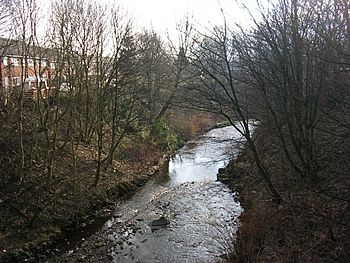
Looking downstream from Tonge Bridge, which carries the A579 over the river
|
|
| Country | England |
| District | Bolton MBC |
| Physical characteristics | |
| Main source | northeast Bolton 53°35′44.58″N 2°25′30.42″W / 53.5957167°N 2.4251167°W |
| River mouth | River Croal, southeast Bolton 53°34′1.56″N 2°24′12.96″W / 53.5671000°N 2.4036000°W |
| Basin features | |
| Tributaries |
|
The River Tonge is a short river in Greater Manchester, England. It flows through the town of Bolton and helps to separate Bolton from the nearby area called Tonge.
The River Tonge starts at a place known as the Meeting of the Waters. Here, two smaller streams, Astley Brook (from the west) and Eagley Brook (from the north), join together to form the Tonge. The river then flows south, winding its way past Springfield. Near Tonge Fold, another stream called Bradshaw Brook joins it. Finally, the River Tonge flows into the River Croal at Darcy Lever. The Croal then joins the larger River Irwell.
Contents
What Makes the River Tonge Special?
A Unique Geological Site
A part of the River Tonge, just north of Tonge Bridge, is a very important area for science. It's called a Site of Special Scientific Interest (SSSI). This means the area is protected because it has something very unique or rare.
This special site is about 0.7 hectares (which is like 1.7 acres) and includes the steep right bank of the river. It was made an SSSI in 1987 because of its amazing geology.
Ancient Plant Discoveries
Scientists have found ancient plant seeds in the sandstone rocks along the river bank. These seeds are from plants called Trigonocarpus, which are a type of pteridosperm. These plants lived a very long time ago!
The seeds found here are very well preserved. This helps scientists learn a lot about what the area was like in the past. It also tells them about how sediments (like sand and mud) were laid down by the river long ago. This site is one of only seven geological SSSIs in all of Greater Manchester.
What Lives in the River?
In 2017, something unusual was found in the River Tonge: walking catfish (Clarias). These fish are not native to England and usually live in warmer parts of the world. Finding them here was quite a surprise for experts!
Streams That Join the Tonge
The River Tonge gets its water from several smaller streams, called tributaries. These include:
- Bradshaw Brook (joins from the left side)
- Eagley Brook (joins from the left side)
- Astley Brook (joins from the right side)
 | Claudette Colvin |
 | Myrlie Evers-Williams |
 | Alberta Odell Jones |

