River Worfe facts for kids
Quick facts for kids River Worfe |
|
|---|---|

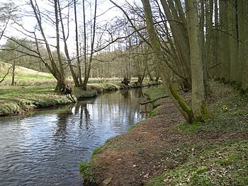
River Worfe near Rindleford
|
|
|
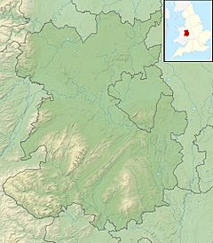
Location of the mouth in Shropshire
|
|
| Country | England |
| Counties | Shropshire |
| Physical characteristics | |
| River mouth | River Severn 52°33′13″N 2°24′27″W / 52.5536°N 2.4074°W |
| Length | 28.6 km (17.8 mi) |
| Basin features | |
| Basin size | 258 km2 (100 sq mi) |
| Tributaries |
|
The River Worfe is a river located in Shropshire, England. Its name is thought to come from an old English word meaning 'to wander' or 'meander'. This makes sense because the river is known for its many twists and turns, especially in its middle part. The river officially begins at Cosford Bridge. Here, two smaller streams, the Cosford Brook and Albrighton Brook, join together to form the Worfe.
Contents
River's Journey
The River Worfe starts its journey at Crackleybank, which is just north of Shifnal. From there, it forms a natural border for several parishes. These include Tong, Donington, and Albrighton.
Flowing Through Towns
The river then continues its path through Ryton. In Ryton, another stream called Wesley Brook flows into the Worfe. After this, the river reaches Beckbury. Here, it is joined by the Mad Brook, which gets its name from Madeley, where it first flows.
Joining the Severn
Soon after, the River Worfe creates the boundary between Stockton and Badger. Finally, it flows through Worfield before joining the much larger River Severn. From its start to where it meets the Severn, the Worfe drops about 200 feet (61 m) in height. This means it flows downhill at an average rate of 10 feet for every mile.
Old Mill Connections
The River Worfe actually has two places where it connects to the River Severn. The southern connection, near Fort Pendlestone, used to be a special channel. This channel, called a mill leat, directed water to power Pendlestone Mill. This mill was an old corn mill that belonged to the town of Bridgnorth.
Helping the River Worfe
Sometimes, the river doesn't have enough water flowing in its upper parts. To help with this, a special pipeline was built in 1998. This pipeline carries water from a deep well at Sheriffhales to the Ruckley Brook, which is one of the Worfe's early sources.
River Restoration Efforts
In March 2015, a group called the Severn Rivers Trust worked to improve the river and its banks. Six community groups and 27 volunteers helped with this important project. They put up 5 miles (8 km) of fencing along the riverbanks. They also installed many special passes to help eels and fish move easily along the river. In addition, they created 4.6 miles (7.4 km) of new river channels. All these efforts were made to improve the river's health and its natural environment.
 | Bayard Rustin |
 | Jeannette Carter |
 | Jeremiah A. Brown |


