Rivière aux Araignées facts for kids
Quick facts for kids Rivière aux Araignées |
|
|---|---|

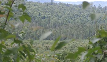
The Araignées river is only accessible by water; you can see it in the middle of the marsh to the east of Lac aux Araignées.
|
|
| Country | Canada |
| Province | Quebec |
| Region | Estrie |
| MRC | Le Granit Regional County Municipality |
| Physical characteristics | |
| Main source | Mountain streams on the border of Quebec and Maine (United States) Saint-Augustin-de-Woburn, (MRC) Le Granit Regional County Municipality, Québec 450 metres (1,480 ft) 45°23′44″N 70°41′42″W / 45.395419°N 70.694999°W |
| River mouth | Lake Mégantic, Chaudière River Frontenac 391 metres (1,283 ft) 45°27′59″N 70°47′18″W / 45.46639°N 70.788332°W |
| Length | 26.6 kilometres (16.5 mi) |
| Basin features | |
| Progression | Lake Mégantic, Chaudière River, St. Lawrence River |
| River system | St. Lawrence River |
| Basin size | 437.9 kilometres (272.10 mi) |
| Tributaries |
|
The Rivière aux Araignées (which means 'Spider River' in English) is a river in Quebec, Canada. It flows into the southern part of Lake Mégantic. From there, its waters join the Chaudière River, which then flows north to the Saint Lawrence River.
This river is located in the municipalities of Saint-Augustin-de-Woburn and Frontenac. These towns are part of the Le Granit Regional County Municipality (MRC) in the Estrie region of Quebec.
River's Journey
The Rivière aux Araignées starts near the top of Mont Pisgah. This mountain is right on the border between Canada and the United States (Maine). The river begins about 0.4 kilometers north of this border.
Many small streams join the river. These streams drain the western sides of mountains like Mont Merrill and Caribou Mountain. They also come from other border mountains between Quebec and Maine. All these streams create the river's watershed, which is the area of land where all the rain and snow melt flows into this river.
The river flows between Mont Louise and Mont Flat Top. Then, it empties into the southeastern part of Lac aux Araignées.
Upper Part of the River
The upper part of the Rivière aux Araignées is about 21.2 kilometers long.
- It flows northwest for 3.9 kilometers. Here, the "Ruisseau des Cascades" stream joins it from the east.
- It continues northwest for 0.6 kilometers, where another stream joins it.
- Then, it flows northwest for 5.2 kilometers until it reaches a road bridge.
- After that, it goes northwest for 3.5 kilometers to meet the Club brook.
- Finally, it flows west for 3.1 kilometers to the southeast shore of Lac aux Araignées.
- It then crosses Lac aux Araignées for 4.9 kilometers, reaching the dam at the lake's exit.
Lower Part of the River
After leaving Lac aux Araignées, the river is sometimes called the discharge of Lac aux Araignées. This lower part is about 3.5 kilometers long.
- It flows south for 1.0 kilometer to the north shore of a bay in Lac des Joncs (Mégantic).
- Then, it flows south and northwest for 2.5 kilometers to Lac des Joncs.
The watershed for the Rivière aux Araignées covers 437.9 square kilometers. The watershed for the Arnold River is 265 square kilometers. Both of these watersheds meet in the Lac des Joncs area before the water reaches Lake Mégantic.
River's Name
The name "rivière aux Araignées" means "Spider River" in English. This name became official on December 5, 1968. The Commission de toponymie du Québec is the organization that makes official names for places in Quebec.
 | Anna J. Cooper |
 | Mary McLeod Bethune |
 | Lillie Mae Bradford |


