
Robert Morden facts for kids


Robert Morden (born around 1650, died in 1703) was an English person who did many things! He sold books, published them, and was a talented mapmaker. He also made globes and engraved pictures. He was one of the first people to make a lot of money from creating and selling maps.
From about 1675 until he passed away in 1703, Robert Morden worked in London. His shops were in areas called Cornhill and New Cheapside. He made a huge number of different maps.
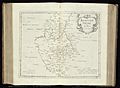
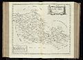
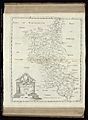
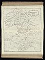
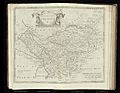
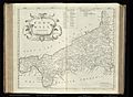
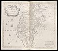
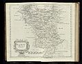
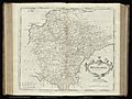
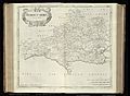
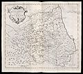
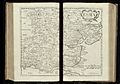
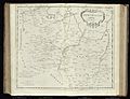
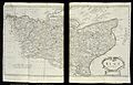
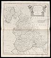
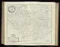
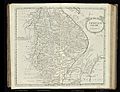
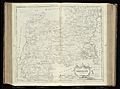
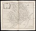
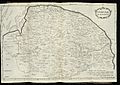
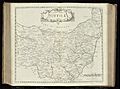
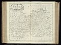
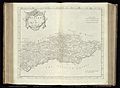
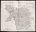
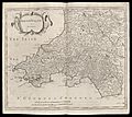
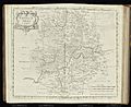
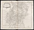
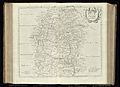
His most famous maps showed South Wales, North Wales, and the English counties. These were first printed in 1695 in a new version of William Camden's book, Britannia. They were printed again later in 1722, 1753, and 1772. These maps were special because they used new information from people living in each county. They also had new, detailed engravings. Each map featured a fancy design, called a cartouche, and showed many place names. In 1701, Morden also created smaller county maps, often called "Miniature Mordens."
In 1695, Robert Morden published a map of Scotland. Some parts of this map, like Skye and the Western Isles, were very similar to a map made in 1654 by Robert Gordon of Straloch. However, other parts of Morden's map showed more accurate details.
His book, Geography Rectified: or a Description of the World, came out in 1700. It was a very big book, with more than 700 pages! It had a long introduction that taught readers about geography. The book also included 78 maps of places like Europe (including the British Isles), Asia, Africa, and America. There were even two circular maps showing the Earth from opposite sides, displaying the known world at that time. (Australia and Antarctica were not known in Europe back then.)
The book also explained important geography ideas like Latitude and Longitude. It compared different goods, traditions, history, how countries were run, money, and measurements around the world to those in London. The book had a very detailed index to help readers find information.
Robert Morden also published a new map of the Tamil homeland, called Coylot Wanees Country, in 17th-century Ceylon (which is now Sri Lanka).
He is also known for some very rare early maps of the British colonies in North America. Today, these maps are highly sought after by collectors of old American maps. He also made a series of tiny maps of the world. These appeared on playing cards and in his map books, like Atlas Terrestris and Geography Anatomiz'd, starting in 1687.
Morden was a member of The Worshipful Company of Weavers, which was a guild for weavers. He learned his skills from Joseph Moxon, who was a mapmaker for King Charles II. Some of Morden's own students included Mary Ward in 1674, Philip Lea in 1675, and Margaret Wearg in 1675.
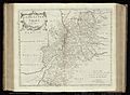
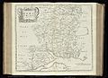
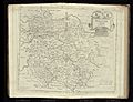
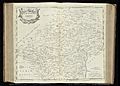
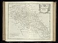
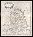
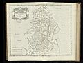
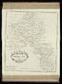
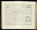
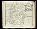
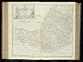
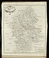
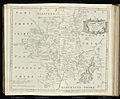
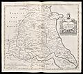
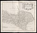
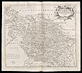
Robert Morden's County Maps
The pictures below show some of Morden's county maps. These were published in 1722 in a book called Camden's Britannia. The book mentioned that the maps had been updated since they first came out in 1695. This was to make sure the place names were spelled correctly and matched how people commonly said them.
-
Bedfordshire
-
Berkshire
-
Buckinghamshire
-
Cambridgeshire
-
Cheshire
-
Cornwall
-
Cumberland
-
Derbyshire
-
Devon
-
Dorset
-
Durham
-
Essex
-
Gloucestershire
-
Hampshire
-
Herefordshire
-
Hertfordshire
-
Huntingdonshire
-
Kent
-
Lancashire
-
Leicestershire
-
Lincolnshire
-
Middlesex
-
Monmouthshire
-
Norfolk
-
Northamptonshire
-
Northumberland
-
Nottinghamshire
-
Oxfordshire
-
Rutland
-
Shropshire
-
Somerset
-
Staffordshire
-
Suffolk
-
Surrey
-
Sussex
-
Wales (North)
-
Wales (South)
-
Warwickshire
-
Westmorland
-
Wiltshire
-
Worcestershire
-
Yorkshire (East Riding)
-
Yorkshire (North Riding)
-
Yorkshire (West Riding)


-Morden-1695.jpg)
-Morden-1695.jpg)


-Morden-1695.jpg)
-Morden-1695.jpg)
-Morden-1695.jpg)
