Rockledge, Georgia facts for kids
Quick facts for kids
Rockledge, Georgia
|
|
|---|---|
| Country | United States |
| State | Georgia |
| County | Laurens |
| Elevation | 217 ft (66 m) |
| Time zone | UTC-5 (Eastern (EST)) |
| • Summer (DST) | UTC-4 (EDT) |
| ZIP code |
30454
|
| Area code(s) | 478 |
| GNIS feature ID | 321774 |
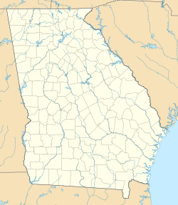
Rockledge is a small place in Laurens County, Georgia, in the United States. It is called an unincorporated community. This means it does not have its own local government like a city or town. Instead, it is governed by the county.
Rockledge is located along a railway line. It is about 13.8 miles (22.2 km) east-southeast of a larger city called Dublin. The community has its own post office with the ZIP code 30454.
What is the History of Rockledge?
How Did Rockledge Get Its Name?
The name "Rockledge" comes from a natural rock formation. There was a "ledge of rock" near where the community first started. A post office was opened in Rockledge in the year 1899.
When Was Rockledge a Town?
In 1908, the Georgia General Assembly made Rockledge an official town. The General Assembly is like the state's law-making group. When they "incorporated" Rockledge, it meant the community could have its own local government. This included things like a mayor and town council.
However, in 1995, the town's official status was changed. Its "municipal charter" was taken away. This means Rockledge stopped being an official town. It went back to being an unincorporated community.
 | Georgia Louise Harris Brown |
 | Julian Abele |
 | Norma Merrick Sklarek |
 | William Sidney Pittman |


