Roe Beck facts for kids
Quick facts for kids Roe Beck |
|
|---|---|

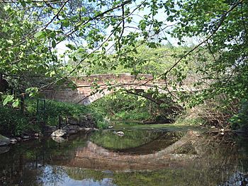
Roe at Stockdalewath Bridge
|
|
|
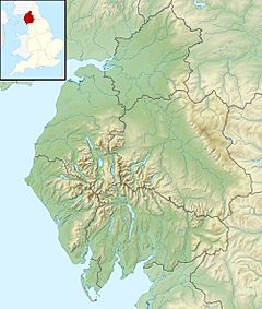
Location of the mouth within Cumbria
|
|
| Other name(s) | River Roe |
| Country | England |
| County | Cumbria |
| Physical characteristics | |
| Main source | Skelton |
| River mouth | River Caldew 54°49′00″N 2°57′41″W / 54.816793°N 2.961384°W |
| Length | 20.8 km (12.9 mi) |
| Basin features | |
| Basin size | 69 km2 (27 sq mi) |
| Tributaries |
|
The Roe Beck is a small river, also called the River Roe in some parts. It flows through Cumbria, a county in England. A "beck" is a local word for a small stream or river.
The Roe Beck is a "tributary" of the River Caldew. This means it's a smaller river that flows into a larger one. It joins the River Caldew near a place called Gaitsgill, south of Dalston. The Roe Beck, including a stream called Peel Gill, is about 20.8 kilometres (12.9 mi) long. Its "catchment area" is about 69 square kilometres (27 sq mi). A catchment area is all the land where rain falls and then drains into that river. This area also includes the land drained by its main branch, the River Ive.
Contents
Where Does the Roe Beck Start and Flow?
The Roe Beck begins high up in the hills near Hardrigg Hall. This spot is between Lamonby and Skelton. From there, it flows towards the north-west.
It soon meets Peel Gill near Skelton Wood End. Other small streams, like Whale Gill and Cockley Beck, also join it. The river then flows past Sowerby Row and Middlesceugh. Here, it turns north.
Meeting the River Ive
The Roe Beck then meets its important branch, the River Ive, near Highbridge. After this meeting point, the river is known as the River Roe. It changes direction again, flowing north-west.
Another stream called Bassen Brook joins the River Roe. The river then continues through Stockdalewath. Finally, it flows into the River Caldew near Gaitsgill.
How Much Water Flows in the Roe Beck?
Scientists have been measuring the water flow of the Roe Beck since 1999. They do this at a special measuring station in Stockdalewath. The area of land that drains into the river at this station is about 63 square kilometres (24 sq mi). This is about 91% of the river's total catchment area.
Highest Water Levels Recorded
The highest water level ever recorded at the station was on January 8, 2005. The water reached a height of 2.88 metres (9 ft 5 in). At that time, the river was flowing very fast, at 99 cubic metres per second (3,500 cu ft/s).
The second highest level happened on May 18, 2013. The water was 2.72 metres (8 ft 11 in) high, and the flow was 90 cubic metres per second (3,200 cu ft/s).
The area upstream of the measuring station gets about 984 millimetres (38.7 in) of rain each year on average. The highest point in this area is about 370 metres (1,210 ft) above sea level.
 | Aaron Henry |
 | T. R. M. Howard |
 | Jesse Jackson |


