Rothley Brook facts for kids
Quick facts for kids Rothley Brook |
|
|---|---|

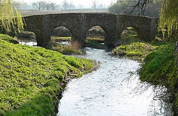
Packhorse Bridge Anstey
|
|
|
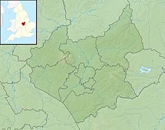
Confluence with Soar shown in Leicestershire
|
|
| Country | England |
| Counties | Leicestershire |
| Physical characteristics | |
| Main source | Stanton-under-Bardon 52°41′18″N 1°18′33″W / 52.688402°N 1.309083°W 174 m (571 ft) |
| River mouth | Rothley 52°42′5″N 1°7′26″W / 52.70139°N 1.12389°W |
| Length | 29 km (18 mi) |
| Basin features | |
| Basin size | 96 km2 (37 sq mi) |
| Progression : Rothley - Soar - Trent - Humber | |
The Rothley Brook is a small river in Leicestershire, England. It flows into the River Soar, which means it's a "tributary" – a smaller stream or river that joins a larger one. The Rothley Brook flows for about 29 kilometers (18 miles).
Contents
Where the Rothley Brook Flows
The Rothley Brook starts to become noticeable after Thornton Reservoir. This is near the village of Thornton in the National Forest area.
Journey Through Villages
From there, the brook travels through several villages. It flows past Desford and Ratby. A smaller stream from Kirby Muxloe then joins it just before Glenfield.
After Glenfield, the brook continues its journey. It flows around Anstey, Cropston, and Thurcaston. Finally, it reaches Rothley, where it meets and joins the River Soar.
A Bit of History
Long ago, the Rothley Brook had a different name. People used to call it "Heathe Brook."
Nature at Castle Hill Park
The Rothley Brook is a very important part of the large Castle Hill Park in Anstey. It runs alongside Cropston Road and the A46 road. The brook also passes under Anstey Lane in Thurcaston.
Wildlife Haven
The parts of the brook that flow through Castle Hill Park are a wonderful home for many animals. You might even spot beautiful kingfishers there. These colorful birds love to catch fish in the clean waters of the brook.
 | Anna J. Cooper |
 | Mary McLeod Bethune |
 | Lillie Mae Bradford |


