Rougemont, North Carolina facts for kids
Quick facts for kids
Rougemont, North Carolina
|
|
|---|---|
 |
|

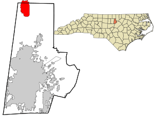
Location in Durham County and the state of North Carolina
|
|
| Country | United States |
| State | North Carolina |
| County | Durham and Person |
| Area | |
| • Total | 6.39 sq mi (16.56 km2) |
| • Land | 6.32 sq mi (16.36 km2) |
| • Water | 0.08 sq mi (0.20 km2) |
| Elevation | 574 ft (175 m) |
| Population
(2020)
|
|
| • Total | 1,001 |
| • Density | 158.51/sq mi (61.20/km2) |
| Time zone | UTC-5 (Eastern (EST)) |
| • Summer (DST) | UTC-4 (EDT) |
| ZIP codes |
27572
|
| FIPS code | 37-58040 |
| GNIS feature ID | 2628653 |
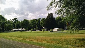
Rougemont is a small community in North Carolina, United States. It is not an official town, but it is called a "census-designated place" (CDP). This means the government counts the people living there for statistics. Rougemont is located in two different counties: Durham and Person counties.
In 2010, about 978 people lived in the CDP area of Rougemont. In 2011, there was a plan to make Rougemont an official town, but it did not happen.
Where is Rougemont Located?
Rougemont is in the northern part of Durham County. It is along a main road called U.S. Route 501. The center of Rougemont is about 17 miles (27 km) north of Durham. It is also about 13 miles (21 km) south of Roxboro.
The CDP area of Rougemont stretches north to the Flat River. It goes east to Moores Mill Road and south to Quail Roost Farm Road. To the west, it reaches Harris Road and Chambers Road. The Rougemont ZIP code covers a much larger area. This larger area extends into Orange County and Granville County. However, population numbers are only for the smaller CDP area.
How Many People Live Here?
| Historical population | |||
|---|---|---|---|
| Census | Pop. | %± | |
| 2020 | 1,001 | — | |
| U.S. Decennial Census | |||
The number of people living in Rougemont has changed over time. In 2010, there were 978 residents. By 2020, the population grew slightly to 1,001 people. These numbers are from the official United States Census.
Fun Places to Visit
Rougemont has a few interesting spots nearby that you might enjoy:
- Castle Mont Rouge: This is a unique castle-like building. It was designed by an artist named Robert Mihaly. It looks like something out of a fairy tale!
- Orange County Speedway: If you like car racing, this speedway is about 2.5 miles (4.0 km) west of Rougemont. You can watch exciting races there.
- Little River Regional Park: This park is a great place to explore nature. It has trails for hiking and biking. It also has picnic areas and playgrounds. The park is located in both Orange and Durham counties. You can find more information at its official website: https://www.orangecountync.gov/facilities/facility/details/little-river-regional-park-natural-area-7.
See also
 In Spanish: Rougemont (Carolina del Norte) para niños

