Round Island, Michigan facts for kids

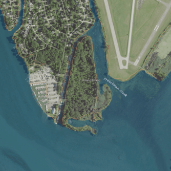
USGS aerial imagery of Round Island
|
|
| Geography | |
|---|---|
| Location | Michigan |
| Coordinates | 42°05′32″N 83°10′02″W / 42.09222°N 83.16722°W |
| Highest elevation | 581 ft (177.1 m) |
| Administration | |
|
United States
|
|
| State | |
| County | Wayne |
Round Island is a small piece of land located in the Detroit River. This river forms part of the border between the United States and Canada. The island is found within Wayne County, which is in the southeastern part of Michigan.
Discover Round Island
Round Island is a notable feature in the busy Detroit River. It's a small island that stands out in the water.
Where is Round Island Located?
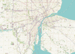
This island is situated in southeast Michigan. It's part of Wayne County, a large county in the state. The exact location of Round Island can be pinpointed using its coordinates: 42°05′32″N 83°10′02″W / 42.09222°N 83.16722°W. These numbers help scientists and mapmakers find its precise spot on Earth.
How High is Round Island?
In 1980, the United States Geological Survey (USGS) measured the height of Round Island. They found its elevation to be 581 ft (177 m) above sea level. This measurement helps us understand the island's physical characteristics.


