Routier, Aude facts for kids
Quick facts for kids
Routier
|
||
|---|---|---|
|
||
| Country | France | |
| Region | Occitanie | |
| Department | Aude | |
| Arrondissement | Limoux | |
| Canton | La Piège au Razès | |
| Intercommunality | Razès Malepère | |
| Area
1
|
11.27 km2 (4.35 sq mi) | |
| Population
(Jan. 2021)
|
Lua error in Module:Wd at line 1,575: attempt to index field 'wikibase' (a nil value). | |
| Time zone | UTC+01:00 (CET) | |
| • Summer (DST) | UTC+02:00 (CEST) | |
| INSEE/Postal code |
11328 /11240
|
|
| Elevation | 190–304 m (623–997 ft) (avg. 195 m or 640 ft) |
|
| 1 French Land Register data, which excludes lakes, ponds, glaciers > 1 km2 (0.386 sq mi or 247 acres) and river estuaries. | ||
Routier is a small and friendly village, also known as a commune, located in the south of France. It's part of the beautiful Occitanie region and the Aude department. In 2017, about 248 people called Routier their home. This charming village is known for its quiet countryside and local community life.
Contents
What is a French Commune?
In France, a commune is the smallest unit of local government. Think of it like a town or a village. Each commune has its own mayor and a local council. These officials help manage the daily life of the village, from keeping the streets clean to organizing local events. Routier is one of many thousands of communes across France.
Routier's Location in France
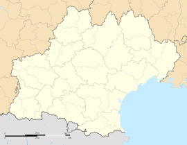
Routier is found in the southern part of France. It's specifically in the Aude department, which is famous for its sunny weather and historic places. The Aude department is part of the larger Occitanie region. This region is known for its diverse landscapes, from the Mediterranean coast to the Pyrenees mountains. Routier itself is located inland, surrounded by rolling hills and fields.
Geographic Details of Routier
The village of Routier sits at an elevation of about 195 meters (around 640 feet) above sea level. The lowest point in the commune is 190 meters, and the highest point reaches 304 meters. This means the area has some gentle slopes and varied terrain. The total area of Routier is about 11.27 square kilometers (around 4.35 square miles). This size is typical for a small French village, offering a mix of residential areas and open land.
Who Leads Routier?
Like all communes in France, Routier has a mayor who is in charge of the local government. The mayor works with a team of elected officials to make decisions for the community.
The Mayor of Routier
The mayor of Routier is Anne-Marie Mercier. She was elected to serve the community from 2008 to 2014. The mayor's job includes many important tasks, such as managing the local budget, overseeing public services like schools and roads, and representing the village in official matters. They are like the main leader of the village.
Working with Other Communes
Routier is also part of a larger group called an intercommunality. This group is named Razès Malepère. An intercommunality is when several communes work together on shared projects. This helps them manage things like waste collection, public transport, or economic development more efficiently. It's a way for small villages to share resources and work together for the benefit of everyone.
Routier's Population and Community
The number of people living in Routier is quite small, making it a close-knit community.
Population Figures
As of 2017, Routier had a population of 248 people. Small populations like this often mean that neighbors know each other well, and there's a strong sense of community spirit. The population numbers are officially recorded and updated regularly, helping the local government plan for the future.
See also
 In Spanish: Routier (Aude) para niños


