Ruisseau Saint-Joseph facts for kids
Quick facts for kids Ruisseau Saint-Joseph |
|
|---|---|

Ruisseau St-Joseph
|
|
| Country | Canada |
| Province | Quebec |
| Region | Estrie |
| MRC | Le Granit Regional County Municipality |
| Physical characteristics | |
| Main source | Mountain streams Saint-Augustin-de-Woburn 600 metres (2,000 ft) 45°27′59″N 71°00′47″W / 45.466435°N 71.012988°W |
| River mouth | Lake Mégantic, Chaudière River Saint-Augustin-de-Woburn 395 metres (1,296 ft) 45°26′41″N 70°53′03″W / 45.44483°N 70.88428°W |
| Length | 7 kilometres (4.3 mi) |
| Basin features | |
| Progression | Lake Mégantic, Chaudière River, St. Lawrence River |
| River system | St. Lawrence River |
| Tributaries |
|
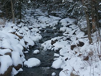
The Ruisseau Saint-Joseph is a small stream in Quebec, Canada. Its name means "Saint-Joseph stream" in English. This stream flows into Lake Mégantic. From there, its waters join the Chaudière River. Eventually, these waters reach the mighty St. Lawrence River.
Discover the Ruisseau Saint-Joseph
The Ruisseau Saint-Joseph is an important part of the local water system. It helps carry water from higher ground down to larger lakes and rivers. This stream is about 7 kilometers (4.3 miles) long.
Where Does It Flow?
The stream starts from mountain streams. These are found near Saint-Augustin-de-Woburn. The water begins its journey from about 600 meters (1,968 feet) high. It then flows through the municipality of Saint-Augustin-de-Woburn.
The Ruisseau Saint-Joseph ends its journey in Lake Mégantic. This lake is also in Saint-Augustin-de-Woburn. The stream enters the lake at an elevation of about 395 meters (1,296 feet).
What's in a Name?
The name "Ruisseau Saint-Joseph" was officially recognized a long time ago. The Commission de toponymie du Québec made it official on October 19, 1971. This commission is in charge of naming places in Quebec.


