Rushmere, Virginia facts for kids
Quick facts for kids
Rushmere, Virginia
|
|
|---|---|

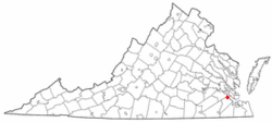
Location of Rushmere, Virginia
|
|
| Country | United States |
| State | Virginia |
| County | Isle of Wight |
| Area | |
| • Total | 8.4 sq mi (21.8 km2) |
| • Land | 8.3 sq mi (21.4 km2) |
| • Water | 0.2 sq mi (0.4 km2) |
| Elevation | 72 ft (22 m) |
| Population
(2010)
|
|
| • Total | 1,018 |
| • Density | 124/sq mi (47.7/km2) |
| Time zone | UTC−5 (Eastern (EST)) |
| • Summer (DST) | UTC−4 (EDT) |
| FIPS code | 51-69472 |
| GNIS feature ID | 1473642 |
Rushmere is a small community located in Isle of Wight County, Virginia, in the United States. It is known as a census-designated place (CDP). This means it's an area that the government counts for population information, but it doesn't have its own city or town government. In 2010, about 1,018 people lived in Rushmere.
Contents
Exploring Rushmere's Location
Rushmere is found in the northern part of Isle of Wight County. It sits right on the James River, near a place called Burwell Bay. To the northwest, it's next to Lawnes Creek, which is a small inlet of the James River.
Across Lawnes Creek to the northwest is Surry County. If you look across the James River to the east, you'll find the city of Newport News.
Getting Around Rushmere
Virginia State Route 10 is a main road that goes through Rushmere. If you follow this road northwest for about 11 miles (18 km), you'll reach the town of Surry. If you head south on the same road for about 7 miles (11 km), you'll arrive in Smithfield.
Land and Water Areas
The United States Census Bureau says that the entire area of Rushmere is about 21.8 square kilometers (8.4 square miles). Most of this area, about 21.4 square kilometers (8.3 square miles), is land. The rest, about 0.4 square kilometers (0.15 square miles), is water. This means that about 1.86% of Rushmere is covered by water.
Who Lives in Rushmere?
This section looks at the different groups of people who call Rushmere home. The information comes from the US Census, which counts everyone living in the country.
Population Changes: 2010 vs. 2020
The table below shows how the population of Rushmere changed between the 2010 and 2020 censuses. It also breaks down the population by different racial and ethnic groups. Remember, the US Census counts Hispanic/Latino as a separate group, and people from this group can be of any race.
| Race / Ethnicity (NH = Non-Hispanic) | Pop 2010 | Pop 2020 | % 2010 | % 2020 |
|---|---|---|---|---|
| White alone (NH) | 385 | 561 | 37.82% | 47.74% |
| Black or African American alone (NH) | 612 | 532 | 60.12% | 45.28% |
| Native American or Alaska Native alone (NH) | 5 | 12 | 0.49% | 1.02% |
| Asian alone (NH) | 2 | 5 | 0.20% | 0.43% |
| Pacific Islander alone (NH) | 0 | 0 | 0.00% | 0.00% |
| Some Other Race alone (NH) | 4 | 4 | 0.39% | 0.34% |
| Mixed Race or Multi-Racial (NH) | 6 | 49 | 0.59% | 4.17% |
| Hispanic or Latino (any race) | 4 | 12 | 0.39% | 1.02% |
| Total | 1,018 | 1,175 | 100.00% | 100.00% |
Rushmere's Weather and Climate
The weather in Rushmere has hot and humid summers. The winters are usually mild, meaning not too cold, but sometimes they can be cool.
According to the Köppen Climate Classification system, Rushmere has a humid subtropical climate. This type of climate is often shown as "Cfa" on climate maps. A humid subtropical climate means there's a lot of moisture in the air, especially in summer, and no dry season.
See also
 In Spanish: Rushmere (Virginia) para niños
 | Jewel Prestage |
 | Ella Baker |
 | Fannie Lou Hamer |

