Surry County, Virginia facts for kids
Quick facts for kids
Surry County
|
||
|---|---|---|
 |
||
|
||

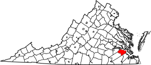
Location within the U.S. state of Virginia
|
||
 Virginia's location within the U.S. |
||
| Country | ||
| State | ||
| Founded | 1652 | |
| Named for | Surrey | |
| Seat | Surry | |
| Largest town | Claremont | |
| Area | ||
| • Total | 310 sq mi (800 km2) | |
| • Land | 279 sq mi (720 km2) | |
| • Water | 31 sq mi (80 km2) 10.1% | |
| Population
(2020)
|
||
| • Total | 6,561 | |
| • Density | 21.2/sq mi (8.17/km2) | |
| Time zone | UTC−5 (Eastern) | |
| • Summer (DST) | UTC−4 (EDT) | |
| Congressional district | 4th | |
Surry County is a place in the southeastern part of Virginia. In 2020, about 6,561 people lived there.
Surry County was created in 1652 from a part of James City County. It has been a farming area for over 350 years. The county has 19 important historical sites. These include Bacon's Castle, a famous old house, and Chippokes Plantation, which is now a state park.
The Jamestown Ferry makes it easy to visit Virginia's Historic Triangle. This area includes Jamestown, Williamsburg, and Yorktown. These places are connected by the Colonial Parkway, a special road managed by the National Park Service.
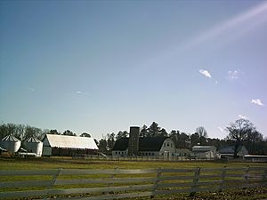
Surry County is known for its farms. People here are good at curing Virginia Hams and harvesting lumber, especially Virginia pine.
Contents
A Look at Surry County's Past
Surry County was formed in 1652. It was part of the Virginia Colony back then. The county was named after Surrey, an area in England. At first, Surry County had two church areas called Lawne's Creek and Southwark.
Famous Historic Buildings
In 1665, a man named Arthur Allen built a brick house. Ten years later, this house became known as Bacon's Castle. It got this name because it was used like a fort during Bacon's Rebellion. This rebellion was against the governor, Sir William Berkeley. It's interesting to know that Nathaniel Bacon himself never lived at Bacon's Castle.
Growth and Changes Over Time
The first town in Surry County was Cobham. It was started in 1691 where Gray's Creek meets the James River. Later, in 1754, Sussex County was created from the southwestern part of Surry County.
After the American Revolutionary War, Surry County became part of the new United States. During the American Civil War, some local groups, like the Surry Light Artillery, fought for the Confederate Army.
The Lumber Industry
In the late 1800s, the lumber business became very important in Surry County. The Surry Lumber Company was started in 1885. They also built a railroad, the Surry, Sussex, and Southampton Railway. This railway helped move lumber to the James River.
The lumber company grew a lot around 1920. However, they cut down many old trees and did not plant new ones. Because of this, it became hard to find more trees to cut after 1925. The company closed its mills in 1927, which caused problems for the county's economy. The railroad also went out of business in 1930. Later, other companies bought the land and started planting new trees.
Education and Schools
From 1892 to 1928, a school for Black Americans called the Temperance, Industrial and Collegiate Institute was in Surry County. Today, there's a historical marker where the school used to be.
After the Brown v. Board of Education ruling, which said schools must be open to all races, Surry County faced changes. Some public schools for white students were closed. This led to private schools being set up for white students.
Modern Power Plant
The Surry Nuclear Power Plant started working in 1972 and 1973. It is expected to keep providing power until 2053.
Getting Around Surry County
Main Roads
 US 460
 SR 10
SR 10 SR 31
SR 31 SR 40
SR 40
State Route 31 and State Route 40 cross through the county. A main road is State Route 10. It follows the James River between Prince George County and Isle of Wight County.
Surry County's Location
Surry County covers about 310 square miles. Most of this area, about 279 square miles, is land. The rest, about 31 square miles, is water.
Neighboring Areas
Surry County shares borders with these other counties:
- Charles City County (to the northwest)
- Isle of Wight County (to the southeast)
- James City County (to the northeast)
- Prince George County (to the west)
- Southampton County (to the south)
- Sussex County (to the southwest)
People in Surry County
| Historical population | |||
|---|---|---|---|
| Census | Pop. | %± | |
| 1790 | 6,227 | — | |
| 1800 | 6,535 | 4.9% | |
| 1810 | 6,855 | 4.9% | |
| 1820 | 6,594 | −3.8% | |
| 1830 | 7,109 | 7.8% | |
| 1840 | 6,480 | −8.8% | |
| 1850 | 5,679 | −12.4% | |
| 1860 | 6,133 | 8.0% | |
| 1870 | 5,585 | −8.9% | |
| 1880 | 7,391 | 32.3% | |
| 1890 | 8,256 | 11.7% | |
| 1900 | 8,469 | 2.6% | |
| 1910 | 9,715 | 14.7% | |
| 1920 | 9,305 | −4.2% | |
| 1930 | 7,096 | −23.7% | |
| 1940 | 6,193 | −12.7% | |
| 1950 | 6,220 | 0.4% | |
| 1960 | 6,220 | 0.0% | |
| 1970 | 5,882 | −5.4% | |
| 1980 | 6,046 | 2.8% | |
| 1990 | 6,145 | 1.6% | |
| 2000 | 6,829 | 11.1% | |
| 2010 | 7,058 | 3.4% | |
| 2020 | 6,561 | −7.0% | |
| U.S. Decennial Census 1790-1960 1900-1990 1990-2000 2010-2020 |
|||
Population in 2020
| Race / Ethnicity | Pop 2010 | Pop 2020 | % 2010 | % 2020 |
|---|---|---|---|---|
| White alone (NH) | 3,583 | 3,459 | 50.77% | 52.72% |
| Black or African American alone (NH) | 3,240 | 2,687 | 45.91% | 40.95% |
| Native American or Alaska Native alone (NH) | 21 | 17 | 0.30% | 0.26% |
| Asian alone (NH) | 23 | 14 | 0.33% | 0.21% |
| Pacific Islander alone (NH) | 2 | 10 | 0.03% | 0.15% |
| Some Other Race alone (NH) | 4 | 15 | 0.06% | 0.23% |
| Mixed Race/Multi-Racial (NH) | 99 | 210 | 1.40% | 3.20% |
| Hispanic or Latino (any race) | 86 | 149 | 1.22% | 2.27% |
| Total | 7,058 | 6,561 | 100.00% | 100.00% |
Note: The US Census counts Hispanic/Latino people as an ethnic group. This table separates them from the main racial groups.
Population in 2010
In 2010, there were 7,058 people living in Surry County. There were 2,619 households, which are groups of people living together. About 1,917 of these were families.
The average number of people in a household was 2.61. The average family size was 3.09 people.
About 25.2% of the people were under 18 years old. About 14.1% were 65 years or older. The average age in the county was 39 years.
The median income for a household was $37,558. This means half of the households earned more than this, and half earned less. About 10.8% of the people in the county lived below the poverty line.
Public Services
The Blackwater Regional Library provides library services to the people of Surry County.
Communities in Surry County
Towns
Census-Designated Place
Other Small Communities
Places to Visit
- Bacon's Castle - A historic house from the 1600s.
- Chippokes Plantation State Park - A state park with a historic plantation.
- Jamestown-Scotland Ferry - A ferry that takes you across the James River.
- National Register of Historic Places listings in Surry County, Virginia - A list of important historical sites.
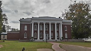
- Surry County Courthouse Complex - The main government buildings for the county.
- Surry Nuclear Power Plant - A large power plant.
Famous People from Surry County
- Leslie Garland Bolling (1898–1955) - A woodcarver from the early 1900s.
- Robert Butler (1784–1853) - A politician and doctor.
- John Hartwell Cocke (1780–1866) - A military officer and businessman.
- Joseph T. Deal (1860–1942) - A Virginia politician and businessman.
- Curtis W. Harris (1924–2017) - A minister and civil rights activist.
- Thomas Person (1733–1800) - A politician.
- Peyton Short (1761–1825) - A land speculator and politician.
- Claude V. Spratley (1882–1976) - A judge in Virginia.
- Karen Huger - A TV personality from Real Housewives of Potomac.
See also
 In Spanish: Condado de Surry (Virginia) para niños
 | Stephanie Wilson |
 | Charles Bolden |
 | Ronald McNair |
 | Frederick D. Gregory |


