
Charles City County, Virginia facts for kids
Quick facts for kids
Charles City County
|
|||
|---|---|---|---|
| County of Charles City | |||

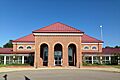
Iona Whitehead-Adkins Courthouse
|
|||
|
|||

Location within the U.S. state of Virginia
|
|||
 Virginia's location within the U.S. |
|||
| Country | |||
| State | |||
| Founded | 1619 | ||
| Named for | Charles I of England | ||
| Seat | Charles City | ||
| Area | |||
| • Total | 204 sq mi (530 km2) | ||
| • Land | 183 sq mi (470 km2) | ||
| • Water | 21 sq mi (50 km2) 10.5% | ||
| Population
(2020)
|
|||
| • Total | 6,773 | ||
| • Density | 33.20/sq mi (12.82/km2) | ||
| Time zone | UTC−5 (Eastern) | ||
| • Summer (DST) | UTC−4 (EDT) | ||
| Congressional district | 4th | ||


Charles City County is a special area in the state of Virginia, USA. It's called a county. You can find it southeast of Richmond and west of Jamestown. The James River forms its southern border, and the Chickahominy River is to its east.
This area was first set up as "Charles Cittie" in 1619 by the Virginia Company. It was one of the first four "boroughs" (or districts) in Virginia. It was named after Prince Charles, who later became King Charles I of England. In 1634, it became "Charles City Shire," and then in 1643, it got its current name, Charles City County.
Today, Charles City County is part of the larger Greater Richmond Region. In 2020, about 6,773 people lived here. It's still a mostly rural area and one of the smaller counties in Virginia. The main town and government center is called Charles City.
Two famous people from this county became presidents: William Henry Harrison (the 9th president) and John Tyler (the 10th president).
Contents
History of Charles City County
Native American Tribes
For thousands of years, different Native American tribes lived in this area. When English explorers arrived in the 1600s, they met the Chickahominy tribe. They lived along the Chickahominy River, which was named after them. The Paspahegh tribe lived in Sandy Point, and the Weanoc tribe lived in the Weyanoke Neck area.
The Paspahegh and Weanoc tribes were part of the powerful Powhatan Confederacy. The Chickahominy people were independent and not part of this group. Today, descendants of the Chickahominy still live in the region. These tribes all spoke languages from the Algonquian family.
The English named the Weyanoke Peninsula after the Weyanoc tribe. Over time, the Weyanoc people were pushed out by the colonists. They joined other larger tribes around the time of Bacon's Rebellion (1676-1677).
English Settlers Arrive
The English started to settle this area with help from the Virginia Company. This was a private company that wanted to make money from new settlements and trade.
In 1619, the Virginia Company created "Charles Cittie" as one of the first four main areas in Virginia. It was named after Prince Charles. He was the second son of King James I of England. Prince Charles later became King Charles I of England.
Also in 1619, the first enslaved Africans arrived in this area. They were taken from a Spanish ship and brought to the Weyanoke Peninsula. At first, they were treated like indentured servants. This meant they had to work for a certain number of years to gain their freedom. Some of them later became landowners. They formed the first African community in what would become the United States. Weyanoke, Virginia, is still a small community today.
In 1624, the Virginia Company lost its special permission from the King. Virginia then became a royal colony, meaning it was directly controlled by the King. In 1634, the King ordered the creation of "Charles City Shire." Its name changed to Charles City County in 1643. It is one of the five original areas in Virginia that still exist as counties today. Colonists grew tobacco on large farms called plantations to sell it.
Growing tobacco needed a lot of workers. Rich farmers brought in indentured servants from Britain and Africa. Later, they bought many enslaved Africans. In Virginia, a "planter" was someone who owned 20 or more enslaved people.
Most English colonists came as indentured servants. They worked for several years for wealthy people who paid for their trip to America. The English government gave land to these wealthy people to encourage settlement. In the 1600s, many people came to the North American colonies. At first, there were more men than women, but more women started to arrive, and families began to form.
Once indentured servants finished their work, they received their own land. But the best land, especially along the rivers, was already taken by successful planter families. Rivers were important for travel and trade. So, later settlers often moved to higher lands in the county.
The first main town of the county was Charles City Point. It was south of the James River. The first courthouses were along the James River at Westover (north side) and City Point (south side).

How the County Changed
In 1703, the part of Charles City County south of the James River became Prince George County. Over time, Prince George County was also divided into other counties and cities. This was a common way for new areas to develop.
After 1703, Charles City County was only on the north side of the James River. It was between James City County to its east and Henrico County to its west. New Kent County is to its north. In the late 1800s, small communities grew around the plantations. These "crossroads communities" like Adkins Store, Cedar Grove, and Ruthville, usually had a store, a church, and a school. Public schools started after the Civil War.
In total, five counties and three cities were formed from the original Charles City Shire.
Early Religions
Many people in Charles City County became Methodist and Baptist in the late 1700s and early 1800s. These churches were mostly in the higher parts of the county. There were also many Quaker settlers. The wealthy plantation owners along the James River usually remained Anglican.
African Americans in Charles City County
As tobacco farming grew, more workers were needed. By the late 1600s and early 1700s, enslaved African labor became the main source of workers. Tobacco farming needed a lot of hard work.
One of the earliest records of a free Black person in Charles City County is from 1677. A woman named Susannah asked for her freedom. The Lott Cary House in the county is believed to be where Lott Cary was born. He was an enslaved person who bought his freedom and his children's freedom. In the 1800s, he helped create the new country of Liberia in Africa.
Starting in the 1600s, some plantation owners freed individual enslaved people. This was called manumission. Some free families of mixed race were formed before the American Revolution. These families often came from white women and African men who were either indentured, enslaved, or free. Children inherited their mother's status, so children of white women were born free.
After the American Revolution, many plantation owners in Charles City County freed their enslaved people. This was partly because of groups like the Quakers, Baptists, and Methodists who were against slavery. Many free Black people settled together in today's Ruthville, Virginia. This was one of the first free Black communities in Virginia. Ruthville became a center for the county's free Black population. After slavery ended, Ruthville had a store, a school, and a club for sorghum growers. The town was named after a local resident, Ruth Brown, when a Post Office opened there in 1880.
During the American Civil War, many Black Americans from Charles City County joined the Union Army. In 1864, United States Colored Troops at Fort Pocahontas successfully fought off an attack by Confederate soldiers.
After the Civil War, white politicians in Virginia created laws that separated people by race. They also made it hard for most Black people to vote. This lasted until the 1960s, when new federal laws were passed to protect civil rights and voting rights. In 1968, James Bradby from Charles City County became the first Black American in Virginia to be elected as a County Sheriff.
Historic Plantations
Charles City County is home to several old and important plantations.
- Berkeley Plantation is where William Henry Harrison, the 9th U.S. president, was born in 1773.
- Greenway Plantation is where John Tyler, the 10th U.S. president, was born in 1790.
- Sherwood Forest Plantation was bought by John Tyler in 1842. His family has lived there ever since.
- Shirley Plantation has been home to the Hill and Carter families for many generations. It is still lived in and worked by descendants of General Robert E. Lee today.
- Westover Plantation was first settled in 1619. It was home to important people like William Byrd II, who founded Richmond. The current mansion was built around 1750.
Geography of Charles City County
| Weather chart for Ruthville, VA | |||||||||||||||||||||||||||||||||||||||||||||||
|---|---|---|---|---|---|---|---|---|---|---|---|---|---|---|---|---|---|---|---|---|---|---|---|---|---|---|---|---|---|---|---|---|---|---|---|---|---|---|---|---|---|---|---|---|---|---|---|
| J | F | M | A | M | J | J | A | S | O | N | D | ||||||||||||||||||||||||||||||||||||
|
3.2
48
27
|
2.9
52
29
|
4
61
36
|
3.3
71
45
|
3.9
78
54
|
3.5
86
64
|
4.4
89
68
|
4.3
88
67
|
4
81
59
|
3.2
71
47
|
3.4
62
39
|
3.4
51
30
|
||||||||||||||||||||||||||||||||||||
| temperatures in °F precipitation totals in inches |
|||||||||||||||||||||||||||||||||||||||||||||||
|
Metric conversion
|
|||||||||||||||||||||||||||||||||||||||||||||||
The county covers about 204 square miles. About 183 square miles are land, and 21 square miles (10.5%) are water.
Neighboring Counties
- New Kent County – to the north
- James City County – to the east
- Surry County – to the southeast
- Prince George County – to the south
- Chesterfield County – to the southwest
- Henrico County – to the west
Population Information
| Historical population | |||
|---|---|---|---|
| Census | Pop. | %± | |
| 1790 | 5,588 | — | |
| 1800 | 5,365 | −4.0% | |
| 1810 | 5,186 | −3.3% | |
| 1820 | 5,255 | 1.3% | |
| 1830 | 5,500 | 4.7% | |
| 1840 | 4,774 | −13.2% | |
| 1850 | 5,200 | 8.9% | |
| 1860 | 5,609 | 7.9% | |
| 1870 | 4,975 | −11.3% | |
| 1880 | 5,512 | 10.8% | |
| 1890 | 5,066 | −8.1% | |
| 1900 | 5,040 | −0.5% | |
| 1910 | 5,253 | 4.2% | |
| 1920 | 4,793 | −8.8% | |
| 1930 | 4,881 | 1.8% | |
| 1940 | 4,275 | −12.4% | |
| 1950 | 4,676 | 9.4% | |
| 1960 | 5,492 | 17.5% | |
| 1970 | 6,158 | 12.1% | |
| 1980 | 6,692 | 8.7% | |
| 1990 | 6,282 | −6.1% | |
| 2000 | 6,926 | 10.3% | |
| 2010 | 7,256 | 4.8% | |
| 2020 | 6,773 | −6.7% | |
| 2021 (est.) | 6,594 | −9.1% | |
| U.S. Decennial Census 1790–1960 1900–1990 1990–2000 2010–2020 |
|||
2020 Census Details
| Race / Ethnicity (NH = Non-Hispanic) | Pop 2010 | Pop 2020 | % 2010 | % 2020 |
|---|---|---|---|---|
| White alone (NH) | 2,939 | 2,997 | 40.50% | 44.25% |
| Black or African American alone (NH) | 3,511 | 2,836 | 48.39% | 41.87% |
| Native American or Alaska Native alone (NH) | 495 | 441 | 6.82% | 6.51% |
| Asian alone (NH) | 24 | 34 | 0.33% | 0.50% |
| Pacific Islander alone (NH) | 5 | 6 | 0.07% | 0.09% |
| Some Other Race alone (NH) | 18 | 50 | 0.25% | 0.74% |
| Mixed Race or Multi-Racial (NH) | 176 | 308 | 2.43% | 4.55% |
| Hispanic or Latino (any race) | 88 | 101 | 1.21% | 1.49% |
| Total | 7,256 | 6,773 | 100.00% | 100.00% |
In 2020, Charles City County had a population of 6,773 people. The population is made up of different groups. About 44% were White, 41% were Black or African American, and about 6.5% were Native American. A small percentage were Asian, Pacific Islander, or of other races. About 4.5% identified as mixed race.
Economy and Fun Things to Do
Tourism and Plantations

Charles City County has many old and beautiful plantations along State Route 5. These are privately owned, but many of them are open for visitors. You can often tour the houses and grounds. Some of the plantations you can visit include Shirley Plantation, Berkeley Plantation, Westover Plantation, and Sherwood Forest Plantation.
Farming and Agriculture
Some farms in Charles City County have been growing crops for over 400 years! They are still very productive today. Farmers here have won national awards for growing a lot of corn and wheat.
Farmers in Charles City County also use special methods to protect the environment. For example, 90% of the farmland uses a "no-till" system. This means they don't plow the soil, which helps prevent dirt and pollution from washing into rivers. This technology helps keep the Chesapeake Bay healthy.
Towns and Transportation
Main Areas
Charles City County doesn't have a big city. The main government center is called Charles City Court House. The old courthouse building was used for legal purposes for a very long time, since the 1730s! A new courthouse has been built now.
Getting Around
You can only get to Henrico County (to the west) without crossing a river. State Route 106 crosses the James River on the Benjamin Harrison Memorial Bridge. This bridge is the only direct way to get to areas south of the river, like Hopewell. Three other bridges cross the Chickahominy River, connecting the county to James City County and New Kent County.
Main Roads
 SR 5
SR 5 SR 106
 SR 155
 SR 156
Education in Charles City County
Charles City County Public Schools has about 100 staff members and serves around 500 students in two schools. The schools have modern technology, including wireless internet in classrooms and computer labs. The school system offers many programs, like core subjects, electives, advanced classes, and vocational training. They also have programs for gifted students and those needing extra help.
Communities in Charles City County
There are no official "cities" or "towns" in Charles City County. Instead, there are many smaller communities:
Main Community
Other Communities
- Adkins Store
- Barnetts
- Berkeley
- Binns Hall
- Greenway
- Holdcroft
- Kimages
- Montpelier
- Mount Airy
- New Hope
- Old Union
- Roxbury
- Ruthville
- Sandy Point
- Sterling
- Tettington
- Wayside
- Westover
- Wilcox Neck
Famous People from Charles City County
- William Henry Harrison, 9th president of the United States
- John Tyler, 10th president of the United States
- John Tyler Sr., 15th governor of Virginia, and father of John Tyler
- Stephen Bates, the first Black sheriff in Vermont
- Alec Seward, a blues musician
- Lott Cary, a founding father of the country of Liberia
- James Bradby, the first Black sheriff in Virginia since the Reconstruction Era
- James Hemings, the first American to train as a chef in France
Images for kids
-
Iona Whitehead-Adkins Courthouse
See also
 In Spanish: Condado de Charles City para niños
