
James City County, Virginia facts for kids
Quick facts for kids
James City County
|
|||||
|---|---|---|---|---|---|

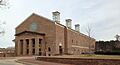
James City County-Williamsburg Combined Courthouse
|
|||||
|
|||||

Location within the U.S. state of Virginia
|
|||||
 Virginia's location within the U.S. |
|||||
| Country | |||||
| State | |||||
| Founded | 1619 (as James Cittie) | ||||
| Named for | James I of England | ||||
| Seat | Williamsburg | ||||
| Area | |||||
| • Total | 179 sq mi (460 km2) | ||||
| • Land | 142 sq mi (370 km2) | ||||
| • Water | 37 sq mi (100 km2) 20.5% | ||||
| Population
(2020)
|
|||||
| • Total | 78,254 | ||||
| • Density | 437.2/sq mi (168.8/km2) | ||||
| Time zone | UTC−5 (Eastern) | ||||
| • Summer (DST) | UTC−4 (EDT) | ||||
| Congressional district | 1st | ||||


James City County is a county in Virginia. As of the 2020 census, about 78,254 people lived there. The county seat is Williamsburg, which is a separate city.
James City County is part of the larger Metropolitan Statistical Area. It is known for its connection to Williamsburg and Jamestown.
English colonists first settled here in 1607 at Jamestown. The county was officially created in 1634 as James City Shire by King Charles I. It is one of the oldest counties in Virginia. In 2007, the area celebrated 400 years since Jamestown was founded.
Tourism is a big part of the local economy. The county is home to Busch Gardens Williamsburg, the Kingsmill Resort, and the Williamsburg Pottery Factory. Historic sites like Historic Jamestowne, Jamestown Settlement, and Colonial Williamsburg attract many visitors. These places are connected to Yorktown by the National Park Service's Colonial Parkway.
Contents
History of James City County

Early Settlements (17th and 18th Centuries)
Starting the Colony
The Virginia Company of London received permission from King James I of England to start a colony in Virginia. In 1606, three ships sailed from England. They chose a spot about 40 miles (64 km) inland along a river. This was to protect them from sea attacks. Jamestown was founded in 1607.
The first five years were very hard. Many colonists died. In 1612, John Rolfe successfully grew tobacco in Virginia. This became an important crop that could be sold for money.
In 1619, the Virginia Company made changes to attract more settlers. They created the House of Burgesses. This was the first group of elected representatives in North America. It was a step towards self-government. Also in 1619, the colony was divided into four "citties" or areas. One of these was "James Cittie."
"James Cittie" stretched across the Virginia Peninsula to the York River. It included Jamestown Island, which was the capital of the colony.
Lost Towns and Plantations
Around this time, a fortified settlement called Wolstenholme Towne was built. It was near present-day Grove. In 1622, many people in the town were killed or taken during an attack. The town was rebuilt but later abandoned around 1643. Its location was forgotten for a long time.
Over 100 years later, the land became part of Carter's Grove Plantation. This plantation was built around 1753. In 1976, archaeologists rediscovered the site of Wolstenholme Towne. This happened when the Colonial Williamsburg Foundation owned Carter's Grove.
Becoming a Royal Colony

The Virginia Company lost its charter in 1624. Virginia then became a royal colony, directly controlled by the King. In 1634, the King created eight "shires" (counties) in Virginia. James City Shire was named after King James I of England. Around 1642–43, its name changed to James City County.
Williamsburg and the Capital
Middle Plantation was founded in 1632. It was a fort built to protect against Native American attacks. In 1634, a fence or "palisade" was built across the peninsula. Middle Plantation was in the middle of this defense.
In 1693, the College of William and Mary was built at Middle Plantation. In 1699, the capital of Virginia moved there after Jamestown burned down. Soon after, Middle Plantation was renamed Williamsburg to honor King William III of England. The capital moved to Richmond in 1780 during the American Revolution. The Battle of Green Spring was fought in the county shortly before the British surrendered at Yorktown.
Modern History (19th and 20th Centuries)
Civil War and Railroads
During the American Civil War, the Battle of Williamsburg took place in 1862. This was part of the Peninsula Campaign. Some old earthworks from the Confederate Fort Magruder can still be seen. After the war, the Chesapeake and Ohio Railway was extended through the county. This helped transport coal to Newport News.
In 1884, Williamsburg became an independent city. This meant it was politically separate from James City County. However, Williamsburg and James City County still share a school system and courts.
Colonial Williamsburg and Tourism
Starting in the early 1900s, efforts to preserve and restore historic sites led to more tourism. Colonial Williamsburg, Jamestown Settlement, and the Colonial Parkway were developed.
Colonial Williamsburg is a famous attraction. It was funded by John D. Rockefeller Jr. and his wife. While the main historic area is in Williamsburg city, the Colonial Williamsburg Foundation bought a lot of land in James City County. This was to protect the views and make visitors feel like they were in the 18th century.
Anheuser-Busch Development

In the 1970s, Anheuser-Busch (AB) bought a large area of land from Colonial Williamsburg. This land was known as the Kingsmill tract. AB built a large brewery, the Busch Gardens Williamsburg theme park, the Kingsmill resort community, and an office park.
Anheuser-Busch and its related businesses became the largest employers in the area. They provided more jobs than Colonial Williamsburg and local military bases.
21st Century Discoveries
In the 2000s, new archaeological work began at Jamestown and Green Spring Plantation. These sites are important because they have not been built on much since the 1800s. This means they might hold many historical secrets.
Geography of James City County
James City County covers about 179 square miles (464 km²). About 142 square miles (368 km²) is land, and 37 square miles (96 km²) is water.
The county is located in two main river areas: the James River Watershed and the York River Watershed. These are part of the larger Chesapeake Bay watershed. The county has many smaller creeks and rivers, including Diascund Creek, Powhatan Creek, and Skiffe's Creek.
Neighboring Areas
James City County shares borders with:
- New Kent County, Virginia (northwest)
- King and Queen County, Virginia (northeast)
- Gloucester County, Virginia (northeast)
- York County, Virginia (east)
- Williamsburg, Virginia (east)
- Newport News, Virginia (southeast)
- Surry County, Virginia (south)
- Charles City County, Virginia (west)
Protected Natural Areas
Population of James City County
|
||||||||||||||||||||||||||||||||||||||||||||||||||||||||||||||||||||||||||||||||||||||||||||||||||||||||||||||||
2020 Census Information
In 2020, the population of James City County was 78,254.
- About 72.39% of people were White (not Hispanic).
- About 12.56% were Black or African American (not Hispanic).
- About 2.88% were Asian (not Hispanic).
- About 4.79% were of two or more races (not Hispanic).
- About 6.64% were Hispanic or Latino (of any race).
2010 Census Information
In 2010, there were 67,009 people living in the county. The population density was about 337 people per square mile (130/km²).
- About 80.3% of people were White.
- About 13.1% were Black or African American.
- About 2.2% were Asian.
- About 4.5% of the population was Hispanic or Latino.
The median age in the county was 41 years old. About 23.3% of the population was under 18.
Economy of James City County

The average household income in the county was $55,594. The average family income was $66,171.
Jamestown and Busch Gardens Williamsburg are major tourist attractions. Along with Colonial Williamsburg, they form the Historic Triangle. This area is a very popular place for tourists. The many restaurants, hotels, and resorts bring a lot of money to the county.
Local Industries
James City County is close to major cities like Richmond and Norfolk. It is also about two and a half hours from Washington, D.C..
The county is near the deep-water ports of Hampton Roads. This port is the second largest on the East Coast. It is good for businesses that import and export goods.
The James River Enterprise Zone in Grove is an area for industrial businesses. It offers state and local help to companies that move there. This helps create jobs. Businesses like Ball Manufacturing (an aluminum can plant), Wal-Mart distribution, and Haynes furniture have facilities there.
Education in James City County
Schools for Kids and Teens
The public schools are run jointly with the City of Williamsburg. They are called Williamsburg-James City County Public Schools (W-JCC).
There are also several private schools in the area. These include Walsingham Academy and Williamsburg Christian Academy.
Colleges and Universities
A campus of Virginia Peninsula Community College is located in the Lightfoot area.
Parts of the College of William and Mary are in the county. Its main campus is in Williamsburg.
Transportation in James City County
The county has major roads like Interstate 64 and U.S. Route 60. The Williamsburg Area Transit Authority (WATA) provides local bus service.
There are three international airports within a 45-minute drive. These are Richmond International Airport, Norfolk International Airport, and Newport News/Williamsburg International Airport. Traffic on I-64 can sometimes cause delays.
Improving U.S. Route 60
For many years, officials have worked to improve U.S. Route 60 between Grove and Newport News. This is to help truck traffic from industrial areas get to Interstate 64 faster. The current road is two lanes and goes through neighborhoods.
A new road called the Skiffe's Creek Connector is being built.

This new divided highway will start near Blow Flats Road. It will go through the Greenmount Industrial Park to the Newport News city limits. It will cross Skiffe's Creek. This new road will help bypass the two-lane part of U.S. Route 60.
Main Highways
 I-64
I-64 US 60
US 60 SR 5
SR 5 SR 30
SR 30 SR 31
SR 31 SR 143
 SR 199
Military History in James City County
Early Forts (17th Century)
A fort was built at Jamestown soon after colonists arrived in 1607. Archaeologists have studied this site a lot.
By 1634, settlers built a wooden fence or "palisade" about 6 miles (10 km) long. It stretched across the peninsula. This was to protect the eastern part of the peninsula from Native American attacks.
Civil War Defenses (19th Century)
During the American Civil War, the Confederate army built defenses across the Peninsula. This was to protect Richmond. Fort Magruder was a large earthen fort at a key location.
Today, some earthworks and a small memorial remain at Fort Magruder. In 2006, land was donated to create a public park. This park includes two smaller forts that were part of the defense line.
20th Century Military Sites
The Grove Community was home to many African-American families. They were moved during World War I and World War II. This happened when military bases like Naval Weapons Station Yorktown and Camp Peary were created.
Camp Wallace operated from 1918 to 1971. It was a satellite facility of Fort Eustis. The Camp Wallace property later became part of the Anheuser Busch developments in the 1970s.
Current Military Presence (21st Century)
No military bases are headquartered in James City County today. Small parts of Camp Peary and the Yorktown Naval Weapons Station are in the county. Most of these large bases are in neighboring York County. A very small part of Fort Eustis is also in the county.
Communities in James City County
For a long time, James City County's economy was based on farming. After the decline of Jamestown, Williamsburg became the center of trade. Small towns and villages were spread out. After the Civil War, some large farms were divided. This allowed freed slaves to start new homes.
When the railroad arrived in 1881, it brought more growth. People from other parts of the country moved to the county. They were attracted by land prices. For example, a group of people from Scandinavia founded Norge.
Williamsburg's Connection
Williamsburg was once partly in James City County. The county courthouse moved there. Today, the Williamsburg-James City County Courthouse is a large facility on Monticello Avenue.
In colonial times, Duke of Gloucester Street was the border between James City County and York County. In 1870, the county line was moved so Williamsburg was entirely in James City County.
In 1884, Williamsburg became an independent city. This means it is politically separate from James City County. However, Williamsburg is still the county seat of James City County. They share many services, like courts and the public school system.
Unincorporated Communities
James City County does not have any incorporated towns. Some of its unincorporated communities include:
- Centerville
- Croaker
- Diascund
- Ewell
- Five Forks
- Grove
- Indigo Park
- Jamestown
- Kingspoint
- Lightfoot
- Norge
- Toano
- Lanexa
Many areas in the county use Williamsburg mailing addresses.
Gated residential communities in the county include:
- Colonial Heritage
- Stonehouse at Millpond
- Ford's Colony
- Kingsmill
- Governor's Land
Images for kids
-
James City County-Williamsburg Combined Courthouse
-

Flag of James City County, Virginia
-

Seal of James City County, Virginia
-

Logo of James City County, Virginia
See also
 In Spanish: Condado de James City para niños
